Curated OER
Perceived Risks
Young scholars rank a list of everyday risks to compare with classmates. They rate each risk on both its ability to be controlled and its observability in the environment. Results are graphed.
Curated OER
Women in Texas Politics: Winning the Vote, Three Pioneers, and Serving the People
Fourth graders study women's involvement in Texas politics. In this US history lesson, 4th graders discuss woman suffrage, examine three Texas female pioneer legislators by reading biographies, and explore women's issues by generating a...
Curated OER
Las Tejanas
Fourth graders recognize that the Tejanas were Texas women of Spanish-Mexican origin who contributed to the history of Texas. Students read and research the Tejanas women, complete an essay about a day in the life of a Tejanas woman ,and...
Curated OER
Tejana Military Members in World War II
Seventh graders discover who the Tejanas were and how they contributed to World War II. In this World War II lesson, 7th graders listen to their instructor discuss who the Tejanas were prior to researching the contributions of three of...
Curated OER
How To Write a Social Studies Outline
One of the keys to success in school is organization. This resource leads learners through the process of creating an outline for a chapter from a social studies text. In addition, they review facts they have learned in their class...
Museum of Disability
Taking Visual Impairment to School
What is the world like when you can't see, or when your vision is impaired? Learn about how Lisa communicates with the world around her with Taking Visual Impairment to School by Rita Whitman Steingold. Learners answer...
Channel Islands Film
Cache: Lesson Plan 1 - Grades 9-12
Archaeologists have discovered a cache of Native American relics. They want to preserve these relics by removing them from the rapidly eroding site to a lab where they can be studied. Native American traditions demand that the items...
Channel Islands Film
Cache: Lesson Plan 2 - Grades 4-6
Class members will dig this activity that has them trying their hand at recovering artifacts. Groups are assigned a section of a sandbox, carefully uncover the artifacts in their section, and then develop theories about who might...
EngageNY
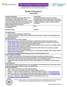
TASC Transition Curriculum: Workshop 12
How can opinions slant facts? Workshop participants learn how to examine primary and secondary sources and identify the author's point of view. They also examine how visual art impacts the meaning and rhetoric of sources. Full of...
Curated OER
CURRENT AND CLIMATE
Students study currents and how they have been used to plot courses for travel. They examine the ocean currents in both the Atlantic and Pacific and discuss their effect on local weather.
Curated OER
Using a Preview Checklist with Informational Text
Sixth graders identify information from texts by working in pairs using Wikki Stix or highlighting tape to locate, mark, and read items on preview checklist. Students then compare what they marked with what another pair marked.
Curated OER
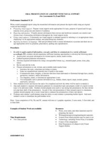
Oral Presentation of a Report With Visual Support
Students create multi-paragraph report using the researched information. Over several class periods, students research a topic of their choosing and create a one-two page report. Student reports are presented to the class using an...
Curated OER
Building a Scale Model
Third graders create a model of the solar system. In this solar system lesson, 3rd graders create a scale model of the solar system. Working in pairs students solve mathematical problems to correctly measure the distance each planet is...
Curated OER
Welcome to New York State
Students choose one region of New York state, and create a travel brochure that includes information such as geographical features, tourist attractions, accesibility, economic features, and historical events that occured in that region.
Curated OER
Gettysburg: The Civil War's Costliest Battle
Students research the Civil War and the Battle of Gettysburg. In this Gettysburg lesson, students analyze journals and letters written by the Gettysburg soldiers. Students define Civil War soldier vocabulary words. Students compare and...
Curated OER
A to Z Observations
Eighth graders examine the cultural conflicts that occurred when Europeans moved into the land the Native Americans lived on that would become West Virginia. In this West Virginia history instructional activity, 8th graders visit the...
Curated OER
West Virginia State Museum Lesson Plan: West Virginia Music
Young scholars compare and contrast music about West Virginia. In this West Virginia history lesson, students analyze popular music so that they may gain an understanding of the relationships between songs and history. Young scholars...
Curated OER
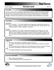
Kansas Land
Fourth graders discover the geographic regions of Kansas. In this geography lesson, 4th graders explore the different regions of Kansas and determine how the different geography affects daily life in Kansas.
Curated OER
Three Gorges Dam: Will China Sink or Swim?
Seventh graders study the Three Gorges Dam, which is the largest dam built in the world. They examine how the dam impacts China as it prepares for the 21st century.
Curated OER
The Tennessee River: The Tie That Binds
Seventh graders examine the Tennessee River to see why it is still a major transportation artery in lieu of the age of modern transportation such as interstate highways, air cargo, and elaborate railway systems.
Curated OER
Trembling, Spewing Earth: Impacts on Human Activity
Seventh graders study to identify patterns in earthquake activity and impacts on human behavior. They also develop plans to cope with such natural disasters.
Curated OER
Synthesis of Information
Locating and synthesizing information is an essential part of the research process but can be overwhelming for many young writers. Eliminate some of the stress and confusion, this resource suggests, by separating these steps. To focus...
Curated OER
Cartogram of the Great Compromise
Students create cartograms of populations during 1790.
Other popular searches
- Maps and Charts
- Analyze Maps and Charts
- Reading Maps and Charts
- Ireland Maps and Charts
- Tables, Maps and Charts
- Maps Graphs and Charts
- Maps, Charts, Globes
- Interpreting Charts and Maps
- Tables Maps and Charts
- Graphs, Charts and Maps
- Graphs\, Charts and Maps
- Word Maps and Charts

