Mathematics Assessment Project
Sorting Equations of Circles 1
Round and round we go. Learners first complete a task on writing equations of circles. They then take part in a collaborative activity categorizing a set of equations for circles based on the radius and center.
Curated OER
Customized Topographic Maps and Models
Students explore the information depicted on topographic maps. They construct a 3-D topographic map of a local area. They go on a field trip to the depicted area and compare the 'real world' with their models.
Curated OER
A Map as a Tool
Students study the concept of using a map as a tool with the usage of a balloon designed to mimic the features of the Earth with the major features marked and shown on the balloon.
EngageNY
Close Reading of Bullfrog at Magnolia Circle: Text-Dependent Questions, Main Ideas, and Key Vocabulary about the Bullfrog
As your 3rd grade class finishes reading Bullfrog at Magnolia Circle, the eighth lesson plan of this unit helps readers from an understanding of the very specific information on the final page of the book. As with the entire unit,...
EngageNY
Mid-Unit Assessment: Close Reading of Bullfrog at Magnolia Circle: Bullfrog Life Cycle
The sixth lesson plan in this Bullfrog at Magnolia Circle unit assesses your third graders' ability to read and understand informational text. The included assessment asks learners to take notes about the main idea and supporting details...
Mathematics Assessment Project
Calculating Arcs and Areas of Sectors of Circles
Going around in circles trying to find a resource on sectors of circles? Here is an activity where pupils first complete an assessment task to determine the areas and perimeters of sectors of circles. They then participate in an activity...
Mathematics Assessment Project
Solving Problems with Circles and Triangles
After completing a task involving examining the ratio of areas of triangles and circles in a given figure, scholars examine sample responses to identify other strategies they could use to solve the problem.
Curated OER
Using the Landscape Picture Map to Develop Social Studies Skills
Enhance your class' geography skills using this resource. Explore a variety of concepts including production and distribution, and people and the environment. Learners make predictions and identify locations on maps. This is a creative...
Curated OER
Orienteering: Map Skills
Students use a map to locate six specific landmarks on a course using a map. They identify how maps can help us and write a paragraph describing how to get from one landmark to another on the map.
Curated OER
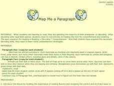
Map Me a Paragraph
There are so many great reading strategies. In this instructional activity, learners practice decoding. They break down two paragraphs to analyze and determine main ideas and details. They each observes ways to model as they map their...
Curated OER
Identifying, Mapping, and Personifying Countries Involved in WWII
Get artsy with this WWII group activity, starting with a whole-class assignment. Create a map of Europe, Northern Africa, and the Pacific using geometric shapes cut from construction paper and placed on the floor. Consider splitting the...
Mathematics Assessment Project
Inscribing and Circumscribing Right Triangles
High schoolers attempt an assessment task requiring them to find the radii of inscribed and circumscribed circles of a right triangle with given dimensions. They then evaluate provided sample responses to consider how to improve their...
Mathematics Assessment Project
Sorting Equations of Circles 2
How much can you tell about a circle from its equation? This detailed lesson plan focuses on connecting equations and graphs of circles. Learners use equations to identify x- and y-intercepts, centers, and radii of circles. They also...
Curated OER
The Big Circle
Students explore geography by participating in a mapping activity. In this concentric ring lesson plan, students utilize a poster board, string and markers to identify their current location within the entire world. Students write about...
Curated OER
Why All Maps Lie
Eighth graders discover the fundamental advantages/disadvantages of both maps and globes. They see that maps may distort size, shape, distance and direction. They discuss the advantages and applications of 5 types of map projections and...
Curated OER
United States Map- Map Legend/City Symbols
Students investigate the United States map. In this map skills geography lesson, students explore city symbols on the map legend and identify them. Students use post-it notes to mark various symbols.
Curated OER
From Maps to Models
Students explore watersheds through the use of a topographic map. They observe topographical maps and discuss their characteristics. In groups, students create a model clay island and make a topographical map of it. Afterward, groups...
Curated OER
Mapping Out the Story
Discuss the reading comprehension strategy of summarization with your elementary schoolers! They read a chapter from their social studies textbook, Regions Near and Far, and create a map, or word web, for the chapter. They identify...
Curated OER
Plotting Earthquakes
Students plot earthquakes on a map. In this lesson on earthquakes, students will explore recent earthquake activity in California and Nevada. Students will plot fault lines and earthquake occurrences on a map.
Curated OER
Countries Involved in World War II
Students create their own floor map of Europe, Northern Africa, and the Pacific. They locate, identify, and speak for one of the countries involved. In addition, they classify the country they represent as an Axis Power or as an Allied...
Curated OER
Introduction to the United States Map
Students identify a map of the United States. In this United States map lesson plan, students study a map of the United States and find various locations on the map. Students then locate and list the state that touches their state.
Curated OER
Simple Route Map
Students identify the best route between various locations on a map. In this map skills lesson, students use a landscape picture map to find routes to and from certain places. Students use map markers to highlight the routes.
Curated OER
United States Map - Lesson 11
Students explore lakes of the United States. For this geography lesson, students identify noteworthy lakes on a map of the United States.
Curated OER
Mapping Your Schoolyard Habitat
Students explore the terrain, structures, plants and signs of habitats around their schoolyard. They draw a sketch map showing the different areas around the schoolyard. Students identify the location of weeds and native plants on their...
Other popular searches
- Circle Map Template
- Arctic Circle Map
- Prewriting Circle Map
- Poetry Circle Map
- Rewriting Circle Map
- Christmas Circle Map
- Thinking Map Circle Map
- Name Circle Map
- Brainstorming Circle Maps
- Sun Circle Map
- Circle Map Template Magnets
- Blank Circle Maps


