Curated OER
Biggest Cities in the UK Quiz
In this online interactive geography quiz worksheet, students respond to 20 identification questions about the biggest cities in the United Kingdom. Students have 4 minutes to complete the quiz.
Curated OER
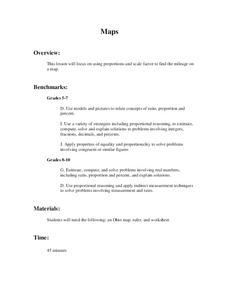
Maps
Students figure out the mileage from one state to another using a map. In this map lesson plan, students look at the scale factor and turn it into a fraction. They measure the distance between two cities and use the proportion to find...
Curated OER
Printable Map of the State of Vermont
In this printable map of Vermont worksheet, students see a clip art picture of Vermont superimposed on the United States map. The capitol city of Montpelier is labeled on the map.
Curated OER
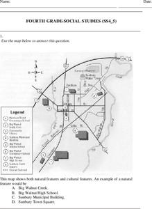
Fourth Grade Social Studies
For this social studies worksheet, 4th graders answer multiple choice questions on state maps, city maps, road maps, political maps, and more. Students complete 25 multiple choice questions.
Curated OER
5th grade social studies geography
In this geography worksheet, 5th graders complete multiple choice questions about hemispheres, maps, cities, ecology, and more. Students complete 25 questions.
Curated OER
Latitude and Longitude
Students demonstrate how to locate places on a map using a grid. In this map skills lesson plan, students are introduced to latitude and longitude lines. Students define these terms and view a large map of a state. Students come up to...
Curated OER
Project Whistlestop:Missouri Vacation Learning Unit
Fourth graders reserach the state of Missouri. For this Missouri History lesson, 4th graders plan a vacation to a region of Missouri. Students work in collaborative groups to determine all aspects of the trip. Students use math...
Curated OER
Lesson 3: Seven Day Road Trip
Students plan a seven day road trip. For this travel lesson, students plan a driving trip that includes five major cities or attractions in Florida or another state of their choice. They show the trip on a map, calculate distances that...
Curated OER
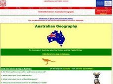
Australian Geography
In this map reading worksheet, students label a map of Australia by adding the names of states and cities. They answer eight questions about the map.
Curated OER
Geography Puzzles
Students study the continents of the world. In this Internet geography lesson plan, students connect to online mapping games. Students collaborate in order to develop their understanding of world geography, including countries and...
Curated OER
Where is the Trail? The Journey of Lewis and Clark
Students explore the trail followed by Lewis and Clark on their journey across the United States. In this United States History lesson, students complete several activities to establish the Lewis and Clark Expedition, including a class...
Curated OER
A Shuttle's Eye View
Students explore the goals of the Shuttle Radar Topography Mission as a springboard to exploring the topographical features of their own state or region. They synthesize their understanding of landforms and topography by mapping their...
Curated OER
Around the Town
Young scholars explore reading maps. In this map reading lesson, students compare distances fom place to place. Young scholars work in groups and predict the distance then find the actual distance using string or rulers.
Curated OER
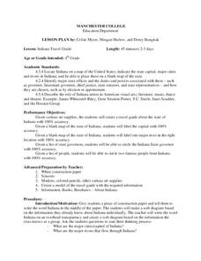
Indiana Travel Guide
Fourth graders share their information about their home state. In this research lesson, 4th graders use graphic organizers to make a travel guide about the state of Indiana. This lesson could be modified for use with any state, it also...
Curated OER
A New Federation
Students describe the relationships between state and federal parliaments in Australia. They identify responsibilities shared between federal and state and territory governments. Students explore an alternative federal structure by...
Curated OER
Mexico: One Land, Many Cultures
Students, through a variety of activities, discover the geography and culture of Mexico. They make maps, read folktales, write a journal, create pinatas and other artistic pieces, and review the history of Mexico.
Curated OER
Finding Your Way on the Farm
Third graders make a grid map. In this directionality lesson plan, 3rd graders review how to use a grid to locate objects or places on a map. Students draw a grid map of the classroom and locate seating assignments. Students create a...
Curated OER
Learning European Geography
Sixth graders discover locations and countries in Europe by identifying them on a map. For this European geography lesson, 6th graders read the book The Lost Little Elephant, with their class and discuss the geography referenced in...
Curated OER
Navigation
Students explain that globes are the best way to show positions of places, but flat maps are portable and can show great detail. They make a mercator projection of the route Lewis and Clark took on their journey.
Curated OER
Spanish Influence in the U.S.
Eighth graders research the role of the first Spanish conquistadors who explored the now United States. Using the internet, they gather information on different explorers and write a paper about why he is important in American history. ...
Curated OER
Forestry and Changing Feelings
Students investigate how the forest affects their daily lives by creating a concept map. In this ecological lesson, students create a concept map linking the forest to the many things they use each day. Students take a field...
Curated OER
Projects For USA Units
Students study different regions of the United states through interdisciplinary activities. This lesson presents very creative, artistic ways for students to explore the variety of regions found in the United States.
Curated OER
Where in the World Is ...
Students locate and place countries and continents on a large map using tag board and yarn. They locate a new geographic location on the map each morning.
Curated OER
Massachusetts Word Search
In this social studies worksheet, students complete a word search. They find words related to Massachusetts (such as names of cities) as well as words about surrounding areas (Atlantic Ocean).

