Curated OER
Ancient Mediterranean Lands: Greece
Students study maps and structures of Ancient Greece and realize how these structures impact times. For this structures lesson plan, students view the structures of how Ancient Greece was put together and discuss how these structures...
Curated OER
Lights On ! Lights Off! Exploring Human Settlement Patterns
Third graders write informational paragraphs based on the settlement patterns of the United States. In this settlement lesson plan, 3rd graders read about population and how it affects where people settle next.
Curated OER
Mystery State #48
In this mystery state worksheet, students answer five clues to identify the state in question. They then locate that state on a map.
Curated OER
Leapin' Landmarks: Locating 10 Man-made Landmarks Around the World
Third graders label continents, oceans, and major mountain ranges on maps and use the maps to write an informational report about landmarks. In this landmarks lesson plan, 3rd graders write about 1 major landmark.
Curated OER
Mystery State #47
In this mystery state worksheet, young scholars answer five clues to identify the state in question. They then locate that state on a map.
Curated OER
The Louisiana Purchase: Worksheet
Celebrate the anniversary of one of the United States' most important land acquisitions with a fun instructional activity. The class answers five matching questions related to those involved with the Louisiana Purchase and then think...
Curated OER
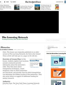
Mapping Meteorites
After reading an article, "Cameras Capture a 5-Second Fireball and Its Meteorite's Secrets," space science superstars use the triangulation method to determine the location of a distant object. In-class activities and homework are...
Curated OER
Carl Sandburg's "Chicago": Bringing a Great City Alive
Students examine the historical and cultural context in Sandburg's poem. The poetic devices of personification and apostrophe are utilized in the poem and identified by Students.
Curated OER
Climate Change in My City
Students investigate the climate changes occurring locally, regionally and globally over the last one hundred years. They brainstorm and predict whether the current year's weather was warmer or colder than last year then check the...
Channel Islands Film
Once Upon A Time (Saxipak’a): Lesson Plan 1
As part of a study of the history of the Chumash on California's Channel Island chain, class members view the documentary Once Upon a Time, respond to discussion questions, and create a timeline for the different waves of migration.
Curated OER
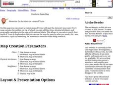
Freeform Texas Map
In this Texas map learning exercise, students research, label and discuss the most important cities in Texas, its physical attributes and the states that surround Texas.
Curated OER
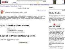
"Label Me" Texas Map
For this Texas map worksheet, students research, label and discuss the top ten major cities in Texas on a map, label the physical attributes and identify the surrounding states around Texas.
Curated OER
Freeform Pennsylvania Map
For this Pennsylvania map worksheet, students research, study and label twenty important cities, physical attributes and the neighbors that surround Pennsylvania on a Pennsylvania map.
Curated OER
Geographics in Arkansas
Third graders discuss where Arkansas is located on the United States map. They use geographic tools to participate in activities.
Curated OER
Texas Outline Map
In this outline map worksheet, students see the state of Texas with a star located at the capital city. There are no directions given for the use of this page.
Curated OER
Map of Australia
In this geography of Australia learning exercise, students color and label a map with major states, cities and physical features. The Australian state borders are shown but not labeled.
Curated OER
Map of New York State
In this map worksheet, students view a blank map of New York. Worksheet does not come with any associated activities, but does have "dots" designating cities on the map.
Curated OER
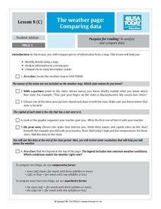
The Weather Page: Comparing Data
Students analyze data from maps. In this comparing data activity, students use comparative and superlative statements to draw comparisons among the weather in different American cities based on USA Today weather maps.
Curated OER
Country Capitals
Students locate country capitals on a world map. For this map skills lesson, students review the definition of the word country and discuss what a capital is. Students locate and label capital cities on a world map using a map marker.
Curated OER
Globe Skills Lesson 1 Some Early American Cultures
Middle schoolers apply their knowledge of geography. In this geography skills lesson, students read brief selections regarding early Americans. Middle schoolers respond to the questions included in the self-guided map skills lesson.
Curated OER
Latitude and Longitude
Students find latitude and longitude on a map or atlas. They create maps with a cruise route. They practice plotting locations given latitiude and longitude.
Curated OER
Creating and Comparing Climographs
Students are introduced to the importance and usefulness of climographs. In groups, they create a climograph of two cities on about the same latitude. They compare and contrast the locations and climates of the two cities and write a...
Curated OER
Third Grade Social Studies Quiz
In this social studies worksheet, 3rd graders complete multiple choice questions about communities, maps, distances, and more. Students complete 11 questions.
Curated OER
Globe Skills Lesson 11The Vietnam War
Students develop their globe and map skills, In this geography lesson, students examine the Vietnam War as they complete an activity that requires them to plot latitude and longitude.


