Curated OER
Geography Review
Third graders name the continent, country, state, and community in which they live. They locate Maryland and Baltimore on a map of the United States.
Curated OER
All Aboard!
Sixth graders plan a road trip to a city in the US. They include railroad saftey messages as they write about the trip.
Curated OER
Texas Week
Students explore Texas in the past and present. They pick out cities on a map and find information and analyze an Internet site.
Curated OER
Mystery Pen Pal
Students investigate different cities and states in the USA, and practice their letter writing skills while corresponding with a pen pal.
Curated OER
Finding Our Place in the Community
Third graders search TDC database for images of our hemisphere, continent, ocean, country, state, and city. They identify their place in the hemisphere, continent, ocean, country, state, and city.
Curated OER
Michigan History Through HyperStudio
Pupils explore the history of their local community. They visit historical landmarks in the city of Marshall. Students create a HyperStudio project about local Michigan history.
Curated OER
Louisiana Parishes
Students research a parish in Louisiana. They research things such as: what makes that parish different from others, major cities, what is the land like there, are there any bodies of water, what is the population, are their any colleges...
Curated OER
Where Is That Place?
Learners choose a school in their state to compare their weather to. They also describe the differences between country, state, and a city. They can make flashcards to help them remember the important terms and concepts.
Curated OER
Geography Overview
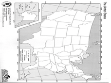
Second graders look at the United States often over the next few months. Help them to see how the United States has changed as territories have become states. They may be surprised to know the areas of our country that were territories...
Curated OER
Compare & Locate via the Internet
Seventh graders compare the location of their home city/town with a town in another country (non U.S.) that they have selected and researched utilizing the Internet. They create a binder of their reports for future research.
Curated OER
Point Me to Puerto Rico
Students research the physical features and geography of Puerto Rico as well as locate it on a world map and identify its major characteristics. Pictures and postcards are shown to each class for a visual connection to Puerto Rico as...
Curated OER
Route 66 And Population Patterns
Learners investigate the geography located along Route 66. They research how the population patterns change in certain areas along the highway. Students use the information in order to form hypotheses about how and why the population...
Curated OER
Somewhere in Indiana
Second graders locate the United States, Indiana, their community, and their neighborhood community on a map, and a world globe 4 out of 5 times correctly. They then discuss what they have learned in the lesson.
Curated OER
Get Ready for the Great Outdoors!
Students discuss what is a map and what they already know about maps. They brainstorm together to compile a list of responses for the board and observe a map of the United States, including states, capitals, and some of the National Parks.
Curated OER
Geography Grid
Fourth graders search a database to find images and scan and affix them on an 8-foot long map of the state of Illinois. They then use it as a basis for discussion.
Curated OER
Texas Weather Report
Students use provided links to observe selected weather sites and collect temperature and precipitation data for listed cities. They enter the information onto their spreadsheet. Students study maps of the Texas natural reagions,...
Curated OER
'My Town' Brochure
Ninth graders use the internet to research a city or town on the "Walk Across Texas" route. They create a brochure or booklet advertising their assigned city or town.
Curated OER
Made in the USA
Young scholars map products made in the United States. They discuss regional interdependence and identify goods the U.S. produces and trades. They describe how economic links make Americans more alike, and locate major manufacturing...
Curated OER
Indiana Travel Guide
Fourth graders create a travel guide about the state of Indiana with 100% accuracy. They label the capital within the travel guide with 100% accuracy. Students label one major river in the right location with 100% accuracy. They circle...
Curated OER
Rivers And Capitals
Pupils become familiar with the use of GIS for research and become aware of the importance of rivers to cities. They also analyze the placement of cities and learn the names of rivers in the United States.
Curated OER
Geography of the English Settlements
Third graders locate several important American colonial cities on a map and research how their proximity to water and nearby arable land affected the rate and success of settlement.
Curated OER
Traveling Across America
Pupils plan a trip to a state capital of their choice with a budget of $2,000. The budgets include site seeing, lodging, food and all necessary expenses. Students keep a daily journal and maintain their budget.
Curated OER
Old Man River
Learners place the four reservoirs of the Kansas-Lower Republican Basin correctly on a map adding creeks and rivers flowing into them. Students explain uses for the reservoirs.
Curated OER
Weather... Or Not
Learners observe and discuss the local weather patterns, researching cloud types and weather patterns for cities on the same latitude on the Internet. They record the data for 6-8 weeks on a graph, and make weather predictions for their...
