Richmond Community Schools
Map Skills
Young geographers will need to use a variety of map skills to complete the tasks required on this worksheet. Examples of activities include using references to label a map of Mexico, identify Canadian territories and European countries,...
National Wildlife Federation
Get Your Techno On
Desert regions are hotter for multiple reasons; the lack of vegetation causes the sun's heat to go straight into the surface and the lack of moisture means none of the heat is being transferred into evaporation. This concept, and other...
Curated OER
USA: Average Precipitation and Temperature Map
In this United States map worksheet, students make note of the average precipitation and temperature in regions of the country.
Curated OER
Climate in Our Back Yard
Learners construct a "A Year in Pennsylvania" poster on which they creatively describe at least three examples of how the climate they live in shapes their lives during every season of the year.
Curated OER
Climate Patterns across the United States
Students articulate differences between climate and weather using examples in a written statement. Using climate data from across the country, they describe climate patterns for various parts of the United States on a map. Students...
Curated OER
Storm Clouds-- Fly over a Late Winter Storm onboard a NASA Earth Observing Satellite
Students study cloud data and weather maps to explore cloud activity. In this cloud data instructional activity students locate latitude and longitude coordinates and determine cloud cover percentages.
Devine Educational Consultancy Services
Geography Student Workbook, Australia
Your youngsters will be experts on the geography of Australia after working with these activities and worksheets, which review the continent's weather, major landforms, dimensions, history, and climate.
Curated OER
How Much Water is in That River?
Young scholars practice measurement using the Hudson River. They calculate the discharge measurement at a location on the Hudson River using ingenuity and a topographic map.
Curated OER
Invasives and Marsh Birds
Students are taught that invasive plant removal can have a variety of impacts. They are shown this by using graphs. Students view maps of vegetation change on Iona Island. They discuss implications of changes on marsh birds using data...
Curated OER
Regions of the US: Gulf Stream, States and Their Capitals
Fifth graders identify one way of dividing the US into geographical regions and then consider alternate ways of doing the same. They locate each of the fifty states and their capitals on a map. They research the Gulf Stream region.
Curated OER
Our State Road Trip
Students take a virtual tour of the country of China instead of a state. Using the Internet, they examine the differences between a political and physical map and use latitude and longitude to locate specific places. They also research...
Curated OER
Location of Cities 201
Students work in pairs to locate the ancient cities on a world atlas using the longitude and latitude measurements. They examine the physical and human futures that explain their locations.
Curated OER
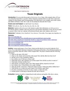
Texas Originals
Seventh graders research the Native Americans of Texas. They create a PowerPoint presentation or poster showing the culture of the Native American tribe they were assigned.


