Curated OER
Sea Ice: Unscrambling the Egg Code
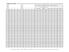
Students determine sea ice thickness, concentration, and floe size by reading egg codes. In this sea ice conditions lesson, students color code a map based on prescribed criteria and use the maps to identify changes in sea ice...
Curated OER
Imagers: The Adventure of Echo the Bat Number to Pictures: How Satellite Images are Created
Students examine the three primary colors of light and design a numerical code to represent those colors. They tell how satellites use numbers to create satellite images after completing a number of experimental activities.
Space Awareness
Valleys Deep and Mountains High
Sometimes the best view is from the farthest distance. Satellite imaging makes it possible to create altitude maps from far above the earth. A three-part activity has your young scientists play the role of the satellite and then use...
South Gloucestershire Council
Animal Classification: A Collaborative Sorting Activity for Key Stages 2 & 3
Introduce the logic behind a dichotomous key or administer a group performance assessment with a fun and challenging classification lesson. With explicit instructions for the teacher and for collaborative groups, as well as engaging...
Curated OER
Africa Savanna
Students discuss the different biomes of Africa. They create a list of biomes of Africa. They color code a map of the biomes of Africa. They research interesting facts about Africa.
Curated OER
Washing Germs Away
Students investigate germs. In this cross curriculum health and biology lesson plan, students listen to Old Black Fly by Jim Aylesworth and identify ways in which flies spread germs. Students discuss hand washing during a visit by the...
Curated OER
Tracking Temperature
Students explore how to read a thermometer and what the instrument does. They practice measuring hot and cold objects and discuss changes in the weather based on temperature.
Curated OER
Ecosystems Lesson Plan
Students research ecosystems (rainforest, desert, grassland, woodland, and arctic tundra). Students compare the seven continents and the importance of proximaty to the equator.
Curated OER
Arctic/Antarctic Animals
Fourth graders explore animals of the Arctic and Antarctic and then create a report. They become aware of the great diversity among animals.
Curated OER
Relief Maps
Learners study geographical maps and their functions. For this geography lesson students work in groups to build a map to scale.
Curated OER
Types of Dinosaurs
Students complete puzzles of dinosaurs. They compare each piece of the puzzle to a fossil and simulate a scientist's role in learning about dinosaurs.
Curated OER
Bridge Building
Students explore bridges and how they are constructed. After reviewing materials on bridges, they work in groups to record their findings. They design and construct a bridge using K'NEX or straws and predict which bridge will hold the...
Curated OER
Adaptable Animals
Students examine the types of adaptations that animals use to survive. They research the animals and report their findings to the class.


