Curated OER
Grades 6-8 Lesson Plan - Cities as Transportation Centers
Learners examine maps of the 1800's and 1900's. In this geography skills lesson plan, students collaborate to read core maps and identify transportation centers and travel networks.
Curated OER
Eastern Europe: Passport to Understanding
Seventh graders explore Eastern Europe. They analyze data on select countries. Students prepare a short oral presentation on the country they researched. They locate their country using an interactive map.
Curated OER
Trade and Travel on the Overland Trails
Students compare and contrast trade routes. In this trade route lesson, students explore the Oregon Trail and the Santa Fe trail. Students compare and contrast the purposes for these trails.
Curated OER
Planning A Railroad Online Lesson
Students plan a route across Donner Summit using topographical maps in order to understand the challenges involved in constructing the railroad in the Sierra Nevada Mountains. In this history lesson, students first discover how to read...
Curated OER
The Hopi Indians
Fourth graders read and look at maps of the Hopi Indians and compare and contrast their lives with the Hopi Indians. In this Hopi Indians lesson plan, 4th graders learn about different cultures and answer short answer questions.
Curated OER
Going, Going, Ghost
Third graders research ghost towns. In this geography lesson, 3rd graders locate ghost towns on a map and choose one location to research. Students construct a research paper and present it to the class.
Curated OER
Indianapolis Government
Learners read about a girl who takes a trip during the time of the State Capital moving to Indianapolis and then write their own essay about a trip that they took. In this Indianapolis Government lesson plan, students use maps and...
Curated OER
COLONIAL FLYERS/TRAVEL BROCHURES TO THE COLONIES
Students investigate concepts of history and geography in this activity. They create travel brochures for travelers who are crossing the Atlantic Ocean to populate the colonies of early America. The brochure has topographical information...
Curated OER
European Agriculture
Students make inferences on how physical geography affected the development of early civilizations and come up with solutions to global issues. In this physical geography lesson plan, students compare maps of the past to maps of today to...
Curated OER
Westward Expansion and the Frontier
Students explore U.S. history by researching a historic map. In this westward expansion lesson, students discuss the mystery of the western U.S. in the early 1800's and the impact expansion had on Native Americans and agriculture....
Curated OER
Tooling Around Arizona: Reading Arizona Maps
Students study geography. In this Arizona maps lesson, students develop their map reading skills. They have class discussions and work independently with various copies of Arizona maps to practice those skills. This lesson mentions...
Curated OER
"Now and Then" Comparing Present Day with Medieval Times
Eighth graders compare a present-day social issue with a medieval issue. They use technology tools to conduct their research and demonstrate their new knowledge. Students present their findings to the class in the form of a PowerPoint.
Curated OER
Savannah, Georgia Historic District
Young scholars complete a variety of activities that go along with the study of and possible fieldtrip to the Savannah, Georgia Historic District.
Curated OER
INTERPRETING MAGNETIC FIELD MAPS
Students interpret magnetic field maps, rotate the coordinates to obtain different views, change the coordinate representation, and produce alternate graphical representations.
Curated OER
Creating Life Maps (Elementary, Reading/Writing)
Young scholars create a personal life timeline to better explain how a historical timeline is effective in studying history. They also write a poem about themselves.
Curated OER
Castolon Historic District
Students complete a variety of activities that go along with the study of and possible fieldtrip to the Castolon Historic District in Big Bend National Park, TX.
Curated OER
Comparing Time Periods in U.S. History: The Ashford Project
Fifth graders use a "fact book" comparing periods in American history then students create a picture to illustrate their assigned periods. # # students use their pictures and concept maps to write expository paragraphs about their...
Curated OER
What do Maps Show?
Seventh graders practice reading maps. In this geography lesson, 7th graders compare a topographical map to a picture of the actual place.
Curated OER
Places in My World
Second graders explore where they are located on the globe. In this maps and globes lesson, 2nd graders use a map to show where they live and show the cardinal directions. Students identify characteristics of mountains, flat land,...
Curated OER
Land Use Change Over Time
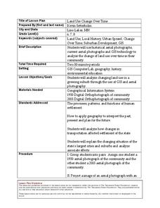
Students use historical aerial photographs and current aerial photographs to compare the change over time to the land. In this land changing lesson plan, students analyze, compare, contrast, and list the land change in their own community.
Curated OER
The Alphabet is Historic: The Roman Alphabet is our Alphabet
Pupils show that the Greeks, Phoenicians and Romans lived in the Mediterranean area. They give reasons why the alphabet was important for the Romans. and say that the Romans developed the alphabet they are learning in school.
Curated OER
Fossil Fuels (Part III), The Geology of Coal
Do not overlook this set of lessons just because your school does not have a data analysis system. There is plenty of material here to administer a complete mini unit on the formation, distribution, and properties of coal. Since it...
Curated OER
Treaty Trail: Historical Perspectives Point of View
Students research the point of view of key figures present at the Walla Walla Treaty council. Students analyze primary and secondary sources to determine how various groups of people involved in the treaty council viewed the events as...
Curated OER
Pioneering Children on the Move
Students inquire about life for pioneer children. In this pioneer period lesson, students analyze photographs of children, make information foldables, and create a covered wagon that was typical of the ones of the past. Students will...

