Curated OER
Where is the Trail? The Journey of Lewis and Clark
Students explore the trail followed by Lewis and Clark on their journey across the United States. In this United States History lesson, students complete several activities to establish the Lewis and Clark Expedition, including a class...
Curated OER
Oil and its Everyday Uses
Explore the properties of oil through an experiment. They use the scientific process to investigate oil, participate in experiments, watch videos,and use information from the internet to determine how oil has changed our...
Curated OER
Then and Now
Students list the similarities and differences seen as they compare and contrast historical and current street maps of their local communities.
Curated OER
New Perspectives
Students examine maps that are designed to give different perspectives. They create mental maps that illustrate their own perspectives and those of people from other parts of the world.
Curated OER
The Aztecs - Mighty Warriors of Mexico
Upper elementary learners identify the Aztecs as the builders of a great city and rich civilization in what is now Mexico. They locate the Aztec Empire and its capital on a map and place the Aztecs in the chronology of American history....
Curated OER
I Hear the Locomotives: The Impact of the Transcontinental Railroad
Students examine the effects the Transcontinental Railroad had on the regions through which it passed. They analyze and discuss maps, view and describe online images, and use photos and documents to develop a cause-and-effect ladder.
Mississippi Department of Archives and History
Protesting Violence without Violence
The ultimate legacy of Emmett Till's violent death is its role in the non-violent roots of the Civil Rights Movement. A lesson compares contemporaneous articles with the lyrics of Bob Dylan's "The Death of Emmett Till" and prompts...
Curated OER
Trends of Snow Cover and Temperature in Alaska
Students gather historical snow cover and temperature data from the MY NASA DATA Web site. They compare this data to data gathered using ground measurements from the ALISON Web site for Shageluk Lake. They graph both sets of data and...
Curated OER
Hopi Running
Students identify why the Hopi tribe practiced running as it relates to health, delivering messages, defeating other tribes, and for ceremonial events. In this social studies instructional activity, students use maps to identify latitude...
Curated OER
Radio Program Disc 1, Track 6
High schoolers place the Ohio river in its historical and geographical context. They listen to the radio stories, and are asked what postive and negative influences does the Ohio River have on nearby communities>
National Endowment for the Humanities
Native American Cultures Across the U.S.
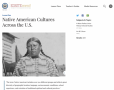
Students examine how American Indians are represented in today's society. They read stories, analyze maps, and complete a chart and create an illustration about a specific tribe.
Curated OER
Tejana Military Members in World War II
Seventh graders discover who the Tejanas were and how they contributed to World War II. In this World War II lesson, 7th graders listen to their instructor discuss who the Tejanas were prior to researching the contributions of three of...
Curated OER
Planning a Railroad
Students use a topographical map to plan a route from Doknner Summit to Truckee, then compare it to the route selected by Theodore Judah.
Curated OER
My Perfect Neighborhood
Second graders make a map of their neighborhoods and identify their homes as being East, West, South, or North from the school on the map. They identify at least six local landmarks on a map of their town.
Curated OER
Nina Bonita: Culture and Beauty
Pupils read Nina Bonita by Ana Maria Machado. In this reading comprehension/ geography lesson, students recall various parts of the story and create a map of where the rabbit traveled throughout the story. They participate in group...
National First Ladies' Library
Peace in the Middle East: A Primer
Middle schoolers are introduced to the concept of three Abrahamic religions and complete the Comparative Religion Exercise. They view slides after taking their best guesses and read the article, "The Path to Peace Runs Through a History...
Curated OER
Activity 2: Disappearing Drainage - the Incredible Shrinking Everglades Watershed
Students examine drastic changes in Florida Everglades watershed, compare and contrast two watershed maps, discuss effects of addition of agriculture, loss of wetlands, and introduction of Water Conservation Areas, and predict condition...
Curated OER
You're Invited...To A Tea Party
Kids read the book Boston Tea Party by Steven Kroll and use maps to locate various landmarks. They identify the cause and effect of the events related to the Boston Tea Party, then write a descriptive composition.
Curated OER
1668 Map of Newark Activity
Eleventh graders read a map for historical information, decipher a map legend and symbols, and expand their knowledge of a historic time.
Curated OER
Lesson #3: Internet Map Activity
Students label assembly centers and relocation camps on a given map of the United States in order to create a better understanding of the relocation experience of Japanese-American citizens and the distance that families had to move and...
Curated OER
Saratoga National Historical Park
Pupils complete a variety of activities that go along with the study of and possible fieldtrip to Saratoga National Historical Park in Stillwater, NY. They determine if any descendents of participants in the war live in their own...
Curated OER
William Howard Taft National Historical Site
Students examine the role William Howard Taft played in American History. They analyze his background and how he got to be president. They compare qualities of leaders today to Taft.
Curated OER
Allegheny Portage Railroad National Historic Site
Students use drawings, maps, readings, paintings and photos to consider how the topography of Pennsylvania led to the construction of the Allegheny Portage Railroad. They also investigate their own community's transportation history.
Curated OER
Alabama Railroads: Maps as Historic Documents
Students identify historic documents and focus on the state of Alabama in 1860. This was during the time of the Reconstruction. The skills of comparison and analysis are used.


