Curated OER
Social Studies: Area and Population Density
Math scholars of many ages examine the concept of population density and then discuss the significance of the population densities of Minnesota and China. They figure the population density of their school.
Curated OER
How Big is Big?
Geography learners compare and contrast population densities throughout the world. Using maps, they estimate the relative size of the world's regions and populations. They develop analogies to discover the world they live in and...
Curated OER
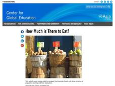
How Much is There to Eat?
Learners examine food production related to population density. In this interdisciplinary lesson, students gather data regarding food production in the American South and in India. Learners follow the outlined steps to calculate the...
Curated OER
Math Lesson: How Many People Live There?
Students are able to calculate the population density of a country, and calculate the population density of large cities in that country. They are able to create an appropriate graph to represent their data for that country.
Curated OER
Learning and Population Information - Where I Live
Students study their county populations in a multimedia presentation format. In this populations lesson, students work in groups of 3 to research the county populations in their state. Students chart their results in an Excel document...
Curated OER
Comparing and Ordering Quiz
In this interpreting information using a table learning exercise, students read the U.S. Municipalities Census table to answer questions. Students answer 9 questions.
Curated OER
A Contouring We Go
Students examine the built environment and infrastructures of their community by constructing contour equipment, using the equipment, and comparing their results to current topographical maps of the same area
Curated OER
Investigating comparative biodiversity of wetland and schoolyard sites
Fourth graders participate in an activity dealing with the environment.
Curated OER
LAND USE ISSUES
Students relate math with real life situations. They identify and plot points on a grid map. They identify and locate the Drop Box Sites.
Curated OER
Quilt Squared
Students study West Virginia quilts. For this mathematics lesson, students use symmetry, geometric shapes, and patterns to create their own quilt square.
Curated OER
Places and Production
High schoolers calculate United States GDP and GDP per capita, use a choropleth map to acquire information, and create choropleth maps of GDP per capita in South America. They identify regions with high and low GDP per capita
Curated OER
Places and Production
Students investigate the economy and the market value of goods. For this algebra lesson, students differentiate between domestic goods value and international good value. The define and identify the importance of GDP or Gross Domestic...


