Curated OER
Maps
Maps, globes, and computer software aid young explorers as they locate state capitols, major cities, geographic features, and attractions for states they are researching. They then use desktop publishing software to create a map to share...
Curated OER
Polydron Fun
Learners investigate nets as they relate to volume and area. In this geometry lesson plan, students use nets as a visual to deepen their understanding of surface area and volume of objects. They make conjectures about different objects...
Curated OER
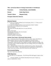
Let the Sun Shine In: Energy Conservation
Students create a project applying their math skills as they discuss energy conservation. For this geometry lesson, students define vocabulary relating to the environment and energy conservation. They construct a building that allow lots...
Curated OER
Making Maps
In this map making worksheet, students learn about the science of making maps, which is cartography. They then answer the 11 questions on the worksheet. The answers are on the last page.
Curated OER
The Overlooked Regular Pentagon
Tenth graders discuss the history of geometry as it relates to pentagons. In this geometry lesson, 10th graders solve problems of a pentagon inscribed inside of a circle using ratio. They review other properties for shapes of polygons...
Curated OER
Show Me the Way To Go Home
Middle schoolers place a pencil perpendicular to the ground and trace its shadow between 11:30 AM and 12:30 PM. They measure the length of the shadow, periodically over several hours, in either English or Metric units. Using the data,...
Curated OER
Measuring the Earth (Eratoshenes' method)
Sixth graders engage in problem solving, communicating, reasoning, and connecting to represent and solve problems, using geometric models.
Curated OER
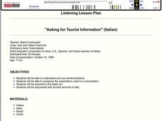
"Asking for Tourist Information" (Italian)
Students explain and use verbal directions, recognize the prepositions used in a conversation, explore Italian art, and acquaint themselves with tourist services in Italy.
Curated OER
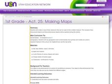
Making Maps
First graders create a map of their classroom that can be used to find a hidden treasure. They examine two- and three-dimensional objects and discover characteristics.
Curated OER
Map It!
Fourth graders demonstrate map making skills by using the computer to create maps of the geographic features, regions, and economy for their state.
Smithsonian Institution
For Land's Sake: George Washington as Land Surveyor
Students discuss the importance of land ownership and the purpose of land surveying in the eighteenth century. They interpret a transcript of an eighteenth-century land survey. They survey and area of land. They create a written or...
Curated OER
Public Land
Young scholars examine the needs of their community for public space and determine the solutions to math problems related to planning landscape designs. They read and discuss an article from the New York Times, create their own designs...
Curated OER
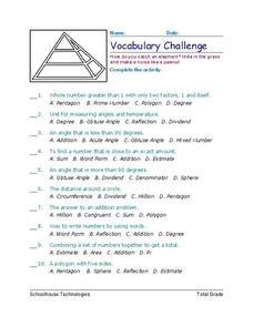
Vocabulary Challenge
In this math vocabulary instructional activity, students choose which multiple choice answer best defines twenty-five mathematical terms. Students place their answers on the lines provided.
Curated OER
Triangle Conjectures
Tenth graders investigate the theorems of ASA, AAS, AAA and ASA. In this geometry lesson, 10th graders discuss the theorems of triangles and how it is used to solve for missing sides or angles. They review how two angles are formed by...
Curated OER
Tibetan Monk Sand Paintings
Students complete an art project. In this sand paintings instructional activity, students learn about the history of mandalas and then create a sand painting of their own. Extensions include writing a story or poem about their sand...
Curated OER
Chocolate Preferences Voting and Graphing Techniques
Young scholars practice sampling and graphing techniques. In this data collection and interpretation lesson, students write and conduct surveys about chocolate preferences and then collect their data. Young scholars graph the data in...
Curated OER
Automobile-Accident Reconstruction
Students investigate an accident and relate it to math. In this trigonometry lesson, students measure the accident scene, the friction produced, and the speed from the skid marks. They create a poster of their findings.
Curated OER
Waldseemüller’s Map: World 1507
Students take a closer look at historical maps. In this primary source analysis lesson, students examine the first world map produced by Martin Waldseemuller. Students complete the included map analysis worksheet and then write letters...
Curated OER
Animals And Behavior
In this animal behavior worksheet, students solve four different kinds of puzzles based on animal behavior vocabulary. There are 8 word scrambles, 6 analogies, 5 crazy eights and 5 short answer questions.
Curated OER
Coastal Surveys
Students investigate the human impact on coastal land. In this coastal surveys lesson plan, students choose a coastal area and complete a survey sheet about the area. They choose a topic about a sea side village called Dunwich to prepare...
Curated OER
Drake's West Indian Voyage 1588-1589
Middle schoolers investigate several maps detailing Sir Francis Drake's voyages. In this geography lesson, students practice reading maps and locating the precise locations of where Sir Francis Drake visited. Middle schoolers...
Curated OER
If You Were Katy: Let's Play a Game
Pupils simulate sound effects from Katy and the Big Snow. They read and discuss Katy and the Big Snow, create sound effects for the objects in the book and practice sounding out beginning sounds for words. After sounding out the words,...
Curated OER
Map Making with Lewis and Clark
Students develop maps based on a virtual internet expedition of The Louisiana Purchase land area. They create the maps based on an actual outdoor expedition of their communities. Student create two maps, one based on the Louisiana...
Curated OER
Flying Objects
Students use metrics to measure, draw, and cut out a boomerang from cardboard.


