Curated OER
Mapping La Salle's Travels
Pupils use the internet to create a map showing the path of La Salle through North America and the Caribbean. They identify the main geographic features of the two areas and the main French forts. They also complete a timeline.
Curated OER
Colonial Geography: To and From Canada
Students identify the major geographic features of colonial New England. They explain the essential parts to a map and interpret journals to plot a journey. They discover the connection between geography and life.
Curated OER
Prosthetic Design
High schoolers research characteristics of different body parts. Students design and sketch a prosthetic they developed. They share their idea with the class and complete a worksheet.
Curated OER
Weather Conditions During the Spring Monarch Migration
High schoolers keep a detailed record of weather patterns during the spring migration of the monarch butterfly. The use of weather reports is used to form a class data sheet. This lesson connects to the skills of graphing and critical...
Curated OER
Landscape Observation: How Portland Has Changed
Students read The Lorax and discuss how populations change the environment. Using given photos, students use a Venn Diagram to compare and contrast the Portland of yesterday to present day Portland. They write a comparison paper and...
Curated OER
Math: A Geometric Neighborhood
Students, as a final project, draw a picture of their ideal neighborhood on a sunny day. In addition to the sun, their drawings include homes, trees, streets, and selected objects. Each object in their drawing has a written description...
Curated OER
Angles in Art Lesson
Students examine the correlation between art and math. Using their computers, students construct and measure angles. Students identify the properties of angles and polygons. They engage in the Angles program on their Palm and use the...
Curated OER
Map It!
Fourth graders collect and explore different maps and their uses before using the program Pixie to create maps of geographic features, political features, and economic information for the state in which they live.
Curated OER
Robots
Fourth graders devise and use problem solving strategies to explore situations mathematically (guess and check, make a drawing, use equipment). The use of logical reasoning is a focus of this lesson.
Curated OER
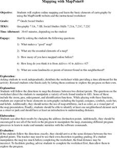
Mapping With MapPoint
The class is engaged through a discussion of mapping. They determine what they believe makes a good map and what the essential elements of a map are. Students work independently to complete a worksheet on mapping. They follow clear...
Curated OER
Media Center Map Skills
Student demonstrates the ability to locate, retrieve, and handle media and equipment by utilizing the library media center floor plan, symbols, and guides. They then use systems of classification to identify, locate, and retrieve materials.
Curated OER
Orientation of the Earth in Space
Students hypothesize the location of the sun in the sky at diferent times of day and at different latitudes. They perform several experiments to provide evidence for their hypothesis. Experiments including observing the sun's position at...
Curated OER
May We Present Planet Earth?
Learners draw a map to scale. They illustrate knowledge of how to use DOGS TAILS on a map. Students identify the main parts of a map. They identify and illustrate the major features necessary for sustaining a quality of life for a society.
Curated OER
Math: a World of Symmetry
Students expand their knowledge of quadrilaterals and identify basic symmetrical forms. Over three weeks, they explore the math, application, and discussion of symmetry. After conducting Internet research, students create symmetrical...
Curated OER
State Research
Students apply previous knowledge of the United States to label a classroom map and then work independently to complete an online scavenger hunt. This lesson is intended for an upper-elementary classroom studying American History and/or...
Curated OER
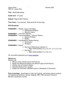
Glacial Geocaching
Eighth graders measure strike and dip of given land features and explain the difference between them. They also look at rock and mineral samples for indentification, along with calculating the density. Finally, information is analyzed...
Curated OER
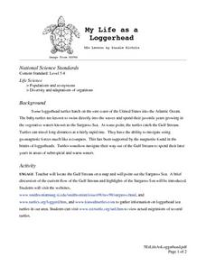
My Life as a Loggerhead
Young scholars discuss the current flow of the Gulf Stream and the characteristics of the Sargasso Sea. They visit websites to gather information on loggerhead sea turtles. Students imagine that they are newly hatched loggerhead turtles.
Other
Federal Aviation Administration: How to Make a Compass [Pdf]
Learn what a compass is, how it works, and how you can create a simple one using a sewing needle, magnet, bowl of water, and a piece of paper.
National High Magnetic Field Laboratory
Magnet Academy: Making a Compass
A well illustrated activity where students make a simple compass. Includes facts about compasses.
Texas Instruments
Texas Instruments: Traditional Compass Construction: Angle Bisector Using Cabri
Use Cabri Jr. and the Compass command to complete the actual construction - pencil, paper, and compass process.
Texas Instruments
Texas Instruments: Traditional Copy an Angle: Compass Construction Using Cabri
Use Cabri Jr to copy an angle. The activity is followed by a student-to-student interview/reflection sheet intended to require students to think, talk, and write about why the construction worked. The reflection sheet could be adapted...
Science Education Resource Center at Carleton College
Serc: Measurement of Compass Orientations of Rock Fractures
In this field activity, learners measure rock fractures with a geologic compass and formulate a hypothesis to explain the origin of the fractures.
American Geosciences Institute
American Geosciences Institute: Earth Science Week: Make Your Own Compass
Students create their own magnetic compass.
TeachEngineering
Teach Engineering: Topos, Compasses, and Triangles, Oh My!
In this activity, students will learn how to actually triangulate using a compass, topographical (topo) map and view of outside landmarks. It is best if a field trip to another location away from school is selected. The location should...






![Federal Aviation Administration: How to Make a Compass [Pdf] Activity Federal Aviation Administration: How to Make a Compass [Pdf] Activity](https://d15y2dacu3jp90.cloudfront.net/images/attachment_defaults/resource/large/FPO-knovation.png)


