Curated OER
PLATE MOVEMENTS AND CLIMATE CHANGE
Students label three geological maps with continents provided to analyze the relationships between the movement of tectonic plates and the changes in the climate. In small groups, they discuss their findings and form hypotheses about the...
Curated OER
Drifting Continents, Dynamic Results
High schoolers plot earthquake and volcano data using a Compass Rose Plotting. They explain the relationship between plate movement and connection. They draw conclusions that earthquakes and volcanoes occur in predictable locations.
Curated OER
Plates on the Move
Students explore how Africa appears to be tearing apart from Asia and tha the other continents are moving and oceans are changing size.
Curated OER
Corals and Coral Reefs
Students label the continents, oceans, and seas on a provided world map and use it to determine where they would expect most of the world's coral reefs to be found based on provided information the teacher has read to them.
Curated OER
Mapping the Ocean Floor
Students construct and interpret a line graph of ocean floor depth and a bar graph comparing the height/depth of several well-known natural and man-made objects and places. In addition, they calculate the depth of two points using sonar...
Curated OER
Marine Debris and Me
Students study the environmental issues that pertain to the marine environment. In this research ocean landfills lesson students come up with alternative means of disposal.
Curated OER
Down on the Ocean Floor
Young scholars build a map of the Atlantic Ocean floor and mark the different depths. In this ocean floor lesson students identify parts of the ocean floor that they created and discuss patterns that they see.
Curated OER
Reading Around the World
Students use the internet to identify the seven continents. Using maps, they locate and identify major physical features of Earth. They are read different books by various authors on the Earth and answer questions related to it. They...
Curated OER
Ocean Zones
Students create a mural showing ocean zones and the diversity of ocean life. They use reference books to create a list of plants and animals that would live in each zone.
Curated OER
Bathymetry
Students study the topography of the ocean floor and the geological processes of how it is formed. They summarize what bathymetry, describe how islands are formed and illustrate a bathymetric model of the sea floor.
Curated OER
Gray Whales on the Move
Students study whale migration and their natural history. In this migration lesson plan students plot whale migration on a map and describe their ecosystems.
Curated OER
The Earth is an Orange
Students examine and identify the various types of maps. Using two types of maps, they compare the data that can be gathered from each one. They also identify and locate the continents and the oceans. They review the purposes of each...
Curated OER
Ocean Color
Students examine NASA's SeaWiFS Project Web site to explore how the SeaWiFS Project monitors environmental and climatic changes in the oceans and atmosphere. They answer questions and write a summary in support of continued funding for...
Curated OER
Climate and Topography, What Is the Connection?
Fourth graders study Neumann's world continent map and explore topography and climate.
Curated OER
Tracing Our Own Family Pilgrimages
Students observe a world map and are introduced to vocabulary like: cities, continents, rivers, lakes, and oceans. They discuss the names of the cities they live in and locate them on the map; then using a colored pushpin indicate: the...
Curated OER
Biome Web Quest
Third graders create paper mache globes, paint them and label the oceans and the continents. In groups, they research a biome, write about it and create an artistic visual representation of the biome and present it to the class.
Curated OER
Sea Secrets
Students study the following: For centuries, people have been challenged by the mysteries that lie beneath the blue depths of our ocean planet. Very little was known about the ocean until late in the nineteenth century, although nearly...
Curated OER
Exploring Marine Objects
Students identify the sources of water on Earth. In this life science lesson, students list the different plants and animals that live in the ocean. They explore marine objects in the lab and draw them.
Curated OER
Modelling Ocean Currents
Students construct a replica of the Atlantic ocean given certain parameters. In this earth science lesson, students draw their own map of ocean currents. They answer questions related to the activity.
Curated OER
Incorporating 3D Visualizations into Your Classroom
Students make observations through 3-D visualizations. They explore scientific and geologic processes through the use of 3-D pictures.
Channel Islands Film
Island Rotation: Lesson Plan 1
How do scientists provide evidence to support the theories they put forth? What clues do they put together to create these theories? After watching West of the West's documentary Island Rotation class members engage in a series of...
Curated OER
Building for the Big One
Students build and test structures that can best withstand earthquakes. They create their structures from playdough, cornstarch, grape-nuts and popsicle sticks and place their structures on a "shake table."
Royal Geographical Society
An Introduction to Maps
First graders are introduced to a variety of maps such as globes, street maps, atlases, and different types of floor plans. The focus of the lesson requires individuals to create their own plan of the classroom using the PowerPoint...
Curated OER
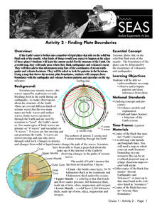
Recent Volcanoes And Earthquakes:
Students investigate the current model for the structure of the Earth. On a world map, they mark areas where they think earthquakes and volcanoes occur and compare those areas with earthquake and volcano location patterns.
Other popular searches
- Oceans and Continents
- 7 Continents and Oceans
- Continents and Oceans Map
- Continents Oceans Landforms
- Label Oceans and Continents
- World Continents and Oceans
- Identify Continents Oceans
- Earths Oceans and Continents
- Canada Oceans and Continents
- Oceans and Continents Maps
- Continents Oceans Rating=3
- Map of Continents and Oceans

