Curated OER
The Making of a Coat
Pupils read the story A New Coat For Anna and discuss their knowledge on how to make a coat. In this reading and coat making lesson plan, students discuss coat making and listen to a speaker that spins thread to make coats.
Curated OER
Pangaea Puzzle
Students explore plate tectonics and the formations of the Earth's surface and why maps are distorted. In this Earth's surface lesson students complete a lab and answer questions.
Curated OER
Diary of a Worm Secret Agents
Second graders explore the geography of Washington D.C. and President Bush's hometown of Crawford, Texas. They read the book, Diary of a Worm, determine the best route to go to Texas from Washington D.C., and throw a birthday party for...
Curated OER
Earth and Space Science: Exploring Earthquakes
Young scholars explore earthquakes. In this earthquake lesson, students research earthquakes and identify where they take place. Young scholars use map skills to track down earthquake locations. There are internet sites suggested in this...
Curated OER
Lights On ! Lights Off! Exploring Human Settlement Patterns
Third graders write informational paragraphs based on the settlement patterns of the United States. In this settlement lesson plan, 3rd graders read about population and how it affects where people settle next.
Curated OER
The Global Grapefruit - Representing a 3-Dimensional Globe on a 2-Dimensional Map
Students compare and contrast world maps and globes. They convert a 3-dimensional globe to a 2-dimensional map. They are introduced to the Mercator map projection. They observe map distortions of shape, area, distance, directions and angle.
Curated OER
The Fault Line
Students use cardboard models of the North American and Pacific plates and sand to investigate what happens when there is an earthquake or movement along the boundaries of the plates.
Curated OER
Spice Up Your Life
Second graders identify major spices found in the world. They link spices with countries they are grown in and the uses for these valuable items.
Curated OER
Where Am I, and How Do I Get Where I am Going?
Students describe geographical places through art, music, writing, and math. They compile information in booklets which may be published.
Curated OER
Planetary Surface Evolution and Resurfacing
Students are provided with drawings of planet surfaces in order to investigate different types of planetary terrain. They make observations for each planet and discuss the characteristics observed. The lesson includes background...
Curated OER
Tracking Ocean Ecology
Students look at the data maps given to them about how chlorophyll affects the algae blooms and make predictions about the harm they will cause. For this data maps lesson plan, students manipulate data sets from the website.
Curated OER
A Line Graph of the Ocean Floor
Learners develop a spreadsheet and import the information into a line graph. In this spreadsheet and line graph instructional activity, students develop a spreadsheet of ocean depths. They import the information into a word processed...
Curated OER
Shifting Coastlines
Learners study North Carolina's changing coastline during the Paleoindian and Archaic periods and determine the positions of the coastline at different times and decide what types of archaeological information has been lost due to rising...
Curated OER
Giving Students a Little Latitude
Students use a world outline map to locate places using coordinates of latitude and longitude. They answer questions about places based on their knowledge of the map and on their research and make up more questions of this sort for each...
Curated OER
Meteors and Meteorites
Students create Earth boxes containing some of Earth's biomes--desert, forest, tundra, ocean, and mountains. They simulate Earth's encounter with a comet trail and the resulting meteor shower. They present their Earth boxes to...
Curated OER
Places in My World
Second graders explore where they are located on the globe. In this maps and globes lesson, 2nd graders use a map to show where they live and show the cardinal directions. Students identify characteristics of mountains, flat land,...
Curated OER
Do You Have a Sinking Feeling
Students determine how marine archaeologists use historical and archaeological data to draw inferences about shipwrecks. Students plot the position of a shipwrecked vessel, and draw inferences about the shipwreck from artifacts that have...
Curated OER
What's the Difference?
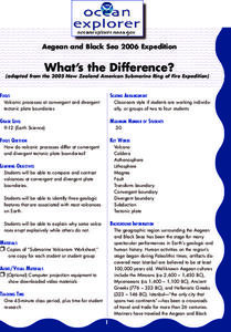
Students investigate volcanic processes at convergent and divergent
tectonic plate boundaries. They read and analyze diagrams, complete a worksheet, and write an essay.
Curated OER
I Robot, Can Do That
Learners examine how underwater robots can be used to assist scientific explorations. They read and discuss an article, conduct Internet research, complete a worksheet, and present an oral report.
Curated OER
Where in the World Am I?
Students are introduced to geography skills. They answer questions on a worksheet using the internet and maps. They examine the area of Japan as well.
Curated OER
Mapping West Virginia
Fourth graders explore West Virginia. In this Unites States geography lesson, 4th graders discuss the type of land and the cities in West Virginia. Students create two overlays, with transparencies, that show the natural land and the...
Curated OER
Australia
In this online/interactive fill in the blank worksheet, students use the words in the word bank to fill in the blanks and complete the sentences about Australia. Students write and check 15 answers.
Curated OER
Global Perceptions: How Your Students View the World
Students examine their own perceptions and attitudes about places around the world. Using their mental maps, they compare and contrast it with a world map from different periods in history. They review the various types of map...
Curated OER
New Perspectives
Students examine maps that are designed to give different perspectives. They create mental maps that illustrate their own perspectives and those of people from other parts of the world.
Other popular searches
- Oceans and Continents
- 7 Continents and Oceans
- Continents and Oceans Map
- Continents Oceans Landforms
- Label Oceans and Continents
- World Continents and Oceans
- Identify Continents Oceans
- Earths Oceans and Continents
- Canada Oceans and Continents
- Oceans and Continents Maps
- Continents Oceans Rating=3
- Map of Continents and Oceans
