Curated OER
A Contouring We Go
Students examine the built environment and infrastructures of their community by constructing contour equipment, using the equipment, and comparing their results to current topographical maps of the same area
Curated OER
Contour and Cross-Section Skills
For this geography worksheet, learners identify the Wolf Creek Crater and how it was formed. They examine a contour map given of how the crater would look from above. Then, pupils use a ruler to draw lines as on the graph to the side....
Curated OER
Cookie Topography
Students construct a cross section diagram showing elevation changes on a "cookie island." Using a chocolate chip cookie for an island, they locate the highest point in centimeters on the cookie and create a scale in feet. After tracing...
Curated OER
Line With Printmaking
Third graders investigate the use of lines in different pieces of art by creating their own ink print. In this art analysis lesson, 3rd graders identify the contours and lines of natural objects such as twigs and leaves. Students trace...
Curated OER
MAPS AND TOPOGRAPHY
Students analyze the details of a topographic map and create one of their own by utilyzing a map of elevations.
Curated OER
Put Your Face on the Map
Young scholars investigate topography and contour lines by examining a human face. In this mapping lesson, students create a plaster cast of a face and create a map of the contours of the face one centimeter at a time. Young scholars...
Curated OER
Cross Section and Slope
Students draw cross sections of given contour maps. In this math lesson, students interpret the different symbols used in the map. They determine slope and steepness through direct measurement.
Curated OER
Tessellations
Students learn and review basic geometric terms, definitions, and theory, including regular polygons, lines, angles, points, etc. They make a tessellating stamp and create a repeating work of art.
Curated OER
What's Its Slope
Learners identify the slope of a lines.For this algebra lesson, students define the meaning of slope and write an equation given the slope. They graph linear functions using the slope and y-intercept.
Curated OER
Paper Maché Mancala Game Boards
Seventh graders create three dimensional works of art from two dimensional plans, develop skills in papier-mach?? technique, utilize elements and principles of design to create 3-D form, and develop math/strategy skills in playing the...
Curated OER
Cartogram of the Great Compromise
Young scholars create cartograms of populations during 1790.
Curated OER
Rule of Quarters
Students memorize four key decimal values for quick and accurate conversion. They convert decimal foot measurements to inches and fractions using math tables, computation or memorization. They memorize decimal foot conversions.
Curated OER
Shapes to Forms
Here is a math activity that is really a visual arts activity in disguise! In it, pupils utilize their knowledge of geometric shapes and forms to create a detailed version of a cylinder. The instructions on how to go about the task are...
Curated OER
TOPSY TURVY MAPS
Eighth graders use the data analyzer and motion detector to collect data and measure distances. They create topographic maps drawn to scale of a given setup and relate the concepts to the creation of historical ocean maps.
Curated OER
Mud in the Water
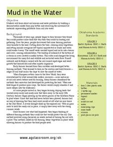
Sixth graders investigate erosion. In this erosion lesson, 6th graders explore how farming changes the environment. Students construct an erosion model and research ways to protect the soil from excess mud generated by farming.
Curated OER
Physics: Visualization of Hydrogen Wave Functions
Students explore various methods for visualizing the results of hydrogen wave function. They observe trends using a polar plot tool and make plots for the first three energy levels of the radial wave function for hydrogen. Students apply...
Curated OER
What do Bison Eat?
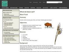
Middle schoolers identify the three major categories of food eaten by bison. In groups, they collect examples of grass and forbs and press them. They complete a chart of the percentages of each type of food the bison eat in a day. ...
Curated OER
Geographical Skills-- Map Scale
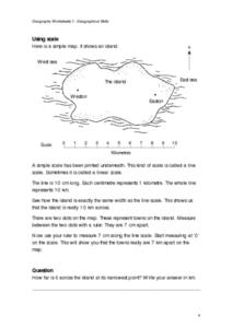
In this maps learning exercise, students study a simple map and the scale in kilometres. Students read the directions and answer one question. Students then look at a sketch map of a town and answer 2 questions. Students also read how to...
Other popular searches
- Contour Maps
- Blind Contour
- Geography Contour Lines
- Contour Maps and Elevation
- Contour Drawings
- Blind Contour Drawing
- Contour Planting
- Contour Line Drawing
- Geography Contour Lines
- Contour Intervals
- Teaching Contour Lines
- Contour Maps Topography


