Curated OER
Riding With Alice
Student listen to Don Brown's, Alice's Grand Adventure before discussing cross country travel. They trace Alice's travels on an outline map of the US and focus on the state of Indiana. They color and label the counties that Alice...
Curated OER
Mending the Rift
Students determine what factors identify a country's political borders. After reading an article, they investigate questions surrounding the Great Rift Valley. On a map, they trace the valley from Asia through Africa and research the...
Curated OER
Mapping the Middle East
Students examine how the countries of the Middle East were created. They explore the influence of various political and geographic factors in their creation. They list the things they should consider in deciding how to draw new borders...
Curated OER
Setting Boundaries
Students investigate the determination of the boundaries of various countries. They work in small groups to research a country's political history and past boundary issues and territorial disputes.
Curated OER
New Food Saves Lives, Could End Hunger
Students locate the country of Niger, then read a news article about a new type of food that is being used to fight childhood hunger in Africa. In this current events activity, the teacher introduces the article with map and vocabulary...
Curated OER
How Many Ways Can You Say Merry Christmas?
Students create a multicultural holiday bulletin board map! students research and study saying Merry Christmas in different languages. They correctly locate the countries on a world map.
Curated OER
Gross Domestic Pizza
Middle schoolers explore major components of gross domestic product (GDP) and how it is determined; students create and compare GDP pie charts for the countries of Pepperonia and Anchovia.
Curated OER
The July Crisis: Can You Stop the Great War?
Students role-play as diplomats from countries involved in World War I who have received telegrams stating they must prepare presentations on their country's position about the war. They have 45 minutes to reach a peace accord, or they...
Curated OER
Zimbabwe
In this Zimbabwe activity, students read an article and examine a map of Zimbabwe and then respond to 11 short answer questions regarding the economy and geography of the country.
Curated OER
Somewhere in the Middle
Students investigate the cease-fire between Israel and Lebanon in August of 2006. The geographic region known as the Middle East is examined and maps created with information on border and territory disputes.
Curated OER
The Time Has Come: Poetry and Drama Use in the Geography Class
Young scholars use drama and poetry in their Geography class. In groups, they role play an interviewer or the interviewee in various plays that were presented to them. In their role, they must locate and label where the countries...
Curated OER
Sectionalism
Students examine sectionalism. In this sectionalism lesson, students explore reasons sectionalism developed. Students realize the conflicts that led to the Civil War and how sectionalism affected citizens on the border of Kansas and...
Curated OER
Immigration Illumination Project Curriculum Materials
Gain an understanding of the complex topic of immigration with a collection of resources. Class members engage in a series of activities designed to give them insight into the factors that influence immigration policies and the effects...
NASA
Outline Maps
Don't miss this gold mine of blank maps for your next geography lesson! Regions include traditional continents such as Asia, Europe, and Africa, as well as other major world areas such as the Pacific Rim and the Middle East.
Academy of American Poets
Teach This Poem: "Maps" by Yesenia Montilla
After examining a physical map of the world, learners conduct a close reading of Yesenia Montilla's poem "Maps." They note the interesting words and phrases, the way the poem is structured, and list questions they might have. After...
Curated OER
Mapping Germany
In this Germany worksheet, learners label the map of Germany with different landmarks. Students label the map with 10 different cities, rivers, and borders.
Curated OER
The Baltic Sea
Students study the Baltic Sea and the bordering countries. In this environmental lesson students study changes in environment and develop a sustainable future.
Curated OER
Map of Italy
In this map of Italy activity, students find, color and label cities, surrounding countries, bodies of water and landforms in the country of Italy.
Curated OER
Creating a Map of France
In this crating a map of France worksheet, students find and label important parts of France, bodies of water, mountains and surrounding countries.
Curated OER
Map of Egypt
In this map of Egypt worksheet, students label the cities, bodies of water, surrounding countries and color the map according to the directions.
Curated OER
Mexico and Its Neighbor to the North
High schoolers stage a debate about immigration between the United States and Mexico. Half the groups the "pro" position of the question and half the groups the "con" position. They research and print online information about U.S.-Mexican
Curated OER
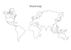
World Map
In this social studies worksheet, students use the unlabeled world map for any geography activity. The individual countries are not marked with border lines.
Curated OER
Mapping the Border
Learners create maps of the borderland region. They decorate their maps with colors, pictures, icons, scenes, words that reflect their understanding of the character and history of the borderland.
Curated OER
World War II Geography
Students explore the geography of Europe. In this World War II lesson, students study and represent countries involved in the war as they participate in a simulation that requires them to discuss war events and how their countries were...


