Curated OER
The Road to Success
Young scholars chronicle the main events in their lives so far. They draft, revise, and publish an anecdote. Students get to know their fellow classmates and they build a nurturing learning community. Young scholars take an interest...
Curated OER
Denali Park Topographic Maps
Middle schoolers construct a topographic map of the Denali National Park. They identify different elevations and record historic landmarks in student science journals.
Curated OER
Treasures of the Silk Roads
Students examine and discuss art objects from the Silk Roads. They analyze images of artifacts, create a word map, and develop and write a short story or poem based on the slides viewed.
Curated OER
Map Reading in the 21st Century
Students interact with MapPoint tools to view maps of the past and the present in multiple ways. They participate in mini-lessons aimed at locating certain points of interest or famous routes taken in history.
Curated OER
Planning a Road Trip!
Students generate plans for a fictitious road trip. For this time management lesson, students investigate the most effective way to travel the country arriving at specific cities. Students create their plans based on time and distance.
Curated OER
Mapping School Grounds
Students map and analyze the natural and cultural environment of the school grounds. In small groups, they sketch the natural and cultural features of each side of the school building, create a map, participate in a class discussion,...
Curated OER
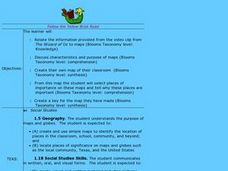
Follow the Yellow Brick Road
Students watch a portion of "The Wizard of Oz" and discuss how a map could be useful to Dorothy. They identify key components of maps and design a map of their classroom, including a key.
Curated OER
Discovering New Mexico
Seventh graders discuss the elements of maps and using basic linear measurement. They calculate the distance between the cities and create a simulated journey around New Mexico using a road map. They write out the directions for their...
Kentucky Educational Television
The Road to Proportional Reasoning
Just how big would it really be? Young mathematicians determine if different toys are proportional and if their scale is accurate. They solve problems relating scale along with volume and surface area using manipulatives. The last day of...
Curated OER
Trade in the Silk Road Cities
Students use Google Earth to map cities along the Silk Road trade route. In this Silk Road trading instructional activity, students complete a worksheet examining production, transportation, and value of goods and research trade items....
Curated OER
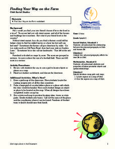
Finding Your Way on the Farm
Third graders make a grid map. In this directionality lesson plan, 3rd graders review how to use a grid to locate objects or places on a map. Students draw a grid map of the classroom and locate seating assignments. Students create a...
Curated OER
George Washington's Revolutionary Journeys
Students take a closer look at historical maps. In this American Revolution activity, students examine the provided historical maps and documents to determine the assignments that George Washington assigned to subordinates during the...
Curated OER
A Shuttle's Eye View
Students explore the goals of the Shuttle Radar Topography Mission as a springboard to exploring the topographical features of their own state or region. They synthesize their understanding of landforms and topography by mapping their...
Curated OER
Neighborhood Map Machine
Second graders study building placements in a neighborhood. They discuss businesses, roads, houses, rivers, police/fire stations, and use Neighborhood Map Machine to create a new map. They complete an exploratory map and community of...
Curated OER
Map of the Ottawa Valley
Students locate Ottawa Valley on a map. They then answer questions in reference to the map such as: What was the first use of timber in the Ottawa Valley?, What occurred first in Gatineau?, and On the Ontario side of Ottawa River, how...
Curated OER
The Landscape of a Novel
Students, after reading a novel, utilize geographic skills to map out the places described in the novel. They collect data, envision spatial features and then design a map to work off of to complete their assignment. Each student also...
Curated OER
Draw an Inch, Walk a Mile
Learners work in small groups to solve the problems presented. The main project, mapping the classroom, use these discussions to collaborate in creating a tangible demonstration of their understanding.
Curated OER
National Road to Indiana
Young scholars explore the National Road to Indiana. For this U.S. highway history and primary source research lesson, students read an original journal written by Jane Voorhees Lewis in 1806 describing her trip west on the first...
Curated OER
Road Trip
Students create PowerPoint presentations on destinations researched on the Internet.
Curated OER
From Maps to Models
Fourth graders study topography maps and learn the importance of their contour lines. In this map instructional activity students create their own topography map.
Curated OER
Mud Maps
Students discuss the location of stores, buildings, and homes in their community. Afterwards, they create a 'mud map' demonstrating the route from one point to another. In pairs, students read travel directions from a brochure, while...
Curated OER
Marco Polo Takes A Trip
Students identify Marco Polo and discuss why he took his trip, indicate on map routes Marco Polo took to China and back, describe challenges of traveling along Silk Road, list several interesting aspects of 13th Century Chinese culture,...
Curated OER
Understanding Geography
Students create a map of their own neighborhood to show the relationships between the geography of the neighborhood and its economy and culture. They view and discuss an introductory video on how geographers study an area then go out...
Curated OER
Why We Count
Students visualize census data on a map and use a map key to read a population map. In this census lesson, students use a map of the Virgin Islands and corresponding worksheets to gain an understanding of population density.


