Curated OER
Setting the Story: Techniques for Creating a Realistic Setting
“It was a dark and stormy night.” Thus begins the 1830's novel Paul Clifford and, of course, all of Snoopy’s novels! Encourage young writers to craft settings for their stories that go beyond Edward Bulwer-Lytton’s often-mocked phrase...
Curated OER
Where in the World is Cynthia San Francisco? A weather-related challenge
Students investigate concepts of weather using a guided, essential question. They collect data from satellite weather images and create models to track the progress of weather changes.
Curated OER
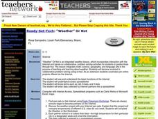
Weather Or Not
Students use the internet to find pen pals to share in their weather experiment. Individually, they research the high and low temperatures for cities within the United States and email the results to their pen pal. They also develop a...
Curated OER
Monarch Butterfly Migration Map
Students examine the migration patterns of the monarch butterfly. They practice using color-coded maps. They create their own maps based on the butterfly's migration. They share their maps wtih the class.
Curated OER
Strawberry Girl: Life on the Frontier
Students explore geographic changes by researching the state of Florida. In this Florida history lesson, students identify the storms and disasters that have created sinkholes in portions of Florida. Students read the book Strawberry...
Curated OER
Project Jukebox
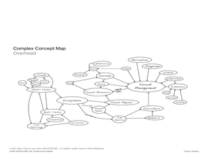
Students analyze an interview with the Climate Change Project Jukebox in order to help them undertand how to use a concept map. In this writing and climate change lesson, pairs of students log onto the Internet site for Climate...
Curated OER
River to the Sea
Students investigate the function of wathersheds and weather while they follow Lewis and Clark on their jouney west. They also create a map using acurate measurements and build a model watershed.
Curated OER
Create a Weather Newscast
Fourth graders explore, research and study how to make and give a weather newscast. They assess a variety of weather terms, research skills on the Web and develop an oral presentation on a weather newscast to present to their classmates.
Curated OER
Mapping a Stream
Students map an actual local waterway. They create full color scale drawings that include windfalls, plant cover, streambed composition, and landmarks such as trees, boulders, and slumps. This is a long-term project that involves...
Curated OER
The Magic School bus Inside A Hurricane
Students investigate the concept of a hurricane by using the cartoon series "The Magic Schoolbus" to simulate the fantasy of traveling through a hurricane. The lesson uses a KWL graphic organizer in order to guide student inquiry and as...
Curated OER
Measuring Precipitation
A little engineering design is mixed into this lesson on precipitation measurement. Groups plan and construct a rain gauge, and use it to collect precipitation. As part of the PowerPoint presentation, learners view a satellite map of...
Curated OER
Color Enhanced Maps
Students download or create maps with numerical weather data. They add isolines and color to create regions on their maps. They explore the visual properties of color palettes and create a visualization applying their knowledge.
Curated OER
Clouds and the Weather
Fourth graders analyze the relationship of clouds and local weather. Students also observe and record cloud data and weather conditions daily as they research different cloud types. The data is analyzed looking for trends in daily...
Curated OER
Weather and Climate
Young scholars identify the words plain and climate and discuss what would happen if it never rained. Students identify and interpret the weather in Poland and create a web illustrating various weather patterns. Young scholars write a...
Curated OER
Weather Patterns and Acid Rain (or What is Chicago's acid rain doing in the Adirondacks?)
Students examine a color-coded map of U.S. acid rain precipitation intensity. Using EPA data table and the blank U.S. map, they record state-by-state values for magnitude of emissions and compare areas of emissions to areas with the most...
Curated OER
Mars Geologic Mapping
Students identify and interpret photographic details of a Martian surface image, design, and create a simple features map. They identify and interpret the geologic history of a part of Mars' surface and then, analyze and discuss the...
Curated OER
The Science of Weather: How Doppler Radar reads weather
Young scholars read about how radar detects changes in the weather. In this lesson plan on weather reporting, students read a diagram that shows how radar reads weather. This lesson plan includes discussion questions and an individual...
Curated OER
WEATHER SATELLITE PREDICTION PROJECT
Young scholars compile weather satellite data from three satellites for one month, obtain weather reports and data from professionals, then create a document with predicted results.
Curated OER
Chart the Weather for Cities Around the World
Learners orally describe Northern and Southern hemispheres, identify 7 continents, and point out specific countries and cities. They locate and record weather information.
Curated OER
Texas Weather Report
Young scholars use provided links to observe selected weather sites and collect temperature and precipitation data for listed cities. They enter the information onto their spreadsheet. Students study maps of the Texas natural reagions,...
Curated OER
Tracking the Weather
Students use satellite imagery and forecasting maps as a storm moves through the United States. In this weather lesson plan students track storm systems and chart the systems on a map.
Curated OER
Tracking Fall's Falling Temperatures
Young meteorologists track weather from day to day and record results on graphs, maps, or other places. They see firsthand how weather temperatures trend cooler as fall progresses and practice grade-appropriate skills in geography (map...
Curated OER
Oceanic Heat Budget Activities
Young scholars map and research imaginary islands located in different parts of the world. They describe the weather and climate of their island and show how local currents, water temperatures and waves may influence the weather patterns.
Curated OER
Data Analysis and Measurement: Ahead, Above the Clouds
Students explore and discuss hurricanes, and examine how meteorologists, weather officers, and NASA researchers use measurement and data analysis to predict severe weather. They plot points on coordinate map, classify hurricanes...


