Curated OER
GIS: Mapping Watersheds of the Edwards Aquifer in Travis County
High schoolers manipulate existing GIS data to create and map a new layer of information that shows that watersheds in Travis County that are on top of Edwards Aquifer. They create and map that shows the watersheds in Travis County that...
Curated OER
Landscape Diversity in the Yukon Territory
Students review and analyze a satellite image of the Yukon territory.
Curated OER
Discovering Prehistoric Trails
Eighth graders examine prehistoric terrain. In this geography lesson, 8th graders discover necessary resources for settlers. Students work in small groups to create a trail crossing the state of Kansas.
Curated OER
What Time Is It? (Latitude and Longitude)
Students practice latitude and longitude by identifying locations by degrees, use meanings of a.m. and p.m. appropriately, become familiar with 24-hour (universal) clock, and calculate time at different degrees longitude.
Curated OER
Ottoman Lyric Poetry
Students explore the Ottoman style of poetry. They view a video, Suleyman the Magnificent, and view maps of Europe, Asia, Africa and the Mediterranean Sea. They research the Ottoman Empire and keep a journal. They read various Ottoman...
Curated OER
Global Perceptions: How Your Students View the World
Students examine their own perceptions and attitudes about places around the world. Using their mental maps, they compare and contrast it with a world map from different periods in history. They review the various types of map...
Curated OER
Think GREEN - Utilizing Renewable Solar Energy
Students use data to find the best renewable energy potential. In this solar energy lesson plan students import data into Excel and explain how solar energy is beneficial.
Curated OER
Massive Migrations
Here is an exciting exploration of a fascinating topic for your emerging ecologists: bird migration! They begin by visiting the US Fish & Wildlife Service website to discover which Arctic birds come to their areas. They are assigned...
Curated OER
International Currency Exchange
Students examine coins from around the world and write down their observations. As a class, they discuss the types of symbols used on the coins from different countries and locate the country on a map. To end the lesson, they calculate...
Curated OER
Landforms Mobile
Students work together in groups to research the various types of landforms found on the Earth and locate them on a map. As a class, they discuss how the landforms affect the way people live in those areas. To end the lesson, they use...
Curated OER
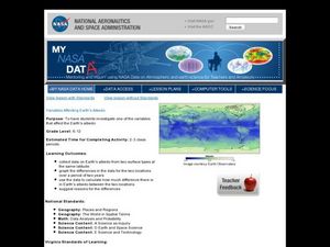
Variables Affecting Earth's Albedo
Students study the variables that affect the Earth's albedo. In this environmental data analysis lesson students interpret and graph information and calculate changes.
Curated OER
What's For Dinner?
Eighth graders discover how the location of restaurants affects the future location of different restaurants. Using a fictionous town, they map the locations of all current restaurants and analyze the data to determine what type of...
Curated OER
Trees of Mississippi
Students research tree species found in Mississippi, and record the tree types, numbers of trees, and locations. Students then research the forest industry sites, and determine possible relationships between industry location and tree...
Curated OER
Various Industries to Help Hawaii's Economy
Students identify various industries in Hawaii and where those products/services are exported to. They create a timeline which highlights important dates and events of those different industries. Finally, they identify on a map places...
Curated OER
Culture Regions of the U.S.
Students identify the location of different cultural groups within the United States (agricultural, retirement, urban, etc.) They map these areas and analyze the correlation between the landscape of a given region and the type of...
Curated OER
Aboriginal Web Design
Students explore world history by participating in a web design activity. In this aboriginal history lesson, students discuss the different jobs associated with designing a web site and identify the types of media that are often shown on...
Curated OER
Sunderland: Discovering Cities
Scholars investigate a local city (Sunderland) by participating in a discussion. They explore the different elements of the UK city by identifying the industrial and economic aspects. They also read an interview of two people speaking...
BBC
Eu, Un, and Commonwealth: Keeping Peace
What are the UN, the EU, and Commonwealth? Have the class brainstorm all they know about these powerful international organizations. Then have them compare and contrast the ways in which different countries or political groups...
Curated OER
Westward Expansion
Students locate California and New York on a map and explore available means of travel in the 19th century. Students explore the role of trade in pioneer America and simulate various barter transactions.
Curated OER
Plate Tectonics & Land Forms
Fourth graders discuss the different interactions of plates and the ways mountains are created. In this plate tectonics lesson students complete an activity in groups.
Curated OER
Brazilian Animals
Students research the animals of Brazil. In this animal science lesson, students locate Brazil on a map and discuss the types of animals that can live in its tropical climate. They research a Brazilian Carnaval and see the roll the...
Curated OER
Adinkra Cloth
Young scholars locate Ghana on a map of Africa and discover features of Ghana culture. They synthesize the importance of Adinkra symbols and cloth to the people of West Africa and design an Adinkra cloth.
Curated OER
Why the Y2Y?
Students investigate the proposed route from Yellowstone to Yukon. They listen to lectures about the proposal and the different opinions concerning it. Students research the type of wildlife in the area for the road and they consider how...
Curated OER
Probing the Unknown: Artists as Explorers
Students gain an understanding of humans need to explore. They create a "journey map" depicting the accomplishments of artistic explorers, and research the influences that caused the artists to embark on these "explorations."


