Curated OER
We're Going on an Animal Safari!
Students take viewers on an animal safari. In this technology lesson, students research animals one would see on an African safari. Students collaborate to create a storyboard and use Flip Video Cameras to create a virtual safari. The...
Curated OER
Mammals of Fields, Meadows, and Hedgerows
For this mammals worksheet, students research the internet to find information and answer short answer questions about mammals of fields, meadows, and hedgerows. Students complete 12 questions.
Curated OER
Biomes: the Threat of the Sea
Students study global warming including its causes and effects. In this creative lesson students make posters on global warming.
Curated OER
The New Madrid Earthquakes of 1811-1812: Shaking Our Misconceptions about Earthquakes in United States History
Students Examine how earthquakes work and what plate tectonics and fault lines are. In this earthquake lesson students complete an earthquake scavenger hunt.
Curated OER
No Magic Borders: Haleakala Style
Students discuss borders and boundaries. They discuss pollution and the fact that boundaries cannot stop pollution and that pollution affects even protected wildlife and plants. They participate in an activity in which they must place...
Curated OER
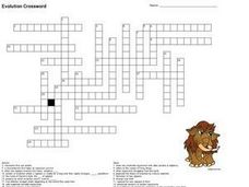
Evolution Crossword
In this evolution crossword worksheet, 7th graders complete a crossword puzzle about evolution. Students read the definitions to fill in the puzzle with evolution terms.
Curated OER
Hands-On Weather Data Collecting
Fifth graders study weather in their community, in the United States, and around the world. They use thermometers, the beaufort wind scale, and simple weather symbols to measure and record the weather outside their school. They also look...
Curated OER
How Islands Form
Pupils how islands form, rising water levels, growth of coral, and volcanoes. They complete Island Investigation worksheets after researching island formation on various Internet websites.
Curated OER
Discovering the Physical Geography of Washington
Pupils develop a mental map of the state of Washington and draw it on paper. Using the Virtual Atlas, they identify the physical features of the state and draw them on their map. They also examine the populations and diversity of the...
Curated OER
Ocean Currents
Fourth graders work in groups to research ocean currents and create posters with their findings. They locate the patterns and names of major ocean currents and identify them on a map. Students also use red pencil to show ocean currents...
Curated OER
Trouble in the Troposphere
Students Use data sets from MY NASA DATA to produce graphs comparing monthly and yearly ozone averages of several U.S. cities. They analyze and evaluate the data and predict trends based on the data. In addition, they discuss and...
Curated OER
Controlling the Flow of the Colorado River: A Study of Dams
Students research and map the Colorado River and its dams and predict the effects of a dam on an area. They suggest reasons a dam would be built and compare the Colorado River system with other major river systems within the US and...
Curated OER
Climate Systems - Which Location Is Best For Me?
Students study the difference between weather and climate. In this climate systems lesson students search the Internet for the parts of the Earth's system, gather climate data and complete a challenge scenario.
Curated OER
Classifying Stars and Constellations
Students examine stars and constellations. In this space science lesson plan, students visit selected websites to discover information about the classification of stars. Students also practice identifying constellations.
Curated OER
It's Getting Hot out Here! Should I be concerned? (Climate Change)
Middle schoolers explore the effects of global warming. They examine the differences between weather and climate. After viewing a video, students summarize information on climate change and drought.
Curated OER
Rock Creek Water Quality
Ninth graders test water in a local creek using chemical kits and probes. They take GPS readings and digital photos. They calculate the Water Quality Index and create a spreadsheet of the test data.
Curated OER
Landforms
Young scholars begin their examination of landforms. Using a map, they locate and identify the major landforms on Earth. They discuss how landforms affect the lifestyle of the community and determine which goods and services the...
Curated OER
Sunrise, Sunset: Quickly Go the Days
Students explore the concept of daylight. In this daylight lesson plan, students compare the amount of daylight on a particular day in Anchorage compared with daylight where they live. Students color maps of the US according to amount of...
Curated OER
Finding an Earthquake's Epicenter
Students examine the process used to identify the epicenter of an earthquake. They identify the Richter scale and interpret a seismograph reading. They also view photographs of the aftermath of earthquakes.
Curated OER
The Search for Secret Agents
Young scholars embark on a scavenger hunt around the school looking for indoor air pollution and mapping source locations. They predict and observe sources of indoor air pollution, understand and give examples of technologies we use...
Curated OER
Carving Mountains
Students explore geography by participating in an illustration activity. For this land-form lesson, students define vocabulary terms associated with glaciers and forests. Students utilize pens, cardboard and pottery clay to draw and...
Curated OER
Geometry of Exploration: Eyes Over Mars
Students research how engineers and scientists generate linear and angular measurements with geometry to survey the Earth and Mars. They assess how geometric shapes affect navigation. A surveyor comes to the classroom and explains how he...
Curated OER
The Distance Between Us and Them: Sea Floor Spreading in the Atlantic Ocean
Pupils examine how geologists determine rates of sea floor spreading between two tectonic plates. They apply mathematical concepts such as the calculation and use of velocities and conversion from one set of units to another.
Curated OER
Where Do Hurricanes Happen?
In this hurricanes worksheet, students label the 6 different regions that hurricanes and tropical cyclones occur around the world.


