Hi, what do you want to do?
Curated OER
Mapping Meteorites
After reading an article, "Cameras Capture a 5-Second Fireball and Its Meteorite's Secrets," space science superstars use the triangulation method to determine the location of a distant object. In-class activities and homework are...
Curated OER
HW Unit 10:7-Light
In this light worksheet, students answer twenty six questions about sound and light and how they both travel. They also answer questions about different types of waves in the electromagnetic spectrum such as radio waves, visible light,...
Curated OER
Graphing Functions
In this graphing functions worksheet, students write functions in logarithmic and exponential forms. They evaluate logarithms and determine the inverse of a function. Students graph functions. This six-page worksheet...
Curated OER
Where Are We?
Students use Cartesian coordinates or degrees of latitude and longitude to locate important locations within their specific countries. They Use a grid to apply the concept of latitude and longitude, or positive and negative Cartesian...
Curated OER
Algebra II - Lesson 10-3: Circles
In this equations of circles worksheet, students solve 4 short answer problems. Students find an equation of a circle given the center and radius.
Curated OER
Follow the Falling Meteorite
Students use triangulation method to locate meteorite landing site on the map. In this earth science lesson plan, students participate in a meteorite treasure hunt set up by the teacher. They explain how this method is used by scientists...
Curated OER
Geology Word List
In this science worksheet, students review the vocabulary words for the separate categories related to the concept of geology.
Curated OER
Roots of the Hawaiian Hotspot
Students explain the processes of plate tectonics and volcanism that resulted in the formation of the Hawaiian Islands. They describe, compare, and contrast S waves and P waves. They explain how
CK-12 Foundation
Ck 12: Earth Science: Locating Earthquake Epicenters Study Guide
This comprehensive study guide covers the main terms and concepts needed for an earth science unit on locating earthquake epicenters. Review questions are included at the bottom of the study guide.
Michigan Technological University
Michigan Tech: Locating an Earthquake's Epicenter
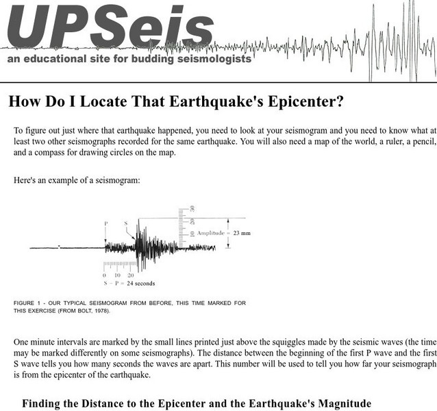
Gives directions on how to find the epicenter of an earthquake, the distance to the epicenter and the magnitude of the earthquake.
National Association of Geoscience Teachers
Nagt.org: A Kinesthetic Demonstration for Locating Earthquake Epicenters
A kinesthetic activity for students to understand the technique for locating the epicenter of an earthquake. It is performed indoors and outdoors in three lessons.
CK-12 Foundation
Ck 12: Earth Science: Locating Earthquake Epicenters
[Free Registration/Login may be required to access all resource tools.] How to find the epicenter of an earthquake.
CK-12 Foundation
Ck 12: Earth Science: Locating Earthquake Epicenters
[Free Registration/Login may be required to access all resource tools.] How to find the epicenter of an earthquake.
University of California
Earthguide: Mystery Detectives: Mystery Epicenter: Earthquake
Students analyze seismograms to locate mystery earthquake epicenters as they produce a news story about a major local earthquake to complete their mission.
Science Education Resource Center at Carleton College
Serc: Subduction Zone Earthquakes
For this lesson, students manipulate a model, consisting of templates on a piece of paper and an overlaying transparency, in order to explore the characteristics of subduction zone earthquakes. In the process, they develop an...
Science Buddies
Science Buddies: Locating an Earthquake Using a Global Seismic Network
When an earthquake happens, how are scientists able to determine the original location of the quake? In this project, you'll use archived data from a global network of seismometers to find out for yourself. You will make your own...
TeachEngineering
Teach Engineering: Earthquakes Living Lab: Epicenters and Magnitudes
Students learn how engineers characterize earthquakes through seismic data. Acting as engineers, they use real-world seismograph data to locate earthquake epicenters via triangulation and determine earthquake magnitudes.
US Geological Survey
U.s. Geological Survey: Earthquake Center: Glossary
This resource provides definitions of important earthquake related terms.
Science Education Resource Center at Carleton College
Serc: Virtual Earthquake
An activity-based program designed to introduce the concepts of how an earthquake epicenter is located and how the Richter magnitude of an earthquake is determined.
Incorporated Research Institutions for Seismology
Iris: Walk Run: Locating an Earthquake Using Triangulation
Roll over the seismic stations to see earthquake epicenters triangulated. Touch buttons to watch movies of seismic waves.
Science Buddies
Science Buddies: Locating the Epicenter of an Earthquake
When an earthquake happens, how are scientists able to determine the original location of the quake? In this project, you'll use archived data from a network of seismometers to find out for yourself. You'll create your own seismograms...
Other
University of Wisconsin Green Bay: Faults and Earthquakes
This site is primarily set up as an outline and is loaded with graphs, maps, and images. It covers a variety of earthquake-related topics, such as what causes earthquakes, fault lines and structures, seismology, a historical look at...
TeachEngineering
Teach Engineering: Earthquakes Living Lab: P Waves, S Waves and More
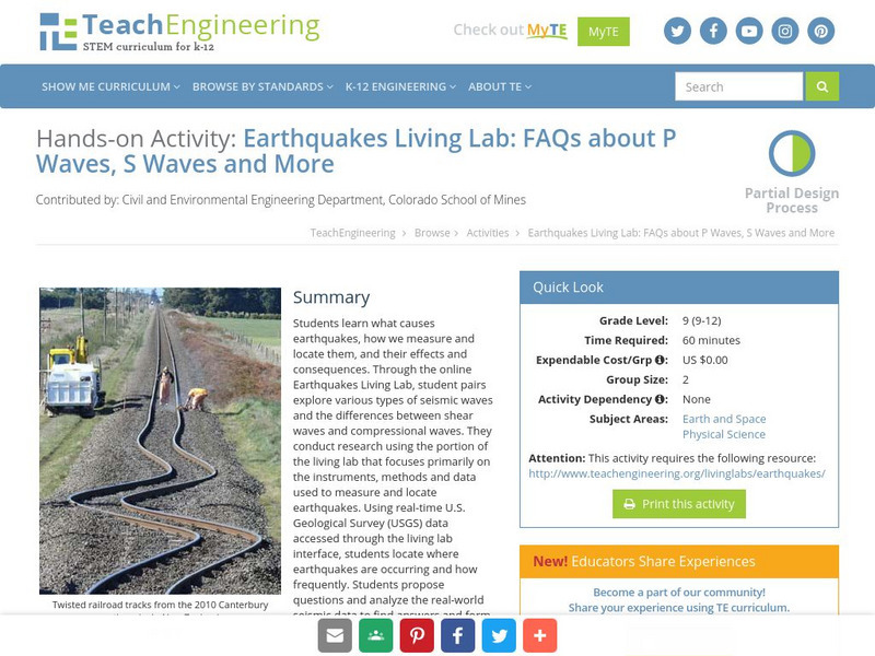
Students learn what causes earthquakes, how we measure and locate them, and their effects and consequences.
American Geosciences Institute
American Geosciences Institute: Earth Science Week: Earthquake on the Playground
In this experiment, students go outside and create a simulation of P and S waves traveling across a 30-meter span. This is repeated using a 30-meter square. They experiment with P and S wave behavior, record results, and use...


