Curated OER
Topographic Maps
Sometimes it is difficult to grasp topographic maps. Here is a clever presentation designed to help your middle school earth scientists understand. Beginning with a side view of a pair of mountains, a graphic guy walks up one slope. As...
Curated OER
Contour Map Worksheet #4
There are only four questions here. There is a contour map of Cottonwood, Colorado and the creek that crosses it. Earth scientists tell in what direction the creek flows, identify the highest elevation on the map, draw a topographic...
Curated OER
Elevation, Plants and Animals
Students determine whether elevation is one of the things that affect where and how plants and animals live. They read plant and animal physical descriptions and determine the environment where the animal might live.
Curated OER
Controlling Flight: Rudders, Ailerons, and Elevators
Fifth graders create paper gliders and check for flight distance and time. In this flight lesson, 5th graders create a paper glider from the attached worksheet and adjust the rudder, aileron, and elevator. They see how these adjustments...
Curated OER
Outdoor Education; Maps, Elevation
Ninth graders use online topographical maps to fill in a chart regarding elevation and contour lines.
Curated OER
Hurricane Impact: Storm Surges and Elevation Transitions
In this hurricane worksheet, student answer 6 multiple choice questions and 8 short answer questions about hurricanes. They color the map to show flooded areas.
Curated OER
Exploring Biomes Lesson 5: You Need a Vacation
In cooperative groups, emerging ecologists research assigned biomes found in Arizona. Combining photos and facts, they use PowerPoint to produce a fully automated commercial that lasts 45 seconds. In addition to the lesson plan outline,...
Curated OER
Exploring Biomes Lesson 2: Biome Research
Learners view a PowerPoint presentation on biomes and their classifications. Divide them into groups and assign them each an individual biome to research. There are pictures of the PowerPoint slides and notes about what to teach for...
Curated OER
Google Earth
In this Google Earth worksheet, students access the Google Earth website and find the latitude, longitude, and elevation for their house and school. Then they do the same for a variety of world locations. This worksheet has 10 fill in...
Curated OER
Introduction to Topographic Maps
Tenth graders create a topographic map and see how it represents different elevations. In this topographic maps lesson students read and interpret topographic maps.
Curated OER
Gilligan's Island
Students investigate topographical maps and match actual landforms to them. In this topographical maps lesson students create "Gilligan's Island" to scale then answer questions about it such as what the highest elevations is and what...
Curated OER
Tracing Highs and Lows in San Francisco
On a topographic map, students identify the scale bar, north arrow, and contour interval. They then locate a hill on the map and make note of the contour lines. Students then locate other places with similar contour line patterns....
Curated OER
Exploring Hawaiian Mountain Zones
Fourth graders watch a video that describes the climate and vegetation zones of Hawaii. They describe the different physical conditions that create vegetation zones from the sea to the mountains. In groups, they create an illustrated...
Curated OER
Contour Map Worksheet #3
Earth scientists answer five multiple choice questions about the topographical map atop the learning exercise. Use this as a quick assessment of understanding after having taught how to read contour lines and topographic maps.
Curated OER
Forest Communities
Students identify tree specimens. In this tree specimens lesson, students collect different parts of a tree from the areas around the school or their home. They then work in groups to create booklet that identifies tree specimens.
Curated OER
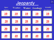
Jeopardy - Earth Sciences
Questions about water, weather, geology, astronomy, and the scientific process make up this Jeopardy game. It is a pretty well-rounded set of slides, although you may want to be aware that a few of the questions are specific to the state...
Curated OER
CLIMATE AND WEATHER UNIT
Learners locate on-line weather source, gathers and interprets weather data, work collaboratively on-line with other schools to collect weather data, and write about the cause of temperature inconsistencies in various locations.
Curated OER
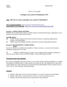
Geologic cross section of Manhattan, NYC
Students draw an accurate geologic cross section by using a given data table. They relate the features of the cross section to geologic processes. Students then relate the characteristics of the bedrock to the architecture.
Northwest High School Science
Metric Conversion: Stair-Step Method
Elevate young scientists' skills with unit conversion using the stair-step method. Detailed instructions and a neat stair-step diagram are on the first page. Four pages of practice problems follow, mostly with real-world applications....
Curated OER
Foliage Tracker
Young scholars discuss the change of leaf colors and the role that climate and elevation play in those changes. They then track leaf changes, input data, and graph foliage changes with a free online tool.
Curated OER
Mapping It Out
Fourth graders examine various aspects of the environment of Utah. In groups, they create four maps of Utah, based on temperature, precipitation and elevation. To end the lesson, they are asked a question as a group and use their maps...
Curated OER
Wind Surge: Interactive On-line Mac and PC
Students examine the influence of the end wall. They find a basin size and wind speed such that a given wall height is overtopped. Then, increase the wall elevation until overtopping stops. Students explain the difference in results.
Curated OER
I Can't Take the Pressure!
Students explore the concept of air pressure. Using candy or cookie wafers to model how air pressure changes with altitude, they conduct an aluminum can crushing experiment, compare the magnitude to gravitational force per unit area,...
Curated OER
Layers with Lines
Students examine topographical maps and the challenges faced by cartographers when drawing the maps. While creating collages, they use contour lines to add dimension much in the same way they are used on maps to show elevation.
Other popular searches
- Angle of Depression/elevation
- Angle of Elevation
- Elevation Plans
- Boiling Point Elevation
- Elevation Maps
- Land Elevation
- Contour Maps and Elevation
- Elevation Relief Map
- Angles of Elevation
- Elevation Changes
- Map Elevation
- Plans and Elevations


