Curated OER
Globe Skills Lesson 8 Dust Bowl Travelers
Students develop their globe and map skills, In this geography lesson plan, students examine the Dust Bowl as they complete an activity that requires them to plot latitude and longitude.
Curated OER
Geography
In this geography worksheet, students answer multiple choice questions about maps, rivers, land, and more. Students complete 20 multiple choice questions.
Curated OER
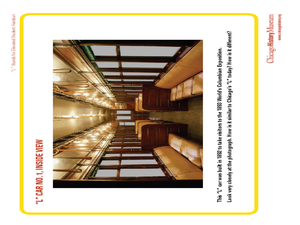
"L" Stands for Elevated
Students play a trivia game to learn more about the Chicago public transportation system. In this transportation lesson plan, students also create an "L" car, and write advertising slogans for Chicago's elevated trains.
Cornell University
Constructing and Visualizing Topographic Profiles
Militaries throughout history have used topography information to plan strategies, yet many pupils today don't understand it. Scholars use Legos and a contour gauge to understand how to construct and visualize topographic profiles. This...
Curated OER
Design an Island
Students explore islands. They create a two- or three-dimensional map of an island. They explain how the topography of an area influences the location of water sources, ecosystems, and human settlements. Lesson includes adaptations for...
Curated OER
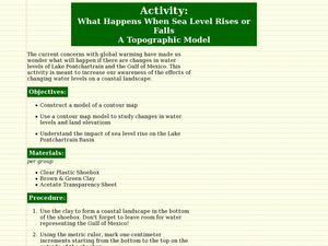
What Happens When Sea Level Rises or Falls
Students examine the impact of sea level on land formations. In this geography and map lesson plan, students construct a contour map model illustrating how much of the clay "coastline" is covered as water is added. Metric measurement...
Curated OER
Salad Tray 3D Topographic Model
Pupils explore the characteristics of topographical maps. They examine the relationship of contour lines and vertical elevation. Students create a three-dimensional model of a landscape represented by a topographic contour map.
Curated OER
Common Themes
Tenth graders test usefulness of a model Earth by comparing its predictions to observations in the real world. In this landforms lesson students construct an island from a contour map using model clay then analyze the landscape features...
Curated OER
Volcano Contour Models Activity
Students experiment with water levels and plastic topographic volcano models to determine the contour lines that would be used to create a topograpohic map of a volcano. They use the traced lines to actually develop the map.
Curated OER
Lesson on GPS
Students investigate global positioning systems. In this technology and mapping lesson plan, students view a PowerPoint presentation in which they identify the features of a GPS, state its uses, and follow steps to find a waypoint.
Curated OER
Highest Cities in the USA
In this online interactive geography quiz worksheet, students respond to 32 identification questions regarding the highest elevated cities in the U.S. Students have 4 minutes to finish the timed quiz.
Curated OER
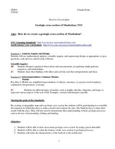
Geologic cross section of Manhattan, NYC
Students draw an accurate geologic cross section by using a given data table. They relate the features of the cross section to geologic processes. Students then relate the characteristics of the bedrock to the architecture.
Curated OER
CLIMATE AND WEATHER UNIT
Students locate on-line weather source, gathers and interprets weather data, work collaboratively on-line with other schools to collect weather data, and write about the cause of temperature inconsistencies in various locations.
Curated OER
The Flow of Fresh Water
In this water flow worksheet, students complete 15 word puzzles, a word search, and 2 picture puzzles about the flow of water and erosion.
Michigan Sea Grant
Exploring Watersheds
Collaboratively, students partake in a hands-on activity in which they build models of a watershed. Each group member draws an elevation map—a bird's eye view—of their model and predicts how water will flow from the high to low points....
Curated OER
Oregon Rainshadows
Students brainstorm list of possible highest locations in Oregon, identify and label places from list on map using color code, and discuss and identify causes of a rain shadow.
Curated OER
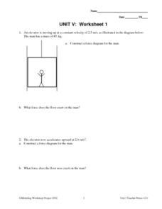
Unit V: Worksheet 1 - Constant Force
In a force diagram, a stick figure man in an elevator takes a ride. Physics analysts work out the force exerted on him by the elevator floor. As the acceleration changes, they draw new force diagrams and compute new force values. This...
Concord Consortium
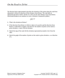
On the Road to Zirbet
The road to a greater knowledge of functions lies in the informative resource. Young mathematicians first graph a square root function in a short performance task. They then use given descriptions of towns and the key features of the...
Curated OER
Volcanoes!: The Dangers of Snow and Ice
Students observe a demonstration of how melting snow and ice can contribute to mudflows. They then observea list of continents with the number of snow and ice covered mountains on each continent and discuss. They then label a group of...
Curated OER
The Geography of the Indian Subcontinent
Gloriously adorned with a glimpse of the Taj Mahal, these slides detail important facts and characteristics of South Asian cultures, such as India, Pakistan, Afghanistan, and several other surrounding countries. Slides cover the...
Curated OER
Nature and Place Names in Arkansas
Middle schoolers examine the way that many place names in Arkansas came to be. By looking at Arkansas highway maps, they find names that come from the characteristics of each of the state's six geographical divisions. This interesting...
Curated OER
Foliage Tracker
Young scholars discuss the change of leaf colors and the role that climate and elevation play in those changes. They then track leaf changes, input data, and graph foliage changes with a free online tool.
Mr. E. Science
Introduction to Earth Science
From the layers of Earth's spheres to latitude and longitude to looking at topographic maps, learners discover the elements of Earth's systems.
It's About Time
Present-Day Climate in Your Community
So what exactly is climate? This first installment of a six-part series introduces the concept of climate using real-world data tables and topographic maps. The timely lesson includes a comprehensive overview of climate, as well as...
Other popular searches
- Contour Maps and Elevation
- Map Elevation
- Reading Elevation Maps
- Map Making and Elevation
- Va Elevation Maps
- Elevation Map Worksheet
- Colorado Elevation Maps
- Elevation Map of Florida
- Reading an Elevation Map
- Elevation Relief Map Asia
- Land Elevation Map
- Greek Elevation Map


