Echoes & Reflections
Antisemitism
Propaganda and anti-semitism were linked to evil ends during the Holocaust. Using video testimony of Holocaust survivors, examples of Nazi propaganda, and discussion questions, learners explore the roots of anti-semitism in Europe and...
Curated OER
Global Lesson: Social Studies On-Line Global Lesson: Social Studies On-Line Continents
In this geography PowerPoint a simple world map on which each continent is represented by a solid green landform is the background for each of the nine slides. The continent names appear in a list on the first slide, followed by one...
Curated OER
Food Detectives
Students investigate the regions in which particular grains are grown. Using the packaging from a variety of foods, grains are identified and the general locations where they are grown are plotted on a map.
Curated OER
Old World and New World - Why Contact Took So Long
Students use a globe to determine why contact between the old world and the new world took a long time. In this map skills lesson, students analyze routes between regions to determine why it took so long for the old world and the new...
Curated OER
World Map and Globe - Lesson 15 (K-3)
Students discover mountain ranges and their locations in the world. In this physical map lesson, students locate and identify major mountain ranges of the world on a large physical map.
Curated OER
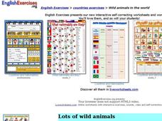
Wild Animals in the World
In this wild animals worksheet, students answer multiple choice map questions, choose the correct animal names for the pictures, and more. Students complete 4 activities.
Curated OER
Religions of the World
In this world religions map learning exercise, students note the 12 regions of the world and the religious beliefs practiced by the majority of people in those regions.
Curated OER
Getting to Know My World
Students participate in hands-on activities using maps and globes to identify geographical features. Students use map legends to identify direction. Students locate oceans, continents, countries, states and cities. Handouts and...
Curated OER
Partition of Africa Questions
In this colonial Africa activity, students study a map of Africa from 1885-1914. Students then respond to 9 short answer questions based on the information presented in the map.
Curated OER
Continents
Students investigate World Geography by researching the different continents. In this Asian Geography lesson, students discuss the continent of Pangaea and color a worksheet of the continents. Students locate China on the map worksheet...
Curated OER
Babar's Travels
Students read the story The Story of Babar and have a class discussion about his travels, discuss their families, design a map, pick music, and more. In this cross curricular musical lesson plan, students create a music map for each of...
Curated OER
Africa - Not Just One Big Safari
Students draw a picture of an African city that is similar to a U.S. city and discover how other parts of the world have the same types of buildings. In this global similarities lesson, students create a map of an ...
Curated OER
Beauty of Maps: Constantinople
In this geography worksheet, students learn the capital cities of European countries. Students match 9 countries to their correct capital city.
Core Knowledge Foundation
Columbus Sailed the Ocean Blue
Young adventurers embark on a journey, setting sail along the blue ocean with Christopher Columbus. Teachers will find that this unit makes their lesson planning smooth sailing!
Curated OER
The Silk Roads Big Map
Pupils generate oversized rendition of the Silk Roads from Europe to East Asia, apply elements such as political and topographic features, the Silk Roads, products of the regions, and the routes of key travelers.
Curated OER
Exploration Resume Project
Seventh graders take on the role of a European explorer and create a resume, or personal data sheet, listing his achievements in reverse chronological order. They draw and label a map and list what the explorer did to add to Europe's...
Curated OER
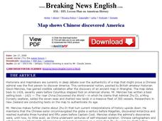
Breaking News English: Map Shows Chinese Discovered America
In this English instructional activity, students read "Map Shows Chinese Discovered America," and then respond to 47 fill in the blank, 7 short answer, 20 matching, and 8 true or false questions about the selection.
Curated OER
Breaking News English: Map Shows the Chinese Discovered America
In this English instructional activity, students read "Map Shows the Chinese Discovered America," and then respond to 47 fill in the blank, 7 short answer, 20 matching, and 8 true or false questions about the selection.
Curated OER
The Renaissance, Background
Students are introduced to the Renaissance by viewing a PowerPoint presentation. In this Renaissance lesson, students locate the important countries and cities of the Renaissance. Students compare how it was in England from the rest of...
Curated OER
European Lakes, Rivers, Bays, and Seas Map Quiz
In this online interactive geography quiz worksheet, students respond to 12 identification questions regarding European lakes, rivers, bays, and seas.
Curated OER
Roman Empire: Physical Framework - Location, Borders, Dimensions
Students relate the classical world to the modern world. In this map skills instructional activity, students turn a blank map into a colorful complete map by following step-by-step directions. This instructional activity allows students...
Curated OER
Australia Cities Map Quiz
In this online interactive geography quiz worksheet, students respond to 17 identification questions regarding Australian cities. Students have 3 minutes to finish the timed quiz.
Curated OER
British Isles
In this map worksheet of Britain, students study a detailed outline map of the British Isles. No labels are provided and there are no directions.
Curated OER
Civil War Naval Strategy
Students apply critical thinking skills to war strategy. In this Civil War map lesson, students use their knowledge of latitude and longitude as well as scale to respond to questions regarding Civil War battle strategies.
Other popular searches
- Maps of Europe
- Blank Maps of Europe
- Outline Maps of Europe
- Geography Maps of Europe
- Maps of Europe 1914
- Map of Europe
- Maps of Europe Political
- Maps of Europe Ppt
- Maps of Europe Pot
- Medieval Europe Outline Map
- Medieval Europe Map
- Maps of Europe 1919


