Curated OER
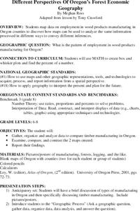
Different Perspectives of Oregon's Forest Economic Geography
Students locate the many forests located in Oregon. In groups, they use the internet to research employment data on wood products made in the state. They discuss how looking at information presented in a different way can change their...
Curated OER
Vectors
Pupils use both magnitude and direction to locate a place. They use locating techniques to make a temperature field of their classroom.
Curated OER
2 x 2
Students work together to grid a 2 x 2 meter unit using the formula for the Pythagorean Theorem. After creating the grid, they identify the location of artifacts and create a map of their location. They develop a graph and table of their...
Curated OER
Virtual Trip of Brazil
Sixth graders develop an annotated list of sights to visit in Brazil including a description of what to see and do there. They name and locate cities within Brazil. They place textual and graphic information on the web.
Curated OER
Clouds and Solar Radiation
Students use satellite imaging and Mesonet solar radiation maps to answer questions given to them by the teacher and look for differences and similiarities in the data.
Curated OER
Geological Development of Indiana and the Movement of Peoples Across the State
Fourth graders examine the geological development of the state of Indiana. Using the internet, they interact with the United States Geological Survey. They identify earthquake zones and energy resources in the state. They work...
Curated OER
Where Is Hoku?
Students are introduced to map making and reading. Using maps, they identify the cardinal directions and discuss the importance of a legend. They analyze the human characteristics of the classroom and create overhead view maps of the...
Curated OER
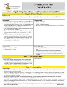
Montana Reservations And Tribes
Fourth graders engage in a lesson in order to find the differences or similarities within seven tribal groups in Montana. They use maps and other resources to find cultural and geographical differences. The influences upon culture are...
Curated OER
Modified Orienteering
Learners participate in activities using compass settings. They find north and notate the bearings of objects that have been set up in the school yard. They find marks that both visible and hidden behind and under things like trees, and...
Curated OER
Power Builders: Leaders and Cities
Students are explained that they are going to consider why cities are built and what needs they meet for their residents. They view a video "The Building of New York City." Students work in small groups to plan imaginary city. They...
Curated OER
Graphing Ordered Pairs
In this math worksheet, students learn to graph ordered pairs. Students examine a graph with 3 labeled points and tell the ordered pairs for each. Students also plot 8 ordered pairs on a graph they draw themselves.
Curated OER
The Slave Trade
Students map and explore a possible slave trade route. In this slave trade mapping lesson, students calculate the distance and amount of time it would take for African slaves to arrive in America.
Curated OER
Cultural Comparison - A Look at Vietnam and the USA
Students identify a map of Vietnam and locate it in Asia. They find the three countries that surround Vietnam. Using a CIA Fact Web site and photographs from Vietnam, students list differences and similarities of these two cultures.
Curated OER
Looking for the Dirty Scoop
Students read "The Negative Effects of Urban Sprawl." They discuss the main forms of transportation in their city and conduct research about the development of their community in terms of land use. Students sketch a map of their city and...
Curated OER
The Search for the Northwest Passage
Third graders listen to lectures and research the motivations and history of the Spanish, French and English explorers searching for the Northwest Passage to India. They trace routes on maps and consider how these explorers helped shaped...
Curated OER
Tracking the Storm
Students discuss the different types of storms that can hit land. They locate specific coordinates on a plane grid. They discuss lonsgitude and latitude to plot the coordinates of a tropical storm. They practice finding coordinates...
Curated OER
Getting to Know the Streets of Honolulu
Students practice identifying the streets names of Honolulu. Using a city map, they identify a main street and two intersecting streets. They research the origin of the name and complete a worksheet. They share their findings and...
Curated OER
ADULT ESOL LESSON PLAN--Level 5--Telephone Communication
Students, after reviewing/defining an extensive list of vocabulary terms on the board, examine/identify a variety of resources found in telephone directories (maps, government agencies, coupons, customer guide section, emergency numbers,...
Curated OER
Discover the Planets
Third graders research the planets. In this science lesson, 3rd graders create PowerPoint presentations over a planet. Students present their findings.
Curated OER
Hazard Alert
Students examine data regarding the occurrence of natural hazards as they occur in the United States. They record data on a classroom chart, map the areas affected by the hazards, and analyze and discuss conclusions drawn from the...
Curated OER
Home Sweet Home-Far From Home
Learners observe slides of U.S. coastal geography. They study topography and vegetation maps for one region. They gather geographic facts on a guided worksheet. Students pretend to be colonists. They decide what kind of economic system...
Curated OER
Ancient Highways-Native Byways of Salmon Lake State Park
Eighth graders investigate the concept of the trail system used by the Native Americans. They compare and contrast the trails to modern transportation roadways of today. Students also define the types of information archaeologists use to...
Curated OER
Surface Water Supplies And The Texas Settlements
Young scholars engage in a lesson that is concerned with the allocation and finding of water resources. The location of different settlement areas is considered as one looks how the water is distributed. They map some of the early...
Curated OER
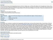
The Hot Spot Hypothesis
Pupils use a digital atlas, geologic maps, and topography maps to explore geologic regions of Yellow Stone National Park. They locate evidence that support the theory of hot spots. Students research and explore the movements of Hot Spots.


