Curated OER
Where's the Barbecue?
Students identify the major landforms, regions and rivers on a map of South Carolina. They compare the locations of the major Native American groups in the state as well. They chart where barbecue restaurants are located and write...
Curated OER
Getting to Know the Seven Continents
Learners are introduced to basic map and globe skills. Using the internet, they identify and locate the seven continents and complete a blank map to reinforce the names of the continents. They also distinguish between land masses and...
Curated OER
Narive American CD research
Fourth graders conduct research on assigned Native American tribes. They are responsible for searching for information on CDs and taking notes on this information. Students are reminded how to load their corresponding Native American...
Curated OER
Introduction to the Barnegat Bay Estuary
Students research estuaries. For this estuaries lesson, students discuss the differences in a bay and an ocean. Students watch a PowerPoint of the properties of the estuaries and geography of Barnegat Bay. Students complete a worksheet...
Curated OER
Looking At Water: a Walking Field Trip
Fourth graders observe the effects of water on the soil and record those effect by drawing sketches of water erosion and conservation practices.
Curated OER
Road Trip
Students explore a state, create a travel plan for visiting that state, write postcards from an imaginary trip there, and research selected points of interest in that state.
Curated OER
Lesson 2: Mapping With Words
Students demonstrate an understanding of the personal relationship that Wabanaki peoples had with the land by analyzing selected Wabanaki place names. They practice map-reading and map-making skills.
Curated OER
Location of Cities 201
Students work in pairs to locate the ancient cities on a world atlas using the longitude and latitude measurements. They examine the physical and human futures that explain their locations.
Curated OER
The Great Topo Race
Students create a three dimensional island out of cardboard to examine how to read and use a topographical map. They make sure that their island can sustain life and that it has one volcanic mountain peak. They trace the parts of their...
Curated OER
Island Research
Students collaborate to gather information about the geography, history, economy, climate, culture, and other aspects of life on the island of Eleuthera.
Curated OER
Where Is Hoku?
Students are introduced to map making and reading. Using maps, they identify the cardinal directions and discuss the importance of a legend. They analyze the human characteristics of the classroom and create overhead view maps of the...
Curated OER
Hawaii's Migratory Animals
Students act as travel agents to plan a trip for a migratory animal. They conduct research and design a travel brochure that includes a migratory route, illustrations of planned stopovers and special tourist attractions the animal might...
Curated OER
Social Studies: Neighborhoods of the Future
Students explore the present physical and human characteristics of their communities and predict their future appearance. In a two-paneled drawing, they depict their community as it is today and then imagine how it might change in the...
Curated OER
Travel Club Unit
Seventh graders participate in a classroom travel club while they research Latin American cities. They research the city finding the pertinent information provided in the directions. They write a letter to other travel club members that...
Curated OER
Around The World
High schoolers identify the capitals of the target countries. They locate the target countries on a world map. Students describe one major issue facing the inhabitants of each of the target countries.
Curated OER
Treasure Hunt Region
Students are introduced to new geography related vocabulary words. In groups, they focus on a different region of the school and develop a new name for it. They create a treasure map for another group to use in the region of the school...
Curated OER
Tooling Around Arizona: Reading Arizona Maps
Students study geography. In this Arizona maps lesson, students develop their map reading skills. They have class discussions and work independently with various copies of Arizona maps to practice those skills. This lesson mentions...
Curated OER
Deforestation
Students identify the different tropical rainforests in the world using a map. In this ecology instructional activity, students describe the different methods of deforestation. They create a memo and present it to class.
Curated OER
Map-Making Basics
Students study maps. In this geography and art lesson, students create their own map of the classroom.
Curated OER
A Tale of Two Cities
Students research and compare Thebes to their hometown to explain how a city's geography, economy, climate, and culture affect its inhabitants.
Curated OER
Anolis Lizards of the Greater Antilles
Students "take a trip" to the Greater Antilles to observethe Anolis lizards. They study the body structures and habitat of different species, then plot this data on a map to look for patterns in their distribution. From the patterns they...
Curated OER
"Heritage" - "Hey, That's the Name of Our School!"
Seventh graders gain a better understanding of the canal period in U.S. History, and more specifically, discern the importance of the Illinois and Michigan Canal on the development of Illinois as a state and Chicago as a prominent city.
Curated OER
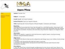
Exploring the Various Regions of Boyle Heights: Continuity and Change
Student study the local landscape of Boyle Heights, California and draw a sketch of the area. Students use map making skills in this activity. Studient make a portfolio of information and photographs they accumulate over time on the area.
Curated OER
NIH Image Fault Investigation
Students use the image processing software, NIH Imageto view images of Earth taken from the space shuttle. They use NIH Image to determine the length of the visible portion of the fault, where it has ruptured the Earth's surface.
Other popular searches
- Egypt Geographic Features
- Geographical Features of Utah
- Geographic Features of Congo
- World Geographical Features
- World Geographic Features
- Earth Geographic Features
- Geographic Features Map
- Egypts 3 Geographic Features
- Africa/geographical Features
- Missouri Geographical Features


