Curated OER
City Skylines Quiz
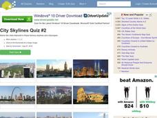
In this online interactive geography quiz worksheet, students respond to 15 identification questions about the pictured city skylines. Students have 4 minutes to complete the quiz.
Curated OER
City Skylines Quiz
For this online interactive geography quiz worksheet, students respond to 15 identification questions about the pictured city skylines. Students have 4 minutes to complete the quiz.
Curated OER
Cities Near Water Quiz
In this online interactive geography quiz worksheet, students respond to 18 identification questions about world cities located near water. Students have 4 minutes to complete the quiz.
Curated OER
5th grade social studies geography
In this geography instructional activity, 5th graders complete multiple choice questions about hemispheres, maps, cities, ecology, and more. Students complete 25 questions.
Curated OER
Connecticut Map
In this state maps activity, students identify the state of Connecticut, and fill in the state capital, major cities, and other major attractions.
Curated OER
Michigan Map
In this state maps worksheet, students identify the map of Michigan. Students then fill in the capital city, major cities, and other state attractions.
Curated OER
Maine Map
In this state maps worksheet, students identify the map of Maine. Students fill in the capital city, major cities, and other state attractions.
Curated OER
Montana Map
In this state maps worksheet, students identify the state map of Montana. Students fill in the capital city, the major cities, and other state attractions.
Curated OER
Delaware Map
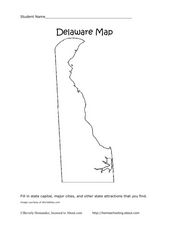
In this state maps worksheet, students identify the state of Delaware, and fill in the state capital, major cities, and other attractions in the state.
Curated OER
Colorado Map
In this state maps activity, learners identify the state of Colorado, and fill in the state capital, major cities, and other attractions for the state.
Curated OER
North Carolina Map
In this state maps worksheet, students identify the state map of North Carolina. Students fill in the state capital, the major cities, and other state attractions.
Curated OER
New Mexico Map
In this state maps worksheet, students identify the state of New Mexico. Students fill in the state capital, major cities, and other state attractions.
Curated OER
Vermont Map
For this state maps worksheet, students identify the map of Vermont. Students fill in the state capital, the major cities, and other state attractions.
Curated OER
Tennessee Map
In this Tennessee outline map, students examine the political boundaries of the state. Students mark the state capital, major cities, and other state attractions.
Curated OER
Places That Changed Names Quiz
In this online interactive geography quiz worksheet, students examine the chart that includes the former names of 20 world cities. Students identify the names of the cities today in 4 minutes.
Curated OER
Tennessee: The Volunteer State Part 1
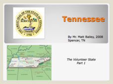
Explore the state of Tennessee, PowerPoint style! Regions, geographical features, and some amazing state facts are yours for the asking. Major cities are named and followed by related facts. This neat presentation on an interesting state...
Curated OER
Personal Travel Guide to a Chinese City
Scholars become travel guides in this group research project to investigate a Chinese city or region for a presentation. Heavily based on Internet research, the activity requires participants to jigsaw the final project, so each team...
Curated OER
Southernmost Cities Quiz
In this online interactive geography quiz worksheet, students respond to 22 identification questions about cities in the world's southern hemisphere. Students have 5 minutes to complete the quiz.
Curated OER
China - the Geography of European Imperialism - Spheres of Influence in China
Ninth graders create a map of China. They identify the various spheres of influence carved out by the Imperialist powers of Europe as well as locating geographical features of china and major cities. They explain the global impact of...
Curated OER
4th Grade Geography Multiple Choice
In this grade 4 geography worksheet, 4th graders complete a total of 25 multiple choice questions relating to 4th grade geography concepts. An answer key is provided.
Curated OER
City Life In Europe
Students explore Paris. In this geography skills lesson, students watch "City Life in Europe," and conduct further research on the city of Paris and the country of France. Students create postcards that feature Parisian landmarks.
Happy Housewife
State Notebooking Pages
When learning about US geography, it can hard to remember facts about 50 different states. Help your young scholars organize all of this information with a collection of easy-to-use note-taking guides.
Sharp School
Geography Project
This very simple geography project can lead to a lot of useful referential information that can be displayed in your classroom! Learners construct a poster-size map of a country, identifying major demographic points and including pie/bar...
Freecloud Design
Stack the States™
Kids have fun learning US geography and state facts, including capitals, nicknames, major cities, and landmarks. They can choose between the game, or informational flashcards for each state.


