Curated OER
Topographic Mapping Skills
In this geography worksheet, students read an excerpt about topographic maps and why they are useful for various jobs. They also respond to eleven questions that follow related to the excerpt and locating specific map points on the map...
Oregon State
World Map of Plate Boundaries
Young geologists piece together the puzzle of plate tectonics in an earth science lesson. Given a physical map of the world, they search for land formations that indicate the location of different types of plate boundaries.
Curated OER
World Geography - Climate Notes
A challenging activity helps young geographers explore the temperatures around the world! They study how the Earth's land temperatures are affected by their proximity to an ocean, as well their latitude and their altitude. A very...
It's About Time
The Changing Geography of Your Community
Lead your class in exploring their local communities as well as the general environment. As they determine continental distributions by investigating minerals, rocks, and fossils located in their local region, pupils construct a...
Cornell University
Too Much of a Good Thing?
Continuing their study of beneficial insects, young entomologists discover where in the world some of these bugs are. By labeling, coloring, and using the scale on a map, pupils explore the territories and arrival of the Asian lady...
NOAA
Why is Hawaii's Ocean Important?
Studying the oceans? Focus on Hawaii's ocean with a resource packed with activity-based worksheets. Everything from products that come from the ocean to the abundance of plants and animals that call the ocean their home, Hawaii's ocean...
Curated OER
Musical Plates-Earthquakes
In this plotting earthquake data instructional activity, middle schoolers use a large world map and given web sites showing the latitude and longitude for the epicenter of recent earthquakes around the world. Students plot 2 weeks of...
Curated OER
Plotting Earthquakes and Volcanoes
In this earthquakes and volcanoes worksheet, students are given the latitude and longitude of earthquakes and volcanoes and they plot them on a world map. They answer questions based on their results.
Texas State Energy Conservation Office
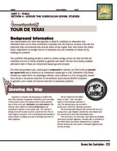
Investigation: Tour de Texas
Teams of Texas tourists gather into groups to analyze what they can do with $50 worth of an alternative fuel. They write checks, keep a balance sheet, and map out their sight-seeing route taking into consideration the location of...
Curated OER
Google Earth
In this Google Earth worksheet, students access the Google Earth website and find the latitude, longitude, and elevation for their house and school. Then they do the same for a variety of world locations. This worksheet has 10 fill in...
Curated OER
African Seas Map Quiz
In this online interactive geography quiz worksheet, students respond to 12 identification questions regarding the seas of Africa.
Sea World
Saving the Wild: Conservation Around the World
Enhance your unit on conservation, ecosystems, or migration with a series of lessons about ways to save the wild around the world. Kids research types of conservation, such as recycling, and use their geography skills to map the...
Smithsonian Institution
Expedition: Insects
Get up close and personal with beautiful and sometimes dangerous insects in an exciting eBook activity! Pupils practice geography skills by reading a map with the location of six different insects. Scientists read about each insect,...
Curated OER
Volcanoes and Plate Tectonics
In this earth science activity, students read and study about divergent and convergent boundaries, tectonic plates and volcanoes to complete 1 data chart 7 short answer questions.
Curated OER
Art And Ecology: Check Out This Place!
In this art and ecology worksheet, students look at paintings and answer questions, using the painting, a world map and climate. There are 2 pictures, each with its own set of questions.
Curated OER
European Capitals Quiz
In this online interactive geography quiz worksheet, students respond to 45 identification questions about the capitals cities of European countries. Students have 5 minutes to complete the quiz.
Curated OER
Climate Change in Canada
In this Canada worksheet, students read a 6 page detailed informational text about climate change in Canada. Students then complete 10 essay/short answer questions.
Other popular searches
- Geography Map Skills Scale
- Geography Map Skills Europe
- Usa Geography Map Skills
- Geography Map Skills Us
- Canada Geography Map Skills
- Map Skills Geography Themes
- Geography Map Skills Ohio
- Map Skills Geography


