Curated OER
Creating a Thematic Map
Students create and analyze a weather-related data table and a thematic map based upon information provided.
Oregon State
World Map of Plate Boundaries
Young geologists piece together the puzzle of plate tectonics in an earth science lesson. Given a physical map of the world, they search for land formations that indicate the location of different types of plate boundaries.
Curated OER
A Map as a Tool
Students study the concept of using a map as a tool with the usage of a balloon designed to mimic the features of the Earth with the major features marked and shown on the balloon.
Curated OER
Topographic Mapping Skills
In this geography worksheet, students read an excerpt about topographic maps and why they are useful for various jobs. They also respond to eleven questions that follow related to the excerpt and locating specific map points on the map...
Howard Hughes Medical Institute
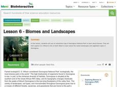
Lesson 6: Biomes and Landscapes
Aside from the amazing animals in Gorongosa National Park, what else is there to discover? The sixth installment in an eight-part themed series contains an interactive map where scholars can learn more about the geographic features of...
Curated OER
Mapping Exercise
In this mapping worksheet, students are given data of children exposed to health risks and their geographical location. Students plot each child's home and the risk factors using an (x, y) grid. They answer 2 questions about the...
Curated OER
Science Inquiry Lesson: Mapping Project
Students explore the methods of creating maps. They create a map of Animas River Park using a compass and measuring tape, develop a single map from the team map sections, and devise another map of the Animas River Park using a GPS unit.
Curated OER
Mapping Electricity
Students complete Internet research and use their map reading skills to learn about how the United States creates and uses electricity in different states. In this energy sources lesson, students study the mini map of energy usage in the...
Curated OER
Mapping a Garden
Second graders recognize the components of a map, particularly the legend, the key, the symbols and the area. They develop their own map of a garden they be planting in their upcoming science lesson plan.
Curated OER
Geography: examining the Glacial Features of Cape Cod
Students examine satellite images of the glacial features of Cape Cod. They analyze where human activity is located in terms of those features. Students make models of the features, including kettle holes. They also use contour maps...
Curated OER
What Is El Niño?
Students access information at remote sites using telecommunications, identify impacts by reviewing past El Ni??o events, make and use scale drawings, maps, and maps symbols to find locations and describe relationships.
Curated OER
Explore Surface Types on a Journey Around Earth
Young scholars explore satellite data. In this technology cross-curriculum math and world geography lesson, students locate specific map areas using a microset of satellite data. Young scholars use technology and math skills to determine...
Curated OER
Reading a Local and National Weather Map
Students practice reading a national and local weather map. Using this information, they work together to make predictions about the weather for the next few days. They discuss the use of symbols and maps as a class and discuss how...
Curated OER
Arkansas State Rock
Here is a activity which shows the value of a mineral called bauxite to Arkansas during the early 1900's. Learners relate the five themes of geography to the history of bauxite and aluminum production in Arkansas. For teachers of...
Curated OER
Urban Planning: Plan a City
Students analyze the concept of urbanization by planning the placement of some of the major urban/suburban features that make up most cities. They arrange the cultural features to benefit the people who live there, and maintain respect...
Curated OER
Geography: African Floor Maps
Learners explore the African continent and identify the various countries there. They examine the history, geography, environment, and inhabitants of the countries. Students create maps of Africa using a variety of materials.
Global Oneness Project
Highways and Change
What is the cost of change? Roberto Guerra's photo essay "La Carretera: Life and Change Along Peru's Interoceanic Highway" asks viewers to consider the impacts of the 1,600 mile-long highway through Peru and Brazil that connects Pacific...
Curated OER
Native Americans and Topography at Rose Bay
Young scholars visit a wetland ecosystem. While they are there, students explore how to read topography maps of Rose Bay.
Curated OER
Peru's Earthquake
Students identify the patterns of earthquakes by mapping USGS data and comparing it to mapped tectonic plates. They discover the relationship between earthquakes and the moving plates of the Earth's crust.
Curated OER
Underground Sleuths Discover Riches Beneath the Plains
Students identify Alberta, Saskatchewan, and Manitoba on map, and use Canadian Atlas to locate regions of natural resources in Central Plains, which have vital impact upon the economy. Students then complete scavenger hunt worksheet.
Curated OER
Circle the Earth - Explore Surface Types on a Journey around Earth
Students use CERES percent coverage surface data with a world map in locating landmasses and bodies of water at Earth's Equator.
Curated OER
The Mysteries of El Nino: How Much do We Really Know?
Seventh graders investigate the causes and effects of El Nino and explore its global impact on weather related occurrences through this series of activities.
Curated OER
Cherishing the Water of Life
Students work in small groups to brainstorm a list of all creatures, plants, natural, and artificial processes that use or depend on fresh water. The class views an aquarium filled with water representing all the water in the world. The...
NOAA
A Moving Crust
Young scientists piece together the geological puzzle that is the earth in the third and final instructional activity of this earth science series. With the help of numerous multimedia resources and a series of engaging hands-on...


