Curated OER
Canadian Provinces Quiz
In this online interactive geography quiz learning exercise, students examine the map that includes 13 Canadian provinces. Students identify the names of the provinces in 3 minutes.
Curated OER
Country Flags Quiz
In this online interactive country flag quiz instructional activity, students examine the 20 pictured country flags and try to name all of the countries represented in 4 minutes.
Curated OER
South America Map Quiz
In this online interactive geography quiz worksheet, students examine the map that includes all of South America's countries. Students identify the 13 countries in 2 minutes.
Curated OER
Middle East Map Quiz
For this online interactive geography quiz worksheet, students examine the map that includes 26 Middle Eastern countries. Students identify the names of the countries in 4 minutes.
Curated OER
Central America Map Quiz
In this online interactive geography quiz learning exercise, learners examine the map that includes 22 Central American countries. Students identify the names of the countries in 3 minutes.
Curated OER
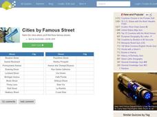
Famous Streets Quiz
In this online interactive geography quiz worksheet, students examine the chart that includes the names of 18 famous streets in the world. Students have 4 minutes to identify the names of the cities where the streets...
Curated OER
State Nicknames Quiz
In this online interactive geography quiz worksheet, students examine the chart that includes the names of 49 states. Students identify the nicknames of the states in 6 minutes.
Curated OER
California Cities Map Quiz
In this online interactive geography quiz worksheet, students examine the map that includes 12 California cities. Students identify the names of the cities in 3 minutes.
Curated OER
Famous Lakes Quiz
In this online interactive geography quiz worksheet, students examine the chart that includes details about 15 famous world lakes. Students identify the names of the lakes in 3 minutes.
Curated OER
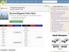
Second Biggest Cities Quiz
For this online interactive geography quiz worksheet, students examine the chart that includes details about 20 major cities in the world. Students identify the names of the cities in 4 minutes.
Curated OER
Canada Map Quiz
For this online interactive geography quiz worksheet, students examine the map that includes 13 Canadian provinces and territories. Students identify the names of the provinces and territories in 2...
Curated OER
Highest Mountain Countries Quiz
In this online interactive geography quiz learning exercise, students examine the chart that includes the elevations of 20 world mountains. Students identify the names of the mountains in 4 minutes.
Curated OER
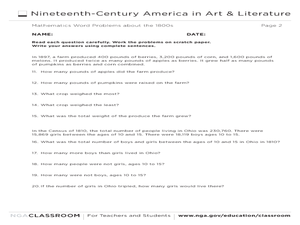
Mathematics Word Problems About the 1800s
In this history and math learning exercise, learners solve 20 problems pertaining to life in America in the 1800s. Students read four paragraphs and solve the five problems using that information. Basic math operations are used.
Curated OER
Maui: People, Places and Patterns
Students predict patterns of growth on the island of Maui, complete a research paper on Maui using one of the geographic perspectives, and share their findings with others through an oral and written report.
Curated OER
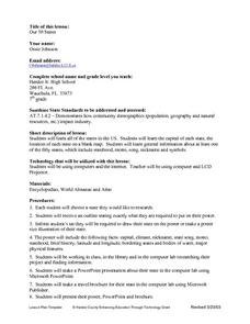
Our Fifty States
Seventh graders identify and locate all fifty states in the United States and their capitals. Individually, they research one state identifying when it became a state, its motto, song, flower and nicknames. To end the lesson plan, they...
Curated OER
Mapping Our Home
Students explore how communities participate in census counting. In this census lesson, students recognize the absolute and relative location of a state and understand ideas about civic life and government.
Curated OER
Lesson 1: Map Data and the Census
Young scholars learn about the history of the census. In this U. S. Census lesson plan, students develop an understanding about how the United States Constitution grants and distributes power and discover how the spatial organization of...
Curated OER
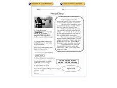
Hong Kong
In this comprehensive reading about Hong Kong worksheet, learners read about its geography, history, climate, and population and answer several types of questions showing their reading comprehension. Students answer 4 questions.
Curated OER
State Poster Fair: US Geography, Social Science, Art
Students research a US state, design and construct a state 'poster' to display important facts about that particular state. They present their work to the class.
Curated OER
Geography of the Wasatch Front
Students identify the three main types of urban environments by learning characteristic land-cover types. They examine and analyze a thermal image of Salt Lake City. Then they predict surface and air temperatures from aerial photos.
Curated OER
Population Diversity in Southeast Asia
Students explore diversity in ethnic, lingual, religious, and political systems of the people of Southeast Asia. The activity's focus is designed to foster an understanding of the complexity of the region.
Curated OER
Past v. Present: Using Geography & Anthropology
Students examine artifacts and documents from their Canadian community. They analyze early Canadian history and make predictions about the future of the country.
Curated OER
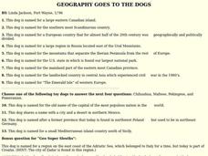
GEOGRAPHY GOES TO THE DOGS
Students use countries and dogs from around the world to answer the questions.
Curated OER
Geography: Mapping Neighborhoods
Students examine their neighborhoods and draw maps reflecting land use. In addition, they make predictions about their community's future. Students also consider the impact of business and industry on their communities and predict ...
Other popular searches
- Population Geography
- Population Geography Graph
- Population Geography Map
- Geography Population Density
- Population Geography Factors
- Population Geography Data
- Population Geography Brazil
- Geography Population Change
- Population Geography India
- World Geography Population


