Alabama Department of Archives and History
Military Conscription in World War I: Alabamians Express Their Opinions
If called, would you go? Should the US government have the power to impose a draft during any war? The Selective Service Act of 1917 (aka the Conscription Act of 1917) authorized the drafting of men into the military for only the...
Rutgers University
How the Allies Won World War II: Island-hopping in the Central Pacific
Using primary source documents, young historians explore the strategies the US used to defeat Japan during WWII. They also learn about the American military experience, and innovations that changed the style of warfare. High schoolers...
Curated OER
Linguistic Diversity Secondary
Don't be scared off by the title! Read this information packet with your class, or send them off on their own. After each section, you'll find a series of comprehension questions. Great preparation for state testing!
The New York Times
Decision Point: Understanding the U.S.’s Dilemma Over North Korea
Simulate the Situation Room and analyze the US's relationship with North Korea. The plan starts off with a quick review and an examination of a online timeline that updates as the situation continues. Next, the class reads an article and...
Howard Hughes Medical Institute
BiomeViewer
Which holds more influence, the environment over humans or humans over the environment? Young scientists explore an online interactive that addresses this discussion. They observe changes in the natural world over time and see which...
Curated OER
Alaska the Elephant
Students explore an Internet website, locating and matching the shape of an elephant's head to a state in the U.S. They complete an Alaska worksheet, identifying other geographical locations surrounding Alaska.
Curated OER
The Eerie Canal
Young scholars discover bodies of water in the United States by investigating the Eerie Canal. In this U.S. Geography lesson, students discuss Lake Eerie and the canal that was built in order to transport goods. Young...
Curated OER
Edible Resource Maps
Third graders work in groups to create an edible resource map showing locations of at least five resources in the United States. Students research on the internet different regions and the resources that are found in those areas. They...
Curated OER
Florida the Best WebQuest
Learners create a multimedia presentation demonstrating that Florida is the Best State in this creative project for the early elementary classroom. The lesson can be adapted for any state or country.
Curated OER
Food For Thought: A Geography of Minnesota Agriculture
Learners participate in hands-on activities and discussions about Minnesota's agriculture. They practice reading maps and locating where certain agricultural products are found throughout the state.
Curated OER
Missouri Vocabulary: Word Jumble
In this Missouri worksheet, students unscramble the letters in 20 words to spell key cities, people, regions, resources or facts pertaining to Missouri. There is a word bank.
Curated OER
Biggest Metro Areas in the USA
In this online interactive geography quiz worksheet, students respond to 100 identification questions about metropolitan areas in the United States. Students have 10 minutes to complete the quiz.
Curated OER
Island Animals
Middle schoolers explore the concepts of endangered animals and conservation. In this animal conservation lesson, students complete activities to investigate the endangered animals of the US Virgin Islands. Middle schoolers complete...
Curated OER
Geological Forces and Topography
Learners discuss and research the Earth's geological processes. In this geology lesson, students study maps of Utah and the United States to learn about geological features. Learners then complete the research cards for each area of...
Curated OER
Personality and Posts
Students examine the personality type needed to become a diplomat in the US Foreign Service. They look at the results of the Myers-Briggs Personality Test that each diplomat in training must take. They study their own personality type to...
Curated OER
Oklahoma
For this geography worksheet, students read a 2 page selection detailing the location, history and early statehood of Oklahoma. They answer 10 true or false questions based on the reading.
Curated OER
Geography of the Study of the Spanish-speaking People of Texas
Students identify the physical features, demographic characteristics, and history of the four Texas towns featured in Russell Lee's photo essay, "The Spanish-Speaking People of Texas." They conduct Internet research, and create a travel...
Curated OER
Going...going...gone? Tropical Rainforests-How They Work, What They Do for Us, What's Being Done to Them...
Sixth graders explore the Tropical Rainforest and come to understand what it is and how it affects the ecosystem. In this rainforests instructional activity, 6th graders write about the Tropical Rainforest, imagine they are in the...
Curated OER
Regions of Virginia
In this geography worksheet, 5th graders identify the regions of the state of Virginia and sort them according to location. Then 10 questions focus upon the specifics of different regions.
Curated OER
Five Themes of Geography
Students conduct research to determine why geography is important and how it provides information regarding many aspects of the world. They investigate the hemispheres, longitude, latitude and absolute location.
Curated OER
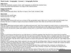
Geography Review
Third graders name the continent, country, state, and community in which they live. They locate Maryland and Baltimore on a map of the United States.
Curated OER
GEOGRAPHY OF FOOD & FIBER
Students will explain the ways geography determines the crops grown in the United States and other countries, and the resulting trade relationships.1. Discuss trade routes, both ancient and current. Discuss why the most direct route from...
Curated OER
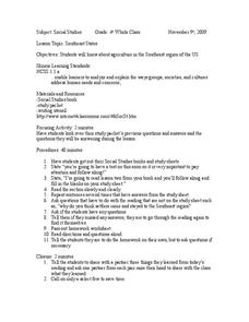
Southeast States
Fourth graders acquire knowledge about the settlement of the southeast region of the United states. For this united states geography lesson, 4th graders learn to analyze and understand the ways in which groups in society have...
Curated OER
Children in the United States and Japan
Students locate Japan on a map or globe and describe the relative location of Japan. They use the Internet to investigate cultural characteristics of children in the United States and in Japan. They use a Venn Diagram as an...
