Curated OER
U.S. States - The Midwest States
In this geography and math worksheet, students complete the simple addition equations and match the sums to the colors. Students then color the Midwest States by the color code.
Curated OER
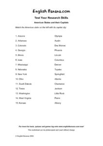
American States and Their Capital- Test Your Research Skills Worksheet
In this geography skills worksheet, students match the American state listed on the left with its capital city listed on the right by drawing a line from one to the other.
California Polytechnic State University
Australian Geography Unit
At the heart of this resource is a beautifully detailed PowerPoint presentation (provided in PDF form) on the overall physical geography of Australia, basic facts about the country, Aboriginal history, and Australia culture and lifestyle.
Curated OER
US City Quality of Life Analysis and Comparison
Students analyze US census data and criteria to compare and measure the quality of life in the country's fifty largest cities. After accessing the 2005 quality of life world report online, students conduct their study to compare three...
Curated OER
Geography Quiz 18
In this geography activity, students answer short answer questions about the geography all over the world. Students complete 10 short answer questions.
Curated OER
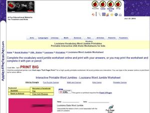
Louisiana State Word Jumble
In this word jumble worksheet, students unscramble the letters to spell words associated with the state of Louisiana. Students spell 20 words.
Curated OER
United States Geography: Crossword Puzzle
In this geography learning exercise, students use the 14 clues in order to fill in the crossword puzzle with the appropriate United States geography answers.
Curated OER
Physical and Human Geography Review Worksheet and Study Guide
In this geography skills worksheet, students respond to 30 short answer questions pertaining to physical and human geography.
Curated OER
United States Map Lesson
Students explore basic map skills. In this United States geography instructional activity, students define "country" and "state," locate their state on a United States map, and identify and trace state boundaries defining their state...
Curated OER
States and Capitals, Mountains and Rivers
Students identify geographical locations in the midwestern United States. In this geography lesson plan, students identify 12 states and capitals and geographical features in the region by using U.S. maps. Students use blank maps to fill...
Curated OER
Establishing Borders: The Expansion of the United States 1846-48
Students investigate how the United States acquired land after the Revolutionary War ended. In this establishing borders instructional activity, students use maps to identify territories acquired by the US and the states that later...
Sharp School
US Geography Landmark Commercial
Experience famous geographical landmarks around the United States right from the comfort of your very own classroom. Learners research national landmarks, such as the Grand Canyon, Yellowstone National Park, and Niagara Falls, and then...
Theodore Roosevelt Association
Roosevelt's Legacy: Conservation
The legacy of Theodore Roosevelt carries through modern American politics, economics, foreign policy, and society. But his proudest and most profound efforts were in the world of conservation, and in preserving the natural beauty of...
Curated OER
US Geography Crossword
In this 50 states worksheet, learners complete a crossword puzzle with facts about US geography. There are 22 words to fit in the puzzle, which has no word bank.
Curated OER
Settlement Patterns of the United States
Pupils examine the conditions that affected the way people settled in the United States. Using maps, they examine the topography and climate of different locations and determine the factors that do and do not allow settlement to occur....
Curated OER
State Capitals- Online Interactive
In this state capitals worksheet, students learn to match the capital cities to the 50 states. Next to each name of the state, students fill in the capital city from a list that is provided. This is an online interactive worksheet.
Curated OER
A Look at the Population Density of the United States
Students acquire census information and create maps of the population density of the United States on different scales. They role play the roles of workers of a retail company and they use the population data to market to their customers.
Curated OER
Colonies and Revolution: Comparing US and Mexican History
Students examine the emergence of the United States and Mexico as independent nations. They compare the colonial history of the two countries and discover the emergence of social classes.
Curated OER
United States Map- State Capitals
Students explore the state capitals. In this geography lesson plan, students use a political map to identify the state capitals and place post-it notes on various capitals.
Curated OER
Illinois State Map
In this Illinois geography worksheet, students color and label a map of Illinois. Students study the location of the capital and where Illinois is situated in the United States. There is a black line map of the state with a grey US map...
Curated OER
Exploring South Carolina
If you are having your students conduct a State study this presentation could be a nice example to show them. This resource provides general information about the geography, animals, and city life one may find in South Carolina. Web...
Curated OER
Introduction to Canada
Ninth graders investigate the country of Canada by examining their media in this geography lesson. They use the Internet to research Canadian newspapers and analyze a topic covered by both US and Canadian media sources. After comparing...
Curated OER
Nature and Place Names in Arkansas
Middle schoolers examine the way that many place names in Arkansas came to be. By looking at Arkansas highway maps, they find names that come from the characteristics of each of the state's six geographical divisions. This interesting...
Curated OER
Arkansas: A Changing Climate, a Changing Land
Here is a lesson on the climate zones and geography of Arkansas. In it, learners look at maps (embedded) of different climate zones found throughout Arkansas. They engage in discussions regarding how global warming and climate change is...


