Curated OER
Applications of GIS
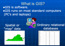
Don't be concerned that the title slide of this presentation mentions Virginia's Geospatial Extension Program; this slide show is very informative for any technology-focused curriculum when considering global information systems. It...
Curated OER
Practical GPS Applications in Forestry & Agriculture
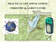
An explanation of the Global Positioning System (GPS) and the Geographic Information System (GIS) is given in this presentation. Uses and applications are considered. How it works and sources of error are also touched upon. A large...
Curated OER
Fostering Geospatial Thinking: Space to Earth: Earth to Space (SEES)
High schoolers locate and access data to help them with their science inquiry. In this geographical positioning activity students evaluate and compare data sets.
Curated OER
Floodplains in the field (with GIS)
Students measure a topographic and geologic cross-section across a floodplain by simple surveying and auguring techniques. They consider the spatial context of the field observations, use GPS measurements, and desktop GIS analyses.
Curated OER
Rivers And Capitals
Pupils become familiar with the use of GIS for research and become aware of the importance of rivers to cities. They also analyze the placement of cities and learn the names of rivers in the United States.
Curated OER
Indiana Tornado Project
Students become familiar with the use of GIS for research, natural phenomena in Indiana, and analyzing collected information.
Curated OER
Names in the Field: A Simple GPS Field Exercise
Students explore basic methods of GPS data collection, uploading the data to a computer, and making simple maps of their data using GIS software. They create a map of the data using GIS software (or Excel)
Space Awareness
Where on Earth Am I?
Almost every phone has GPS installed, but a large number of teens don't know how the technology works. An initial activity illustrates how GPS determines a location on Earth. Scholars then apply trilateration procedures to a...
Curated OER
GPS Treasure Hunt for Knowledge
Students examine themselves as being part of a global community. In this global community lesson, students investigate GPS systems. Students gain knowledge on how the device works. Students discover that satellites provide information...
Curated OER
Mapping My Community
Ninth graders are introduced to GPS technology. They complete fieldwork as they visit a specific area of their community to identify and map types of land use in the surveyed area. They use the collected data to create a digital map.
Curated OER
I Know Where You Are!
Students study what a GPS is and use it to challenge themselves and find positions on a map. For this investigative lesson students find various points on a map using a GPS system and answer questions on a worksheet.
Curated OER
Where Am I - Navigation and Satellites
Learners explore geography by completing a navigation activity in class. For this satellite positioning lesson, students define terms such as orbit, satellite, GPS and triangulation. Learners view diagrams of the Earth's orbit and...
Teach Engineering
Where Are the Plastics Near Me? (Field Trip)
With a piece of plastic here and a piece of plastic there, here a piece, there a piece, everywhere a piece. Teams go on a field trip in order to document the locations and kinds of plastic trash in an area near them. The eighth...
Curated OER
Rock Creek Water Quality
Ninth graders test water in a local creek using chemical kits and probes. They take GPS readings and digital photos. They calculate the Water Quality Index and create a spreadsheet of the test data.
Curated OER
Rock Creek Water Quality
Ninth graders test water in a local creek using chemical kits and probes. They take GPS readings and digital photographs. They calculate the Water Quality Index and create a spreadsheet.
Alabama Learning Exchange
The Sun and the Earth
Third graders study and diagram the positions of the Earth and sun during the four seasons. They predict weather for cities in the northern and southern hemispheres.
Curated OER
Using Soil properties and Vegetation Differences to Hypothesize the Land Use History and Topographic Differences between Two Locations
Ninth graders take soil samples and perform tests on these samples.


