Curated OER
Understanding Latitude and Longitude
Teaching learners about latitude and longitude can get a little complicated. Present the concept by first representing it as a graph. Just like finding a location on a graph using the x and y-axis, learners will be able to locate items...
Edgate
Great Grids
Learners use grid boxes as a measurement tool and discover how grids are used for mapmaking and scaling down an area. They begin by attempting to draw a model shape drawn by the teacher by using the gridding process. At the conclusion of...
Curated OER
Where is ? ? ? ?
Students explain and explain the concept of a grid system. They define absolute and relative location and develop an imaginary city on graph paper using a grid system.
Curated OER
George Washington Teaches Map Directions
Learners follow teacher given directions, either oral or written to plot points on a grid to create a profile of George Washington. They apply cardinal and ordinal directions to find the points on the grid.
Curated OER
Location, Location, Location: Using a Grid to Determine Context
Seventh graders are introduced to making inferences about artifacts. Using a grid system, they locate the artifacts and determine where they originated from. They use this information to make conclusions about the way people lived...
Alabama Learning Exchange
Coordinate Geometry
Where do the coordinates lead? As children brainstorm ways to find the location of different buildings, they learn about coordinate points and how to use them to locate areas on a grid or map. They practice using ordered pairs by playing...
Curated OER
Earth on the Earth
Fourth graders plot points on a graph and transfer those coordinates onto a large scale model resulting in an outline of the Western Hemisphere. They identify the major geographical landforms of the Western Hemisphere.
Curated OER
School Sleuths Treasure Map
Students are explained how a grid and compass work. They are also explained that archaeologists use grids as a record of the exact location of artifacts. Students define the term datum as a point of reference on grids from which all...
Curated OER
Fly on the Ceiling
Fourth graders complete activities to increase their understanding of coordinates. They listen to Julie Glass' book, The Fly on the Ceiling, before playing fly tic-tac-toe and Swat the Flies, in which they use ordered pairs to state the...
Curated OER
WORLD GEOGRAPHY
Students identify and analyze map symbols and map grids by completing various worksheets and creating their own map using these skills. Students identify and analyze what latitude and longitude are on a map to play a game of Bingo....
Curated OER
Map Your School
Learners participate in a project to map their school. They measure and graph various areas around the school. Young scholars find the longitude and latitude of the school and research the school's history, and highlight special...
Curated OER
Real World Investigation- Math and Geography- Elevation Changes
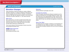
For this math and geography real world investigation, 6th graders plan a driving trip to a city that is located several states away from their home while recording the elevations of three cities that are included in the trip. They use...
Curated OER
Mapping a Site Using a Coordinate Plane
Learners map their playground as if it were an archeological site. They locate objects on the playground and determine their location using coordinate points. A related lesson is Coordinate Grid: Mapping an Archeological Site.
Curated OER
Mapping the News
Students explore cartography. In this map skills and map making lesson, Students work in groups to create wall size world maps including legends, compass roses, latitude and longitude, and physical features. Students collect...
Curated OER
Mapping with a Compass: A Simulated Survey
Students use compasses and grids to map the locations of artifacts found in a simulated dig site. In groups, they role-play as future archeologists excavating a school site. Groups begin at their assigned datum and site the artifacts...
Curated OER
Census Data and New Hampshire History
Learners graph the population growth of New Hampshire using historical census data.
Curated OER
Sunken Slave Ship
Students investigate shipwrecks. In this marine archaeology instructional activity, students create the site of a shipwreck by using a tub filled with sand and items from a "ship". Students excavate the site and analyze the findings.
Curated OER
Where Am I: How to Read a Map
Third graders develop an understanding of maps. They explore what a map is, who uses maps, and how to use maps. Students investigate the compas rose. They create a compose rose which illustrates the cardinal directions. Students practice...
Curated OER
Japan: A Cultural Study
Third graders "take a trip" to Japan. They discover what life is like for a typical Japanese child and compare/contrast it to life in America. They give an oral presentation of Japanese holidays and festivals.


