Curated OER
Regions of Utah - Mapping
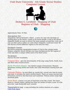
Fourth graders draw a rudimentary map of the state of Utah, dividing it into the three regions: the Great Basin, the Colorado Plateau, and the Rocky Mountain Region.
Curated OER
The World's Last Great Wilderness (Antarctica)
It's a shame that there are no photographs in this presentation because the information is fascinating! Each identically fashioned slide contains bullet points of information about Antarctica that will enhance an earth science...
Curated OER
The Geography of the United States
Full of bright maps and interesting information, this presentation details U.S. Geography. Slides include basic facts about size, regions, topography, and demographics, as well as fascinating trivia about the United States, including...
Curated OER
Why Do Geese Fly South For the Winter?
Fifth graders examine migration by tracing animal migration routes on a map. In this animal life lesson, 5th graders observe a map of North America and read about the migration patterns of geese. Students trace the path most geese take...
Curated OER
Mystery State # 5
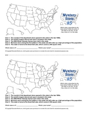
Mystery state number five is none other than Utah! Quiz your kids on state knowledge while building deductive reasoning skills. They use each of the five clues to determine the name of the mystery state. A great warm up when studying...
Curated OER
The Four-Color Problem: Concept and Solution
Take a walk through time, 1852 to 1994, following the mathematical history and development of the Four-Color Theorem. Learners take on the role of cartographers to study an imaginary world of countries that need to be mapped. One rule:...
Curated OER
What if the Mormons had not come to Utah?
Fourth graders use critical thinking, evaluation, and geography skills to find alternative locations that Brigham Young could have taken the Mormons to settle.
Curated OER
Where is the Water?
Learners explore freshwater ecosystems. In this geography lesson, students brainstorm all the lakes and rivers they know then mark them on a map. Learners will then mark all the major freshwater resources on each of the seven continents,...
Curated OER
Geography of the United States
Students examine the population growth of the United States. In this Geography lesson, students construct a map of the fifty states. Students create a graph of the population of the USA.
Curated OER
Traveling Through North America
Students identify places and landmarks in North America, specifically Canada and the United States, by using and constructing maps. Six lessons on one page; includes test.
Curated OER
Dead Sea Investigation: Middle East and African Connections
Students demonstrate comprehension of the physical characteristics of the Dead Sea region and its connection to the Red Sea and the African Great Rift Valley. They are given students the opportunity to understand the role of plate...
Curated OER
Designing a Park and Lodge
Students view a video entitle Great Lodges of the National Parks. They design, in groups of three, their own park based on research of a specific area. Each member of the group possess a different task in order to accomplish the project.
Scholastic
Perfect Postcards: Illinois
Connect the geography and history of Illinois using an art-centered activity on the railroads. The railroad connected once-distant places, particularly in the Midwest. Using research, class members create postcards of fictional...
Curated OER
Mystery State #15
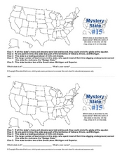
Do you know the name of the Badger State? Using five fantastic clues, your super sleuths will determine the name of mystery state number 15. A wonderful way to warm up the class!
Curated OER
Utah Weather
Fourth graders diagram the weather in Utah through the use of a glyph. For this Utah weather lesson, 4th graders create weather glyphs of different areas in the state. Students answer questions about the weather and then compare their...
Curated OER
Developing a Gateway to the West
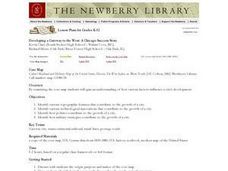
Students identify various topographical features that contribute to the growth of a city. They identify how military strategies contribute to the growth of a city.
Curated OER
The Sahara Desert
The children will create a watercolor picture of the Sahara Desert and label it.


