Curated OER
MAP GRIDS, CLIMATES AND HEMISPHERES
Students compare/contrast the grid and latitude/longitude system used on a globe. They describe the areas which are considered to be a tropical, temperate, and polar, based on knowledge of climates.
Curated OER
Square Numbers Grid
In this math worksheet, students examine a grid that is 7 squares by 7 squares. There are no directions on the page which is labeled "Square Numbers Grid."
Curated OER
Double Bar Graph Grid
In this math worksheet, students use this blank double bar graph grid as a tool for any graphing problem. There is a space for the title, labels for each axis and a spot for the key.
Curated OER
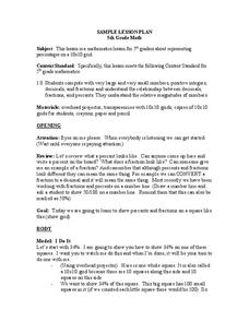
Percentages On A Grid
Fifth graders show percentages on a 10 x 10 grid. In this percentages lesson plan, 5th graders color in the squares to show a percent.
Curated OER
4-figure Grid Reference
Fourth graders study maps and grid lines. In this weather map lesson students complete an activity that allows them to understand grid lines on a map.
Curated OER
Gridding a Site
Students make observations of effigy mounds and record them in a notebook. In groups, they must determine the scale of measurement and create their own grid to scale part of the Effigy Mounds National Monument. They also practice using...
Curated OER
Irst-quadrant Grids
In this math instructional activity, students examine six first-quadrant grids. Students may plot different points on each grid or describe points for a partner to plot.
Curated OER
Quarter-inch Grid
In this learning tool worksheet, 6th graders can draw or depict information on a blank quarter-inch grid. There is a space at the top for name and date.
Curated OER
Inch Grid
In this math worksheet, students analyze a seven by eight inch grid. Students may use the grid for a variety of math activities, including measuring or creating shapes.
Curated OER
One-Inch Grid
In this learning tool worksheet, students use this multi-purpose grid to find measurements or graph objects. Teachers can determine how to use this 7 inch by 8 inch grid.
Curated OER
Multiplication Grids
In this math worksheet, students cut out 12 multiplication grids. Students use the cards to solve a variety of multiplication problems.
Curated OER
Inch Grid
In this learning tool worksheet, 6th graders will draw or depict information on a blank inch grid paper. There is space for name and date at the top.
Curated OER
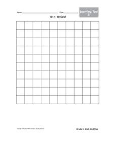
10 x 10 Grid
In this math worksheet, students examine a grid with 10 squares across and 10 squares down. There are no directions or problems on this math tool paper.
abcteach
Street Mapping
What's around the block? Or down the street? Ask your pupils to tap into their map skills by drafting the area around their home and school.
Curated OER
School Sleuths Treasure Map
Students are explained how a grid and compass work. They are also explained that archaeologists use grids as a record of the exact location of artifacts. Students define the term datum as a point of reference on grids from which all...
Curated OER
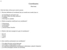
Coordinates
For this coordinates worksheet, 6th graders solve ten multiple choice questions by using their knowledge of coordinates on a grid. This is an interactive worksheet.
Curated OER
Cross Out
In this number grid worksheet, 3rd graders look over a number grid, cross out the numbers in 5 directives, fill in the blank to one question and then double check their answers. Students make their own original cross out grid.
Curated OER
Area by Design
For this grid worksheet, 4th graders make a three-color design on a grid. Students use the color blue twice as much as red and the color green three times more often than blue. Students fill in three blanks with the area covered by each...
Curated OER
Picture This
For this shapes worksheet, 2nd graders look at 9 lettered pictures within a grid and copy each shape in the correct lettered box in the second grid. Students write down what they see in a complete sentence.
Curated OER
Latitude and Longitude
Students demonstrate how to locate places on a map using a grid. In this map skills lesson, students are introduced to latitude and longitude lines. Students define these terms and view a large map of a state. Students come up to the map...
Curated OER
Linear Equations
Seventh graders explore battle plans using grids. In this linear equation instructional activity, 7th graders see how math is used in battle. Students create a grid on the floor using tape and plastic army men to serve as the...
Curated OER
Line 'Em Up!
Students find coordinate points on a grid and create a line graph with those points. This lesson should ideally be used during a unit on various types of graphs. They make and use coordinate systems to specify locations and to describe...
Curated OER
The Solar Neighborhood within 17 Light Years!
In this distance between stars worksheet, students plot the distance between the sun and 11 other stars on a 2 dimensional grid using a protractor and a ruler. They determine the distances between various stars and they find the shortest...
Curated OER
Where in the World
Students explore the global grid system. In this globe lesson, students identify latitude and longitude lines and how these can tell the coordinates of any place. They use the Internet to find the exact coordinates for their town.
Other popular searches
- Coordinate Grids
- Grid Drawings
- Christmas Coordinate Grids
- Number Grid
- Math Grid
- Hundreds Grid
- Grid Paper
- Grid Art
- Grid Maps
- Hundredths and Tenths Grids
- Four Quadrant Grid
- Grid System


