Curated OER
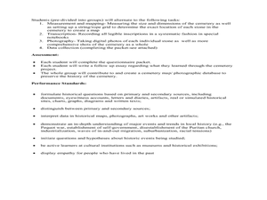
Cemetery Mapping Lesson
Eighth graders explore historical records. In this cemetery mapping lesson, 8th graders analyze local community data as they examine gravestones and read epitaphs.
Curated OER
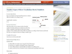
Number Types: Where Vocabulary Meets Numbers
Rational, irrational, real, natural. All these words can refer to numbers. Who knew? Learners use the Visual Thesaurus and a semantic feature analysis grid to examine the different attributes of numbers. Step-by-step instructions for...
Curated OER
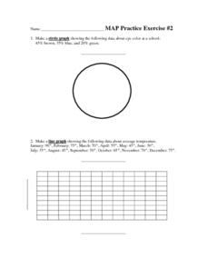
MAP Practice
In this geometry activity, students create circle, line and bar graphs using different comparisons of events. There are 24 questions with an answer key.
Curated OER
Where in the World? :Understanding Latitude and Longitude
Students play a grid-based game and devise clues to help classmates locate spots on the globe in order to recognize the value of using longitude and latitude for identifying locations.
Curated OER
Cookie Mapping
Students study the components of a bedrock geology map through a hands-on activity involving a cookie and graph paper.
Curated OER
Giving Students a Little Latitude
Young scholars use a world outline map to locate places using coordinates of latitude and longitude. They answer questions about places based on their knowledge of the map and on their research and make up more questions of this sort...
Curated OER
Where in the World? The Basics of Latitude and Longitude
Students are introduced to the concepts of latitude and longitude. In groups, they identify the Earth's magnetic field and the disadvantages of using compasses for navigation. They identify the major lines of latitude and longitude on a...
Curated OER
Degrees and Minutes
In this latitude and longitude worksheet, students place 9 cities on a map using the latitude and longitude of each. Once cities are placed in the correct location, students complete 2 short answer follow-up questions.
Curated OER
Investigating Latitude and Longitude
Students examine the lines of latitude and longitude on a map, and explain why these lines might be useful. In this lesson students also explore websites that provide information to improve their understanding of how and why latitude and...
Curated OER
Mapping the Local Community
Young scholars review the symbols and legends of a map. In groups, they follow a set of directions to create a map showing the route to a specific place. They present their map to the class and review the basic components of a community.
Carnegie Mellon University
Renewables Workshop
Youngsters examine resource maps to find out which states are using solar and wind power and discuss as a class various other renewable energy sources. They use a provided data table to record pros and cons to each technology, build and...
Curated OER
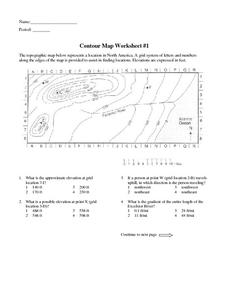
Contour Map Worksheet #1
Being able to read a topographic map is a standard in middle school earth science units and imperative for outdoor enthusiasts. As you introduce learners to this skill, you can assign this as an assessment or reinforcement. Pupils view a...
Curated OER
Locating Places
Learners demonstrate how to use the map grid system. In this map skills lesson, students are given coordinates to locate several locations on a world map. Learners use the map grid system to identify these locations.
Curated OER
A STEP IN SPECIATION
Learners place different subspecies of a CA salamander are placed on grid map of CA according to where samples were collected. Then discuss patterns of their distribution, their likely evolutionary relationships, and probable sequence of...
Curated OER
Mapping Africa
Students identify the location of parallel and meridian coordinates. They illustrate their understanding of the physical shape of the continent of Africa through a mapping activity, then explain the processes that have influenced the...
Curated OER
Community Map
Students examine the relationship they have with the community and the location of the community in relationship to other communities. They practice using a map of their community and photographs to recongize the area.
Curated OER
Longitude & Latitude
Seventh graders role play as ship's captains to study longitude and latitude.
Curated OER
LAND USE ISSUES
Students relate math with real life situations. They identify and plot points on a grid map. They identify and locate the Drop Box Sites.
Curated OER
Mapping and Excavating a Jello Mold
Fifth graders, in groups, map the three layers of different colored jello layers in molds and note the placement of fruit in them. On the grid paper they draw each grape, raisin, or other object and carefully remove each layer. After...
Curated OER
Coordinate Grid: Mapping Archeological Sites
Fourth graders discover how to apply the Cartesian coordinate system by figuring out the length and width of their school playground. They determine that pacing is an important tool for the initial mapping of a site. Students conduct a...
Curated OER
Mapping with a Compass: A Simulated Survey
Students use compasses and grids to map the locations of artifacts found in a simulated dig site. In groups, they role-play as future archeologists excavating a school site. Groups begin at their assigned datum and site the artifacts...
Curated OER
Plotting Grids Using Battleship
Learners coordinate grid points on X and Y axises to plot a physical location. The game of "Battleship is used to present first hand knowledge of this skill.
Curated OER
MAP MAGNETIC FIELD OF A ROOM
High schoolers map the magnetic field of a room (classroom or room at home -- recommend kitchen) at two or more heights. They create a coordinate grid within the room and make a relatively accurate map of the room to super impose the...
Curated OER
4-figure Grid Reference
Fourth graders study maps and grid lines. In this weather map lesson students complete an activity that allows them to understand grid lines on a map.
