PBS
Inspector Detector
How do spacecraft detect magnetic fields? The fourth installment of a five-part unit has learners develop a device with magnets that allows for the detection of magnetic fields. They use a map of an imaginary planet to try out their...
Teach Engineering
Who Can Make the Best Coordinate System?
Working with a map that does not have a coordinate system on it, small, collaborative teams must come up with a coordinate system for their map. Groups then explain their coordinate structure to the class.
Carnegie Mellon University
Renewables Workshop
Youngsters examine resource maps to find out which states are using solar and wind power and discuss as a class various other renewable energy sources. They use a provided data table to record pros and cons to each technology, build and...
Curated OER
Locating IIT Using Ordered Pairs
Students investigate ordered pairs. In this math activity, students plot and locate ordered pairs in a coordinate plane and are exposed to how to read and create a map.
Curated OER
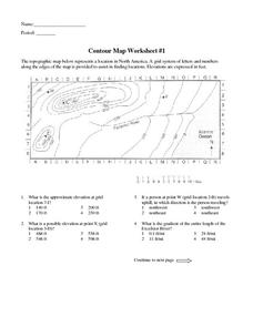
Contour Map Worksheet #1
Being able to read a topographic map is a standard in middle school earth science units and imperative for outdoor enthusiasts. As you introduce learners to this skill, you can assign this as an assessment or reinforcement. Pupils view a...
Curated OER
A STEP IN SPECIATION
Learners place different subspecies of a CA salamander are placed on grid map of CA according to where samples were collected. Then discuss patterns of their distribution, their likely evolutionary relationships, and probable sequence of...
Curated OER
Ordinal Numbers
In this mathematical ordinal numbers worksheet, students follow ten directives to show mastery of sorting out ordinal number problems on grids.
Curated OER
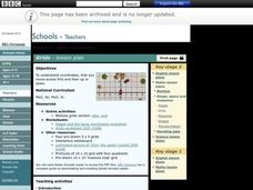
Grids
Take your study of coordinates online! Groups of students complete an online graphing introduction, plotting the points of virtual objects. A worksheet is included for extra practice.
Curated OER
Explore Surface Types on a Journey Around Earth
Students explore satellite data. In this technology cross-curriculum math and world geography lesson plan, students locate specific map areas using a microset of satellite data. Students use technology and math skills to determine...
Illustrative Mathematics
Latitude
The greater the latitude, the less of the Earth is north. Scholars graph the relationship between the latitude and the percentage of the Earth that is north of the latitude. Using the graph and the table, class members interpret values...
CK-12 Foundation
Position and Displacement Simulation
How can we use vectors to determine a person's position when traveling? The simulation offers guided practice at determining the coordinates and the distance between coordinates on a map grid. It reinforces the importance of positive...
International Technology Education Association
Reinventing Time
Take a trip through time. A lesson resource provides instruction on the origin of current measurements for time. The text explains the different tools humans used throughout history to measure time as well as provides examples such as...
Illustrative Mathematics
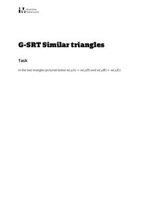
Similar Triangles
Proving triangles are similar is often an exercise in applying one of the many theorems young geometers memorize, like the AA similarity criteria. But proving that the criteria themselves are valid from basic principles is a great...
Curated OER
Locating Places - Making a Map Grid
Students learn how to use a letter and number map grid. In this map grid lesson, students look at a landscape map and describe how to locate the airport. They compare the descriptions of different students to determine how they are the...
Curated OER
Latitude on World Maps - World Map Activity 2
Learners explore the concept of latitude. In this geography activity, students discover the global grid system and complete a map activity which require them to record the latitude of various cities in the world.
Curated OER
South America Layered
Seventh graders create an overlay map of South America. They show the relationships between population, landforms and economies with their maps.
Curated OER
Mapping Africa
Students identify the location of parallel and meridian coordinates. They illustrate their understanding of the physical shape of the continent of Africa through a mapping activity, then explain the processes that have influenced the...
Curated OER
WORLD GEOGRAPHY
Students identify and analyze map symbols and map grids by completing various worksheets and creating their own map using these skills. Students identify and analyze what latitude and longitude are on a map to play a game of Bingo....
Curated OER
Community Map
Students examine the relationship they have with the community and the location of the community in relationship to other communities. They practice using a map of their community and photographs to recongize the area.
Curated OER
Are We There Yet?
Students discover how to use maps and why they are important when using a map. They calculate distance using a map scale and time using travel speed and a map scale.
Curated OER
Design an Island
Students make a map of an imaginary island using the topographic symbols provided from a worksheet. Students place lakes, dwellins, reefs, etc. in areas where they would logically be located from understanding how the topography of an...
Curated OER
Cardinal Directions
Young scholars explore cardinal directions. In this social studies lesson, students create maps of home and school using the cardinal directions.
Curated OER
Where Am I?
Students apply map reading skills by locating places through the use of latitude and longitude.
Curated OER
Third Grade Social Studies Quiz
In this social studies activity, 3rd graders complete multiple choice questions about communities, maps, distances, and more. Students complete 11 questions.
Other popular searches
- Grid Map Skills Worksheets
- Grid Map Activities
- Second Grade Grid Maps
- Grid Map Skills
- Reading a Grid Map
- Grid Map Washington d.c.
- Letter Number Grid Maps
- Mapping Grid Maps
- Interpreting a Grid Map
- Letter/number Grid Maps
- Grid Map Lessons
- Grid Map Washington Dc


