Curated OER
Put Me in My Place: Using Alphanumeric Grids to Locate Places
Learners practice locating points on a large wall grid and create and label a neighborhood map. For this geography lesson, students spell and discuss places as the teacher places them on the map. They discuss the concept of an...
Curated OER
The Mathematician And The Archaeologist
Students decorate clay pots and destroy them in order to learn the techniques of modern-day archaeologists and practice mathematical measurements. This is an exciting lesson suitable for Social Studies, Math, Science, or Art classroom.
Curated OER
Geography and Culture of China
Take out a map, a paper, a ruler, and those coveted colored pencils for a lesson on Chinese culture and geography. This is a multifaceted approach to basic geography skills that incorporate story telling, class discussion, primary source...
Curated OER
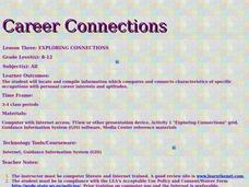
Career Connections
Students research the characteristics of specific occupations with personal career interests and aptitudes. In this career exploration instructional activity, students select three careers to explore and consider their own interests and...
Curated OER
Tuck Everlasting and Economic Decision-Making
Sixth graders use a decision-making grid and list the alternatives and criteria for deciding to drink the Water of Immortality. They examine advertisements and list the product for sale, where it is sold, and why consumers should buy it,...
Curated OER
Assessing and Making Maps
Students evaluate maps using the TODALSIGs basic map analysis system, explained on the worksheet. They create a map of Alaska using TODALSIGs. Students brainstorm the elements of maps.
Curated OER
My Own Private Idaho; Using Social Studies to Explore Idaho
Students engage in several activities to explore Idaho and Social Studies themes. Using an variety of media, students become familiar with Idaho's geography and geology.
Curated OER
Lewis and Clark: Prized Possessions
Young scholars consider the role of Sacagawea as part of the Corps of Discovery. In this Lewis and Clark expedition lesson, students discover details about Sacagawea's wampum belt and then create their own wampum belts using their...
Curated OER
Shipwreck Mystery
Young scholars draw inferences about a shipwreck. In this marine archaeologist activity, students examine historical and archaeological data to draw inferences about the age and identity of shipwrecks.
Curated OER
Introduction to Archaeology
Students view a PowerPoint presentation called, Archaeological Terms then discuss the job of an archaeologist and new vocabulary. They view the teacher made "artifact grid" and photograph the grid from different angles. They work in...
Curated OER
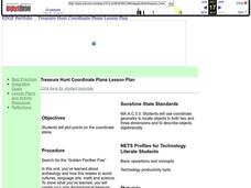
Coordinate Plane Treasure Hunt
Middle schoolers create a treasure map by plotting points on a coordinate plane using a computer drawing program. Students name and identify different landmasses and structures on their map. They create instructions to find the...
Curated OER
Give Me a B: North Dakota Quarter Reverse
Students examine the North Dakota quarter reverse and note the bison. and Badlands displayed on it. After practicing as a group making the B sound, they explore the classrom for more words beginning with that letter. Working in pairs,...
Curated OER
Where in the World? The Basics of Latitude and Longitude
Students are introduced to the concepts of latitude and longitude. In groups, they identify the Earth's magnetic field and the disadvantages of using compasses for navigation. They identify the major lines of latitude and longitude on a...
Curated OER
Introducing Maps Through Dance
Students are introduced to the key concepts of maps; direction, pathway/line, shape and symbol. They create the pathways and shapes they have "mapped" out on paper on the floor. They dance along the paths.
Curated OER
Design Your Own Building
Students explore the use of design principles in the real world. They evaluate how problems can be solved using design principles. In groups, students design the floor plan for a building of their choice.


