Curated OER
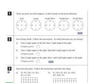
Compass Directions
In this compass activity, students solve 10 problems pertaining to compass directions. Students draw arrows on compasses according to the directions. Students also plot paths on grid paper, following directions given. This page is...
Curated OER
All About the Animals
Whose footprints are those? After reading Janet Halfmann's book, Little Skink's Tail, young scholars use footprints to determine where on a gridded map certain animals have been spotted. They use the map to answer 3 questions, one...
abcteach
Street Mapping
What's around the block? Or down the street? Ask your pupils to tap into their map skills by drafting the area around their home and school.
Curated OER
The Treasure Map
Third graders problem solve using drawings and map interpretations. They preview graphs and Cartesian geometry. They follow directions on a map using a grid and compass references while simulating they are reading a pirate map.
Curated OER
Cartography Project
A lesson involving mapping, the use of a compass, writing and following directions, and exploring the first two themes of geography is here for you. Learners create original maps that show the routes they take through their own...
Mathed Up!
Rotation
Two videos show first how to perform a rotation, given the center, the angle, and the direction of rotations. Individuals then see how to find what the rotation is from one figure to another. Pupils practice doing both in seven problems...
Curated OER
Angle Benchmarks
Sixth graders discuss the characteristics of specific angles and then use the information to to identify and estimate given angles. The class goes outside, identifies north, and turns a specified amount of degrees. Using a given compass,...
Curated OER
Gridding a 2 x 2 Meter Unit
Students use the internet to examine what happens at an archeological dig site. In groups, they practice measuring a 2x2 meter square unit and gridding it out as an archeologist would do. They review the possible solutions at the end of...
Curated OER
Robots
Second graders examine the concepts of direction and movement as they attempt to program a robot to move. They design a set of instructions using right, left, forward, backwards, and quarter turn so that the robot can accomplish tasks.
Curated OER
Lagoon Lake
Students develop skill in using co-ordinates. Up to eight cardinal points of the compass are used making this a useful activity in simple map and grid work. They utilize educational software to gain practice.
Curated OER
2 x 2
Students work together to grid a 2 x 2 meter unit using the formula for the Pythagorean Theorem. After creating the grid, they identify the location of artifacts and create a map of their location. They develop a graph and table of their...
Curated OER
Red October
Fourth graders follow directions given in bearings. They invent their own maps using them and use a protractor to help them with their designs. Students
produce their own maps with instructions for navigating the maps. The channels...
Curated OER
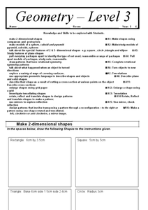
Geometry Level 3
What a wonderful resource! Learners create two-dimensional shapes according to the instructions stated, use the squares to make a triangular prism, a cube, and a pyramid, and identify features of plane shapes, among a myriad of other...
Mathematics Vision Project
Module 6: Congruence, Construction, and Proof
Trace the links between a variety of math concepts in this far-reaching unit. Ideas that seem very different on the outset (like the distance formula and rigid transformations) come together in very natural and logical ways. This...
Curated OER
X Marks the Spot
Fourth graders use games and puzzles to explore co-ordinate systems and their uses. Students are given the opportunity to invent their own systems by locating counters on a sheet of paper and by finding the dead center of a set of objects.
Curated OER
Mapping a Site Using a Coordinate Plane
Learners map their playground as if it were an archeological site. They locate objects on the playground and determine their location using coordinate points. A related lesson is Coordinate Grid: Mapping an Archeological Site.
Curated OER
Number in Geometry
Students use a number line to assist with their additions. They use a calculator to check for factors. Students are taught factors and multiples. They use array model of multiplication to define meaning. Students develop a wide range of...
Curated OER
Robots
Fourth graders devise and use problem solving strategies to explore situations mathematically (guess and check, make a drawing, use equipment). The use of logical reasoning is a focus of this lesson.


