Curated OER
Planning A Railroad
Students use topographical maps students explain the challenges involved in building the railroad in the Sierra Nevada mountains.
Curated OER
The Water Nearby
Students explore water located near where they live. In this map skills maritime lesson, students use Google Maps to find their school and the body of water closest to them. Students research the body of water and answer questions about it.
Curated OER
Project Whistlestop:Missouri Vacation Learning Unit
Fourth graders reserach the state of Missouri. In this Missouri History lesson, 4th graders plan a vacation to a region of Missouri. Students work in collaborative groups to determine all aspects of the trip. Students use math...
National Endowment for the Humanities
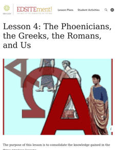
Lesson 4: The Phoenicians, the Greeks, the Romans, and Us
Learners review knowledge gained in the three-part unit on the history of the alphabet. Using maps and images, learners consolidate their understanding of ancient Greece, the Romans and the Phoenicians, and their respective impacts...
Curated OER
Lewis and Clark
Fifth graders use the Internet to research a topic. In this expeditions instructional activity, 5th graders answer questions about Lewis and Clark based on the movie they watched previously, use the Internet to research Lewis and...
Curated OER
Mapping Roxaboxen
Fourth graders read Roxaboxen and draw a map of the Roxaboxen community. In this language arts and geography lesson, 4th graders use specifications given, adding features to the map as described in the book and creating a legend.
Curated OER
Of Maps and Worldviews
Students explore Ptolemy's world map as an expression of the Renaissance view of the world.
Curated OER
Life in Old Babylonia: The Importance of Trade
Students read maps and artifacts for information indicating the existence of a trade network in Old Babylonia and beyond. They list goods imported to and exported from Babylonia. They indicate trading centers on a map of ancient...
Museum of Tolerance
Where Do Our Families Come From?
After a grand conversation about immigration to the United States, scholars interview a family member to learn about their journey to America. They then take their new-found knowledge and apply their findings to tracking their family...
Curated OER
All Aboard the Freedom Train!
Young historians identify Harriet Tubman, her character traits, and role as a conductor on the Underground Railroad. They create an escape map using map legends and the Cardinal directions. This plan utilizes one of my favorite video...
BrainPOP
World History Lesson Plan: Uncovering Essential Questions
Have you ever noticed a news story revolves around an essential question? Scholars research methods of reporting historical events. Working in groups, they use an interactive module to gather information on a historical topic, uncovering...
Curated OER
Mapping an Empire
How did the expansion of the Roman Empire during the first century contribute to its downfall? Using a map of the Roman Empire in 44 BC and one of the Roman Empire in 116 AD as references, class member use critical reading skills to...
Curated OER
Map Your State: Regions of Arizona
Fourth graders define vocabulary and locate physical features on maps. In this mapping lesson plan, 4th graders explore regions of Arizona through landforms found on topographic maps. Students research the history and culture...
Curated OER
Using Repeat Photography to Map Environmental Hazards
Students investigate the changes of their environment by experimenting with photography. In this environmental observation lesson, students compare historic photographs of areas with pictures they have just taken. Students...
Curated OER
Historical Atlas
Sixth graders evaluate how revolutions have affected the world throughout history (i.e. boundaries of nations, culture, economics, etc...) through the research for and creation of a historical atlas for assigned countries.
Curated OER
Cultural Maps
Fifth graders examine map elements. In small groups they create a map of an imaginary country that includes a title, legend, directional indicator, scale, boundaries, capital cities, country name, and icons of five natural resources. ...
Curated OER
Lesson 8: Changes in Deerfield, Massachusetts Shown in Maps
Eighth graders study maps of the same area from different time periods which show the ways in which the land stayed the same, and the ways this New England village changed over the years.
Curated OER
Waldseemuller's Map: World 1507
Seventh graders analyze various maps. In this Geography lesson, 7th graders create a large map as a whole class. Students write a letter to Mr. Waldseemuller.
Curated OER
Maps with a "Spin"
Students, in groups, research and map the effects of a proposed airport three miles outside of town. They prepare a presentation based on a set of maps they make and explains its different points of view from the viewpoints of the town...
Curated OER
Maps and Local History
Students study old and current maps of their town. They make connections between the geography of a town and the activities of its inhabitants.
Smithsonian Institution
Borders with the World: Mexican-American War and U.S. Southern Borderlands
The Mexican-American War created social borders—not just physical ones. Scholars learn about the effects of the Mexican-American War on the people living in the borderlands using text excerpts, maps, and partnered activities. Academics...
University of California
Decolonization
The ripple effect from one small event can impact many others. Young historians research the ripple effect World War II had on decolonization in the second installment of an eight-part series. Through primary and secondary documents as...
Alabama Department of Archives and History
From Alabama Farmer to Civil War Soldier
As part of a study of the Civil War, class members conduct a WebQuest to create a timeline of battles fought by the 10th Alabama Infantry Regimen. They then use Google Earth to pinpoint these battles of the Civil War on a map of Alabama.
Benjamin Franklin Tercentenary
From Ben’s Pen to Our Lives
What would Ben do? Jumping off from the pseudonymous letters Ben Franklin fooled his older brother into publishing when he was still a teenager, young literary lovers dive into acting, writing, and addressing a local issue with wit and...
Other popular searches
- Historical Maps Explorers
- Historical Maps Wwi
- Historical Maps Trade Routes
- Historical Maps Rome
- Historical Maps Mesopotamia
- Historical Maps Pirate
- Comparing Historical Maps
- Carthage Historical Maps
- Historical Maps Imperialism
- Historical Maps Inauguration
- Historical Maps Ussr
- Historical Maps" Ptolemy


