Curated OER
Mapping Your Identity: A Back-To-School Ice Breaker
Identify the unique personal attributes of your class members. Begin by viewing the Visual Thesaurus and discussing displayed attributes associated with famous American leaders. Using these identity maps as models, pupils generate nouns...
Curated OER
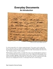
Everyday Documents
Almost more of a lesson than a worksheet, this particular resource has learners examine different types of historical documents. There is a historical docment embedded in the worksheet that learners study, and they also bring in...
Curated OER
Connecting Cartography to Society
Older high schoolers use maps to study changes in society like migration, population loss, and economic shifts, and then connect events from historical events to present day mapping of their region (The resource focuses on Canada, but...
Curated OER
Play Doh Map of Your State
Students create a state map using Playdoh. In this hands-on state geography lesson, students work in groups to form a three-dimensional map of their state using Playdoh made at home following a (given) recipe. Students use four colors...
Curated OER
Wagons West!
The first pioneers faced many obstacles on their journey west. Middle schoolers read different historical fiction texts (ideas are provided), make connections, and complete a detailed packet (included). Reading guides, journal ideas, and...
Curated OER
Local History: Mapping My Spot
Students explore maps to discover historical information about their local area. In this mapping and history lesson, students use panoramic maps of their own town/city to interpret historical information. Students also place themselves...
Curated OER
Paint My Counties: Map Coloring the Counties of Arizona
Fourth graders identify the counties of Arizona. For this social studies lesson, 4th graders color a county map of Arizona using the fewest number of colors possible. Students write a persuasive paragraph.
Curated OER
Arkansas Geography/History Relief Map
Sixth graders research a number of sources including the Internet to find information about the regions of Arkansas while locating sites of national historic interest. They located sites on maps while working at assigned websites. They...
Curated OER
Kid Maps: Reading and Creating Maps with Human Characteristics
Students look at maps. For this map lesson, students listen to the book My Map Book by Sara Fanelli and they see the difference between human characteristics (buildings, etc.) and natural characteristics (rivers, etc.). They create...
Curated OER
Red Dirt Groundbreakers
Discover Oklahoma's first farmers. Read about 14 different agriculture workers and their contribution to Oklahoma's farming. After reading, have your class complete several activities such as researching an agriculturist, writing a...
Curated OER
Robbing the 'Hood?
Students investigate historical figures and how they play a role in tourism by reading and discussing the article "When Robin Hood Supped, Was it Yorkshire Pudding?" In groups, students investigate issues related in the article in...
Curated OER
Mapping the West
Learners determine how Americans' perception of the geographical features of the West changed following the Lewis and Clark expedition. They analyze historical maps of the West.
Curated OER
The Water Nearby
Learners explore water located near where they live. In this map skills maritime lesson, students use Google Maps to find their school and the body of water closest to them. Learners research the body of water and answer questions about it.
Curated OER
Lewis and Clark
Fifth graders use the Internet to research a topic. In this expeditions lesson, 5th graders answer questions about Lewis and Clark based on the movie they watched previously, use the Internet to research Lewis and Clark, write a journal...
Curated OER
Mapping Roxaboxen
Fourth graders read Roxaboxen and draw a map of the Roxaboxen community. In this language arts and geography lesson, 4th graders use specifications given, adding features to the map as described in the book and creating a legend.
Curated OER
Mapping an Empire
How did the expansion of the Roman Empire during the first century contribute to its downfall? Using a map of the Roman Empire in 44 BC and one of the Roman Empire in 116 AD as references, class member use critical reading skills to...
Curated OER
Map Your State: Regions of Arizona
Fourth graders define vocabulary and locate physical features on maps. In this mapping lesson, 4th graders explore regions of Arizona through landforms found on topographic maps. Students research the history and culture of the...
Curated OER
Using Repeat Photography to Map Environmental Hazards
Students investigate the changes of their environment by experimenting with photography. In this environmental observation lesson, students compare historic photographs of areas with pictures they have just taken. Students create a...
Curated OER
Narrative Structure: Les Miserables
What is the initiating event? What is the protagonist's goal? What attempts are made to achieve this goal? What is the outcome? Model for your class how to map out the structure of any narrative. Readers then search for answers as the...
Curated OER
Let's Look at Legends: Oregon quarter reverse
Analyzing historical legends is a fun way to develop critical-thinking skills. Pupils will use a graphic organizer to compare and contrast two historical legends relating to volcanoes. While this activity focuses on the image of Crater...
Curated OER
Westward Expansion and the Frontier
Students explore U.S. history by researching a historic map. In this westward expansion lesson, students discuss the mystery of the western U.S. in the early 1800's and the impact expansion had on Native Americans and agriculture....
Curated OER
Places in My World
Second graders explore where they are located on the globe. For this maps and globes lesson, 2nd graders use a map to show where they live and show the cardinal directions. Students identify characteristics of mountains, flat land,...
Curated OER
Walking Down Main Street: The Changing Times of a Railroad Town
Students explore the historic district via a scavenger hunt. In this community history instructional activity, students complete a scavenger hunt using historic postcards and clues as guides. Students create a timeline demonstrating...
Curated OER
Making a Travel Brochure of a Louisiana Parish
Although the attachments for this travel brochure project are no longer linked, you can still use the idea here and create your own assignment sheet and rubric. Learners choose a parish in Louisiana (or a city in your state) to research,...
Other popular searches
- Historical Maps Explorers
- Historical Maps Wwi
- Historical Maps Trade Routes
- Historical Maps Rome
- Historical Maps Mesopotamia
- Historical Maps Pirate
- Comparing Historical Maps
- Carthage Historical Maps
- Historical Maps Imperialism
- Historical Maps Inauguration
- Historical Maps Ussr
- Historical Maps" Ptolemy


