NOAA
I Can't Breathe!
The Gulf of Mexico dead zone, an area of low oxygen that kills marine life, costs the United States $82 million every year. Young scientists research anoxic ocean environments then come up with a hypothesis for the cause of the Gulf of...
Curated OER
Tear the Continents
Students tear paper into representative continent shapes and configure them with world oceans through relative location, direction and latitude and longitude starting points. They recognize the shape of the continents. Students recognize...
Curated OER
Sharks At Risk Viewing Guide
Learners complete a worksheet while viewing a film about sharks. They examine the reasons for overfishing of the oceans. They identify predator-prey relationships as well.
Curated OER
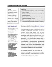
Climate Change & Coral Activities
Students study how the ocean stabilizes our planet's climates and how global warming is becoming a threat to this fine balance. In this climate change lesson, students identify that fossil fuel emissions are responsible for...
Curated OER
Plankton / Phytoplankton
Students discuss the importance of plankton in the ocean ecosystem. For this biology lesson, students identify the different types plankton by observing them under the microscope. They explain how plankton population affect global climate.
Curated OER
Marine Protected Areas
Students role play different stakeholders perspective on the debate about Channel Islands. In this marine science lesson, students identify different types of Marine Protected Areas. They research about their stakeholder's point of view...
Curated OER
Great Lakes at Stake
Students explore conservation of the Great Lakes. In this geography and ecology lesson, students identify the Great Lakes on a map and view a video depicting the history and importance of these lakes. Students work in groups to research...
Curated OER
Places in My World
Second graders explore where they are located on the globe. In this maps and globes lesson, 2nd graders use a map to show where they live and show the cardinal directions. Students identify characteristics of mountains, flat land,...
Curated OER
Ocean Planet: Sea Secrets
Students identify ocean features and draw a profile using data points on a map. Through discussion and research, they discover the importance of oceanography and plot a profile of the ocean floor in search for a vessel full of precious...
Curated OER
Water Cycle
Students identify the different stages in the water cycle. In this earth science lesson, students calculate the residence time of water in oceans using a mathematical formula. They explain how this cycle regulates the Earth's climate.
Curated OER
Carve That Mountain
Students investigate major landforms (e.g., mountains, rivers, plains, hills, oceans and plateaus). They build a three-dimensional model of a landscape depicting several of these landforms. Once they have built their model, they act as...
Curated OER
Seeing the Seafloor Using Sound - Multibeam Sidescan Sonar
Students are told that sound is not just stuff that our ears hear. They are explained that it is a tool for measuring and looking at objects in a new way. Students are introduced to sound waves and sonar imaging. They are explained...
Curated OER
The Good, The Bad, and the Arctic
Students investigate the social, economic and environmental consequences that might result from Arctic climate change. Students identify and discuss at least three consequences.
Curated OER
Rain Forest Adventures
Students identify and describe where tropical rain forests are located and examine the geographical correlation between rainfall and rain forest. They brainstorm what they think they know about tropical rain forests - where they're...
Curated OER
Sea Ice Board Game
Students understand the sea ice cycle and can explain its stages. In this Sea Ice lesson, students play a game to identify types of sea ice. Students answer critical thinking questions about sea ice. Students complete a sea ice worksheet.
Curated OER
In The Zone
Third graders identify ways that ocean animals grow, survive, reproduce, and adapt. They use computer Internet skills to acces and collect information. They create a PowerPoint presentation. They demonstrate writing skills throughthe...
Curated OER
Evaporation Introductory Lesson
Fourth graders examine the concepts of evaporation and the water cycle. They describe the relationship between heat energy, evaporation and condensation of water on Earth and identify the sun as the source of energy that evaporates...
Curated OER
Exploring National Marine Sanctuaries
Learners research marine ecosystems by creating class presentations. In this oceanography instructional activity, students research the different locations of marine sanctuaries by identifying them on a transparency map in class....
Curated OER
Pennsylvania Watersheds
Students identify the major watersheds of Pennsylvania. In this forestry lesson, students learn what a watershed is and are assigned one of the major watersheds of Pennsylvania. Groups then need to determine the boundaries of the...
Curated OER
Who Has the Data? Monitoring Coral Reefs
Students access data to characterize coral reefs. In this scientific research lesson, students access data and explain the need for such data when monitoring coral reefs. They will identify and explain three major threats to coral reefs.
Curated OER
Social Studies: The Birth of Olympism
Students complete maps of Ancient Greece identifying key sites of the ancient Olympic games. After watching a video, they complete worksheets about the games and the athletes. Students discuss how the spirit of Ekecheiria, the "Sacred...
Curated OER
Michigan Food: From Farm to You
Young scholars recognize Michigan on a map and understand how its climate is affected by the Great Lakes. In this Michigan food lesson, students play a trivia game to identify the produce of Michigan. Young scholars relate the climate in...
World Maps Online
Introduction to the World Map
Students identify the differences between maps and globes. In this map skills instructional activity, students are shown a globe and a map and recognize the differences. Students use post-it notes to locate several locations on the world...
Curated OER
Sea Ice: Unscrambling the Egg Code
Students determine sea ice thickness, concentration, and floe size by reading egg codes. In this sea ice conditions lesson, students color code a map based on prescribed criteria and use the maps to identify changes in sea ice...


