Curated OER
Water Features - Lesson 2 - U.S. Political Map Grade 4-5
Students locate water features on maps. In this geography lesson, students complete worksheets that require them to identify water features on a U. S. political map.
Curated OER
Go West My Class
Students find data that can be mapped on the Factfinder Web page. They analyze the data from the web site and state recommendations on whether a person should live in Illinois or not based on their preferences.
Curated OER
Down on the Farm
Learners are introduced to a map of an Illinois farm. They determine whether the map is of the past, present, or future by looking at features on the map. They also use the map to make a three-dimensional model.
Curated OER
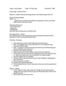
Southeast States
Fourth graders acquire knowledge about the settlement of the southeast region of the United states. For this united states geography lesson, 4th graders learn to analyze and understand the ways in which groups in society have...
Curated OER
Interpreting Aerial Photographs
Students interpret aerial photographs. They view aerial photographs or satellite-produced images to locate and identify physical and human features. They study satellite images and label their images for bodies of water, clouds,...
Curated OER
El Dia de los Muertos (Day of the Dead)
Fifth graders describe ways in which people in the United States remember and honor the dead. They identify the similarities and differences between El Dia de los Muertos, Memorial Day, and Halloween.
Curated OER
Along the Banks of the Mississippi
Students write a report about one of the states along the Mississippi River.
Curated OER
South Asian Architecture
Seventh graders review and discuss architecture from South Asia. They then study images of various buildings from North Africa/Southwest Asia, and make comparisons
Curated OER
Amazonian Travel Brochure
Young scholars create a brochure. In this Amazon research lesson, students research a tourist attraction in the Amazon and develop a travel brochure.
Curated OER
Understanding Latitude, Longitude, and Time Zones
Students take an imaginary world tour by locating cities with latitude and longitude. They plan an itinerary and calculate the time zones from which they would call home. Then they construct word problems involving travel across time zones.
Curated OER
Comparing the Impact of Multiple Uses
Students study multiple land uses and their effects on one another. They assess multiple land uses in National Forests and Grasslands and evaluate the effects of each use on all other uses. They develop a comprehensive list of human...
Curated OER
An Upbeat West Side Story: Puerto Ricans and Postwar Racial Politics in Chicago
Tenth graders read an article about the migration of Puerto Ricans to Chicago. As a class, they identify the barriers the immigrants faced regarding employment and separation from family members. To end the lesson, they work with a...
Curated OER
The Odyssey of a Coin
Learners create a fictitious newspaper article to document the travels of an ancient Greek coin. They evaluate the economic conditions that existed in ancient Greece and analyze the impact Alexander the Great had on the ancient world.
Curated OER
Country Mouse, City Mouse?
Students recognize the characteristics of a rural area. They analyze land use to determine whether the map is of a rural (country) area or an urban (city) area.
Curated OER
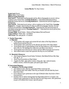
The Hopi Indians
Fourth graders make a mask of who they are as an individual after studying the Hopi Indians. In this Hopi Indians lesson plan, 4th graders compare and contrast the Hopi life with theirs, make predictions, and learn about culture.
Curated OER
The Hopi Indians
Fourth graders read and look at maps of the Hopi Indians and compare and contrast their lives with the Hopi Indians. In this Hopi Indians lesson plan, 4th graders learn about different cultures and answer short answer questions.
Curated OER
Animals in Myths and Real Life
Students research the role of lions, elephants, and bears in ancient Roman life and mythology. They develop a strong understanding of the role animals played in important ancient Roman historical events and myths.
Curated OER
Our Cultural Classroom
Second graders are introduced to the cultural diversity within their own classroom and relate this diversity to community, country and world. They create a visual family culture poster containing different aspects of their personal culture.
Curated OER
Egg Hunt: Review of States and Capitals
Fourth graders participate in an Easter egg hunt that gives them clues to states and their capitals. In this states and capitals lesson plan, 4th graders use clues to figure out the states described.
Curated OER
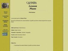
Wild Habitats
Students research and Illustrate the natural habitats of giraffes and other animals imported into ancient Rome. They draw a map of Europe, North Africa, and West Asia and draw the animals that come from each region in their proper places.
Curated OER
Organizaton of American States Project
Young scholars discover the Organization of American States by researching currents issues in those countries. They create a PowerPoint presentation and share with the class.
Curated OER
Habitat Cards
Students discuss the relationship between a habitat and the environment. In groups, they use the internet to research the relationship between the animals and the habitat on their card. They present their information to the class to...
Curated OER
Symbols from History: Mesopotamia Today
Young scholars identify the various symbols different nations use to represent themselves. As a class, they discuss the recent events in Iraq and identify the needs of its people. They use print resources to research various...
Curated OER
The First Farmers
Students show how constant irrigation, with repeated evaporation of water that left salts in the soil, eventually ruined much farming land in southern Mesopotamia. They discuss the idea that with the development of irrigation people...


