Curated OER
"Snapshot" Exercises & Sensory Detail Word Bank
Read a sample of creative descriptive writing to your science class. Discuss how writing can be used to record and communicate observations that scientists make. Reading selections and thought-provoking questions are suggested. Also...
NOAA
Ground-truthing Satellite Imagery with Drifting Buoy Data
Ground-truthing ... is it even a word? The last installment of a five-part series analyzes how scientists collect sea surface temperature data. Scholars use government websites to compare temperature data collected directly from buoys...
Curated OER
Imagery Chart
In this imagery worksheet, students fill in the graphic organizer with the five senses that they observe. Students complete 5 sections.
Curated OER
Polar Bear Literacy Activity
Students generate vocabulary words synonymous or related to "noise." In this literacy lesson, students listen to the book Polar Bear, Polar Bear, What do You Hear? by Bill Martin and Eric Carle and discuss the meaning of vocabulary words...
Curated OER
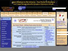
Our Poetic Planet - Writing Poems about the Earth
As a way to combine language arts and science, try this instructional activity on writing cloud poetry. Begin by showing a PowerPoint presentation and images of cloud types. Take meteorology masters outdoors to explore the sky using the...
Curated OER
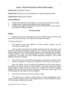
Remote Sensing and Landsat Satellite Imagery
Students comprehend how satellites use remote sensing to produce images. They use supervised classification with Landsat images. Students recognize that the earth's surface has different basic land surfaces that reflect/emit different...
Purdue University
Benefits of Connecting with Nature
Feel the healing effects of nature. Individuals learn about the benefits of nature using imagery. They begin by defining words to express how they feel emotionally and then practice using those words with hands-on activities. Once they...
Curated OER
PLANT IMAGERY
Students study morphological terminology. One student is blind-folded while the other describes a nearby plant. Once the blindfold is removed, the partner tries to find the plant that was described. They share their experience...
Curated OER
A Guided Journey Into the Past
Fourth graders use guided imagery to discover and judge an alternative way to enjoy artifacts without removing them from archaeological sites.
Alabama Learning Exchange
Introduction to the Universe
Fifth graders write descriptive imagery and identify facts about various components of the universe. They listen to the book "The Magic School Bus, Lost in the Solar System," develop a list of descriptive words from the story, compose a...
Curated OER
Quad Squad
Learners pretend they have visited a forest research station on an overnight field trip. They study forest fires, use compass directions, read maps, interpret imagery, and think about the impact of fire on ecosystems.
Curated OER
Hello Summer
Young scholars celebrate the great outdoors and the coming summer break by studying the natural world. In this seasons lesson, students engage in bark rubbing and operate a digital camera to capture outdoor imagery for a collage to...
Curated OER
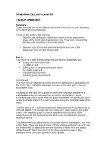
Shaky New Zealand
Students explore Earth science by building a model in class. In this tectonic plate lesson, students identify the impact tectonic shifts have on humans and animals and where the plates and faults lie under New Zealand. Students examine...
Curated OER
Essential Elements of Habitat
First graders compare their local area with the Belize landscape. They construct maps of the school area, adding descriptive information. They write haiku poems about their favorite outside places.
Curated OER
Environment: Just Around the Bend
Pupils decipher landforms on a map and corresponding satellite imagery. They consider the impact of pollution on agriculture and water. They draw diagrams demonstrating how pollution works its way into the food source.
Scholastic
Study Jams! Our Solar System: Inner Planets
Stunning images make up this slide show on the inner planets of our solar system. While visiting Mercury, Venus, Earth, and Mars, viewers also are introduced to the International Space Station and the Spirit Rover on Mars. Follow this...
Curated OER
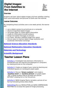
Digital Images: From Satellites To The Internet
Students examine digital images and how satellites orbiting Earth send information and pictures to Earth over the Internet. They use a digital camera to put pictures on a computer and decode a satellite image from space.
Curated OER
Making Sense of Density
Students identify the concepts of density, mass, and volume that define the property of a substance. They also determine that the properties of materials, such as, density and volume, can be compared and measured by using rulers,...
Curated OER
Salmon Run
Pupils examine the life cycle of the Pacific salmon and the impact of humans on salmon migration. They watch a Powerpoint presentation, trace migration routes on satellite imagery, and complete mock calculations of salmon energy...
Curated OER
A Comparison Study of Water Vapor Data to Precipitation over North America
Students use NASA satellite data to compare water vapor over the United States. In this data analysis lesson students use an Excel spreadsheet to map their data.
Illinois Department of Natural Resources
Section Two: Why is Biodiversity Important?
Explore soil, genetic traits, natural resources, and pollution in a series of lessons that focus on biodiversity. Kids complete experiments to learn more about the importance of varied genes and organisms in an ecosystem.
Association of American Geographers
Project GeoSTART
Investigate the fascinating, yet terrifying phenomenon of hurricanes from the safety of your classroom using this earth science unit. Focusing on developing young scientists' spacial thinking skills, these lessons engage...
Curated OER
Global Greenup
Students utilize satellite images to track the life cycle of vegetational growth over a large area. Animal migratory patterns are compared to this cycle.
Curated OER
Keeping Watch on Coral Reefs
Students investigate the dangers Coral Reefs face by investigating satellite images. In this environmental protection lesson, students utilize the Internet to discover the types of satellites and sensors used to provide...


