GoSoftWorks
GoSkyWatch Planetarium for iPad - The Astronomy Star Guide
Digital compass alignment enables navigation of the skies with true orientation at any time. Just point to the sky or "aim for the stars!" This application acts as a virtual telescope, allowing you to zoom in on any object that is...
Curated OER
Idea-Noun Definition: Source Searching
A great idea for showing language arts pupils the universality of themes, even in the real world! Have class members choose an idea-noun (peace, justice, war, love, etc.) at the beginning of the year or semester. They complete weekly...
Curated OER
Geographic Information Systems (GIS) and Water Resources
Students demonstrate how water quality and environmental health issues can be analyzed together, how hydrologic information can be built up, and how decisions can be made using GIS.
Curated OER
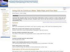
Using GIS to Construct Water Table Maps and Flow Nets
Pupils examine how to use GIS software to analyze patterns of groundwater flow. Seepage lake elevation data from the Sand Hills of Nebraska is used to construct a water table map and flow net using Esri's Arc Map software.
Curated OER
Advanced Information Systems Database Access
Students investigate the usage of databases. They design and create their own databases to hold information. They edit the file and sort/ index the new database. They also generate a detailed report of the data present.
Curated OER
Understanding Wikis and Ethical Responsible Posting of Information
Students, using the Internet, post information about local attractions. They choose a topic and create a website. They review each others website and make comments on its content.
Curated OER
Tell It Like It Is
Students consider the accuracy of the Web sites they regularly use, then prepare for a formal debate on the reliability of Wikipedia and similar Web sites. For homework, they prepare note cards and practice delivering their orations.
Curated OER
State History Acting and Podcasting
Students participate in a play. In this historical figures lesson, students choose a person from history and take on their role. Students research the character, create historically accurate costumes and work in groups to prepare a...
Curated OER
Image Classification
Students explore what are "multi-spectral" or "multi-band" images? They investigate how landscapes change over time- at least over the time-span of satellite imagery, particulary due to human influences. Students explore how to train...
Curated OER
Reference Skills
Students participate in an online scavenger hunt using the parts of a book to locate information. In this reference materials instructional activity, students locate the title, subtitle, table of contents and glossary. Students...
Curated OER
Scientific Data: It's Not as Pretty as It Looks!
The difference between accuracy and precision is fundamental for high school science learners. Using test kits for nitrate concentration in water, they compare readings with each other. They consider the accuracy, precision, and bias of...
Weebly
Hotel Rwanda
Terry George's 2004 award-winning film, Hotel Rwanda, is the focus of a study guide that asks viewers to examine how Paul's views change over the course of the film and to assess the accuracy of the film.
Curated OER
Past Imperfect: Examining Secondary Sources of the American Revolution
Ninth graders respond in essay form to the following writing prompt. Mel Gibson, star of The Patriot, is quoted as stating, "If one were to adhere to historical accuracy all the way, you'd probably have the most boring two hours on...
Curated OER
Pregnancy
Dispel the many myths and misunderstandings for teens regarding pregnancy. Health learners discuss the reproductive system, how conception occurs, and review new information through an excellent in-class game. Some wonderful blackline...
Curated OER
Who Lives in the Water? Stream Side Science
Andree Walker thought of everything when he wrote this resource. It includes a detailed list of materials and background information links for the teacher. In addition, it has procedures, a macroinvertebrate identification key, and tally...
Curated OER
AWARD CERTIFICATE FOR A CHARACTER
Connect to real-world experiences by having your primary learners create an award certificate based upon literal and inferential information from a story. They present the award to a character from a story and explain the criteria used....
Santa Monica College
Introducing Measurements in the Laboratory
We use basic units of measurement to break down things and communicate clearly. The first lesson in an 11-part series teaches the proper way to measure various items. It starts simply with measuring the dimensions and areas of geometric...
Curated OER
Empowered Barbie
Students access prior knowledge of vocabulary on feminism and psychoanalytic theory, and gender schema. In this Empowered Barbie lesson, students recreate a Barbie doll. Students write a reflection on how they changed...
Discovery Education
The Everyday Science of Sports
Physical science juniors will enjoy this sensational enrichment on aerodynamics, especially if they are also sports fans! With a focus on physical features and behaviors, collaborative groups make observations on five different golf...
Carolina K-12
The Major Conferences of World War II
Young historians create a 1940's news radio broadcast on the five major World War II conferences, including the Atlantic, Casablanca, Tehran, Yalta, and Potsdam.
Common Sense Media
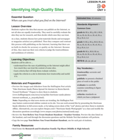
Identifying High-Quality Sites
Use a Huffington Post article focused on false pictures of Hurricane Sandy to launch a discussion about the reliability of online information. Groups compare and contrast how print and broadcast media regulate...
Curated OER
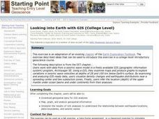
Looking into Earth with GIS
Students work with data from a seismic wave model in a freely available GIS (geographic information system) program, ArcVoyager SE. Using a GIS, they examine maps and produce graphs to explore variations in seismic wave velocities at...
Curated OER
Floodplains in the field (with GIS)
Students measure a topographic and geologic cross-section across a floodplain by simple surveying and auguring techniques. They consider the spatial context of the field observations, use GPS measurements, and desktop GIS analyses.
College Board
Evaluating Sources: How Credible Are They?
How can learners evaluate research sources for authority, accuracy, and credibility? By completing readings, discussions, and graphic organizers, scholars learn how to properly evaluate sources to find credible information. Additionally,...

