Curated OER
Civil War Research
Eighth graders research different aspects of the Civil War using various multi-media techniques. Students create a report based on their research that includes views of the war from the point of view of the North, South and slaves.
Curated OER
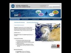
Troical Atlantic Aerosols
Learners explore the effect aerosols have upon he weather and climate. They observe NASA satellite images to explore and draw conclusions about aerosol transport. From studying the images, students track the path of aerosols. They...
Curated OER
Trends of Snow Cover and Temperature in Alaska
Students compare NASA satellite data observations with student surface measurements of snow cover and temperature. They practice data collection, data correlations, and making scientific predictions.
Curated OER
Roles of the President
Students read a document which explains the roles and responsibilities of the President of the United States. In groups, they tour the George Bush Presidential Museum and participate in a Presidential scavenger hunt. Once back in the...
Curated OER
Addressing the Nation
Students examine the leadership skills of Civil War leaders. In this American Civil War instructional activity, students describe attributes of effective leaders and then debate the effectiveness of leaders during the war.
Curated OER
A to Z Observations
Eighth graders examine the cultural conflicts that occurred when Europeans moved into the land the Native Americans lived on that would become West Virginia. In this West Virginia history instructional activity, 8th graders visit the...
Curated OER
Is Charleston Your Lucky Charm?
Students determine what makes Charleston, West Virginia unique. In this West Virginia history instructional activity, students explore the West Virginia History Museum to identify why Charleston became the capitol of the state.
Curated OER
Landscape Picture Map
Students design a landscape picture map. For this landscape picture mapping lesson, students understand when and why to use a landscape picture map. Students discuss landscape picture maps.
Curated OER
My Summer Vacation
Learners study the United States geography using Google Earth. In this U.S. geography lesson, students create travel journals about five U.S. geographical locations. Learners research the human and physical characteristics for each region.
Curated OER
Estimation With Percents
Pupils examine percents. In this percents lesson, students will estimate percentages. Using advertisements from a newspaper, pupils problem solve to determine the final price of a sale item.
Curated OER
Navigating Your Community
Students draw a map from memory describing the route between their classroom and the gym including a legend, a compass rose, a map scale, symbols, and a landmark at every change of direction. They then retrace their steps in their maps...
Curated OER
Favorite Christmas Carols
Third graders take a survey of friends' and family members' favorite Christmas carols. They illustrate a favorite Christmas carol and have students try to guess the name of the carol based on the picture.
Curated OER
James and the Giant Peach
Fourth graders read James and the Giant Peach, write a chronological narrative, and complete a webquest dealing with the life of Roald Dahl.
Curated OER
On the Surface
Students draw and label the 15 major rivers in Texas. They then draw and label another map with the major lakes and reservioirs of Texas. Students use the maps and locate and label the location of the following major Texas cities:...
Curated OER
Virginia In the World: The Geography of Commerce
Students examine how Virginia connects with the world through export trade. Using a map, they use symbols to depict the value of trade and the direction of the flow of goods. They complete a scavenger hunt using electronic almanacs and...
Curated OER
Circle the Earth - Explore Surface Types on a Journey around Earth
Students use CERES percent coverage surface data with a world map in locating landmasses and bodies of water at Earth's Equator.
Curated OER
Biome Web Quest
Third graders create paper mache globes, paint them and label the oceans and the continents. In groups, they research a biome, write about it and create an artistic visual representation of the biome and present it to the class.
Curated OER
Chart the Weather for Cities Around the World
Learners orally describe Northern and Southern hemispheres, identify 7 continents, and point out specific countries and cities. They locate and record weather information.
Curated OER
Looking through the Sands of Time: 80's Decade
Students view the comic "Time sliders" from the Celebrate the Stamp Unit from the 1980's. They discuss what the comic magazine contains. Students listen to a speaker from the post office discuss how stamps are selected. They use...
Curated OER
In Line with Time
Third graders create a timeline of inventions and inventors made out of light colored bulletin board paper.
Curated OER
Dr. Teeth and Dr. Gums To The Rescue
Second graders role play as dentists researching teeth and their care. They create a slide show showing how a character, Bear, can take care of this teeth explaining habitats, diets and teeth.
Curated OER
Presenting Your Community
Students research the history of a notable building and prepare a Power Point presentation to be used on the online scrapbook. They research the location of the building in the community, the architectural style and the date of...
Curated OER
Affects of Geography on Colonial Cultures
Sixth graders examine the effects of geography on the development of culture. They discuss how geography can affect the lifestyles and development of a society's culture. Students examine the geography and climate of New England and the...
Curated OER
Brochures
Students discuss how the climate in their area affects they way they live their life. In groups, they identify the climate zones throughout the world and research one country of interest to them. To end the lesson plan, they make a...

