Curated OER
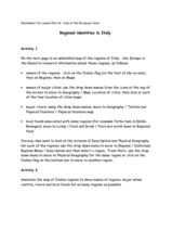
Regional identities in Italy
In this Italy map activity worksheet, students complete 2 map activities that require them to identify major cities and landforms in the country.
Ms. Catsos
Ancient Rome Map Worksheet
It wasn't just the great leaders of ancient Rome that shaped their civilization—the geography of the region played a major role as well. After first identifying major land masses, bodies of water, and city states on a map of Europe,...
Curated OER
Western Civilizations, Chapter 12: The Civilization of the Renaissance
If you can't take your western civilization class to the Renaissance Faire, try this online resource to give them an idea of this era and others! While designed to accompany the Western Civilizations text, this tool can be utilized...
Curated OER
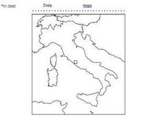
Italy Outline Map
In this outline map activity, students examine the political boundaries of the European nation of Italy. The map may be used in variety of activities that individual teachers create to accompany it.
Curated OER
The Roman Empire-Map Activity
In this Roman Empire worksheet, students complete a map activity in which they label and color civilizations, countries and physical features as instructed. There are no maps included.
Curated OER
Map of Italy
In this map of Italy worksheet, students find, color and label cities, surrounding countries, bodies of water and landforms in the country of Italy.
Scholastic
Drones Take Off
Ever wonder what drones are doing high above us in the sky? This article gives your class an insight to what those robots in the sky are doing. After reading an article on drone technology, pupils are prompted to respond to a...
Curated OER
Getting to know Italy
In this Italy worksheet, students complete short answer questions about the geography of Italy. Students complete 15 short answer questions.
Curated OER
Creating a Map of France
In this crating a map of France learning exercise, students find and label important parts of France, bodies of water, mountains and surrounding countries.
Curated OER
Sixth Grade Social Studies Quiz
In this social studies instructional activity, 6th graders complete multiple choice questions about economics, climate, maps, and more. Students complete 15 questions.
Curated OER
Coral Reef Geography
In this coral reef geography worksheet, students find locations of reefs on a globe or map. There are 10 instructions to follow. There is no map provided--an atlas, globe or map is needed.
Curated OER
Project Map: Latitude And Longitude Worksheet
In this latitude and longitude worksheet, students find the coordinates of 14 cities around the world and use this information to complete 14 short answer questions. This worksheet includes online atlas web links.
Curated OER
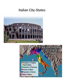
Italian City-States
Check out this packet of worksheets involving mapping activities, vocabulary logging, reading and comprehending informational texts, etc., which focuses on Italian city-states during the fourteenth and fifteenth centuries. There are also...
Student Handouts
Christopher Columbus Workbook
Youngsters gain ample reading comprehension practice while studying the history of Christopher Columbus with this great workbook! It includes word puzzles and comprehension checks of multiple assessment styles, including multiple choice,...
Curated OER
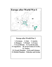
Europe after World War I
In this Europe after World War I map worksheet, learners note the 11 regions of the Europe labeled on the map.
Curated OER
Choral Music II
In this music worksheet, students look at a map of the world and find the places where the Santa Fe, New Mexico Desert Chorale has traveled. There is little information about music on this page.
Curated OER
Open Cities: Europe
In this European cities activity, 10th graders find the countries of Europe on a map, match countries with capital cities, categorize different types of cities and identify cities from pictures and on a map.
Curated OER
Primary History: Ancient Greeks
In this ancient history worksheet, students examine the world of the ancient Greeks. They examine pictures of the Wooden Horse before making one with everyday items. They read about Odysseus and the characters in the story. They locate...
Curated OER
Drifting Continents
In this plate tectonics worksheet, learners study the continents map and complete 8 short answer questions related to them. They predict what the Earth will look like millions from now.
Curated OER
London Quiz 1
In this London activity, students answer short answer questions about the history and geography of London. Students complete 20 short answer questions.
Curated OER
Airborne & Special Operations Museum- Grade 8
In this gallery scavenger hunt activity students answer 18 questions about the displays in the Airborne & Special Operations Museum.
Curated OER
Foreign Place Names Quiz
In this online interactive geography quiz worksheet, learners respond to 20 identification questions about foreign place names. Students have 4 minutes to complete the quiz.
Curated OER
Causes of World War II
In this World War II worksheet, students view a PowerPoint presentation on the war and then respond to 82 short answer questions about the content of the presentation. The PowerPoint presentation is not included with this worksheet.
Other popular searches
- Map of Italy
- Blank Map of Italy
- Choropleth Map of Italy
- Choropleth Map for Italy
- Physical Map of Italy
- Landforms Map of Italy
- Map of Renaissance Italy
- Worksheet Map of Italy
- Printable Map of Italy
- Choropleth Maps Italy
- Outline Map of Italy
- Renaissance Italy Maps
