Curated OER
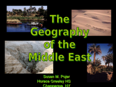
The Geography of the Middle East
Topographic, political, and satellite maps establish the world of the Middle East for your class- a land about which they have heard quite a lot, but might not really understand. This presentation would be a good introduction into a unit...
Curated OER
Guided Reading: " A River Ran Wild"
Students answer "essential questions" to establish background and prior knowledge of the book, "A River Ran Wild." In this language arts lesson, 3rd graders complete a graphic organizer of vocabulary words and read and take notes at...
Curated OER
Louisiana's Indian Tribes At the Time of the Louisiana Purchase
Students research primary readings concerning first hand accounts of the Indian tribes living in and around Louisiana's River systems. They complete a brief character sketch of each tribe characterized in the digital readings. These...
Curated OER
Topography of Africa
Students study Africa's diverse landscape and investigate how these features impact the available water supply, food sources, and population distribution of the continent. They compare topographical features and
their affect on each...
Curated OER
Reading a Map
Third graders become familiar with the vocabulary and skills related to mapping. In this guided reading lesson, 3rd graders find proper nouns on from the map. Students read Goldilocks. Students make a map...
Curated OER
Wetland Adaptation
Students participate in a simulation to investigate the impact of the wetland environment on the migration of birds. They discuss the patterns of migration they took and why they avoided certain wetlands.
Curated OER
Utah's Biomes
Fourth graders discover what a biome is and study biomes that are native to Utah in this series of lessons. They examine how Utah's biomes have changed over time due to the influence of the Mormon pioneers and other human populations.
Curated OER
Wetland Adaptation
Fourth graders study the impact of the wetland environment on the migration of birds. They make a list of the important reasons on a large piece of paper to be posted in the classroom and point out the biggest wetland in the state (The...
Curated OER
Dead Sea Investigation: Middle East and African Connections
Pupils demonstrate comprehension of the physical characteristics of the Dead Sea region and its connection to the Red Sea and the African Great Rift Valley. They are given students the opportunity to understand the role of plate...
Curated OER
Bible Activities
In this religious worksheet, students complete various activities related to the Bible. For example, students color in an illustration from the Bible and solve a related crossword puzzle. Students also match animals to their homes in a...
Curated OER
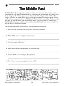
The Middle East - Regional Research
In this geography worksheet, student read a short blurb about The Middle East as a region of the world before conducting further research. They complete 10 short answer questions, and complete a 15 question activity in which they match...
Curated OER
Shape Collage Pizza
Students identify shapes. For this geometry lesson, students cut out various shapes and create a "Shape Collage Pizza." Students glue their shapes onto a pizza template.
Curated OER
Seventh Grade Social Studies Quiz
In this Georgia social studies assessment activity, 7th graders respond to fifteen multiple choice questions based on seventh grade social studies skills.
Curated OER
The Middle East-Quiz 1
In this Middle East quiz learning exercise, students answer a set of 10 short answer questions. Page includes answers and links to additional activities.
Curated OER
Bible Activities
In this religion worksheet, students draw a happy or sad face over 6 pictures depending on if they think it would make Jesus happy or not. Students also complete various activities related to the Bible.
Curated OER
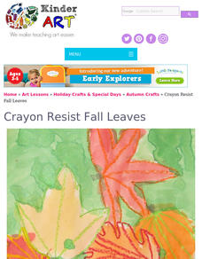
Crayon Resist Fall Leaves
Students observe the different colors in fall leaves. They create a multi-color fall leaf in the crayon-resist technique.
Curated OER
Crayon Resist Fall Leaves
Students create examples of fall leaves using crayons, paints, and white paper in this fall Art lesson for the early-elementary classroom. Emphasis is placed upon a class lecture/discussion about why leaves change color prior to the...
Curated OER
Map of Egypt
In this map of Egypt activity, students label the cities, bodies of water, surrounding countries and color the map according to the directions.
Curated OER
Underground Railroad-Coded Messages
In this worksheet on The Underground Railroad, students are instructed to "use the code word and phrases sheet" in order to decode a set of 10 messages. Word and phrases sheet not included on this worksheet.
Curated OER
Iraqi Geography
In this word search instructional activity, students discover for terms related to the country of Iraq. The terms include important geographical features, cities, countries and people.
PBS
Pbs: Journey to Planet Earth: Rivers of Destiny
Journey to four major river systems - the Mississippi, Amazon, Jordan and Mekong rivers - and take a look at the challenges happening to the people whose livelihood hinges around them.
Countries and Their Cultures
Countries and Their Cultures: Samaritans
The Samaritans are a sect numbering about 500 who currently reside in Nablus, on the west bank of the Jordan River in Israeli-occupied Jordan, and in Holon, south of Tel Aviv, on the Mediterranean coast of Israel. The Samaritans call...
Khan Academy
Khan Academy: Jericho
The history of Jericho is rich and complex, punctuated with the same parade of triumphs and tragedies that so many other ancient cities have experienced. But Jericho's status as the most ancient city on Earth makes it unique. This...
Countries and Their Cultures
Countries and Their Cultures: Palestinians
Palestinians inhabit an area east of the Mediterranean Sea and south of Lebanon. The Jordan River, Lakes Huleh and Tiberias, and the Dead Sea separate Palestine from Jordan. Christians refer to Palestine as "the Holy Land." Today...


