Curated OER
Capitals, Oceans, And Border States
Students investigate geography by completing games with classmates. In this United States of America lesson, students examine a map of North America and identify the borders of Mexico and Canada as well as the Pacific and Atlantic....
Curated OER
Gel Electrophoresis: Sort and See the DNA
For this DNA worksheet, students access a website to learn how DNA fragments are separated through the process of gel electrophoresis. Then students model the construction of DNA fingerprints and practice interpreting restriction maps....
Curated OER
Do You Know Your 50 States?
Learners use the names and abbreviations of the 50 states to label a blank map of the United States.
Curated OER
Design an Island
Students explore islands. They create a two- or three-dimensional map of an island. They explain how the topography of an area influences the location of water sources, ecosystems, and human settlements. Lesson includes adaptations for...
Curated OER
Metrics And Measurements
Middle schoolers engage in a study of measuring distances between geographical locations on a map. They are able to define and use the map scale in conjunction with the metric system. For this lesson they make their own maps and measure...
Curated OER
Journey of Discovery and Rivers
Students investigate the rivers encountered and mapped by the Corps of Discovery. They analyze maps, outline and label rivers on a blank map, complete a chart, and answer discussion questions while watching a National Geographic video,...
Curated OER
Our 50 States
Students identify the location of the 50 states using an interactive map. They practice geography skills by playing a fun game. Pupils become familiar with the state abbreviations for the US states. Students become familiar with the...
Curated OER
We've got the whole world in our hands
Students explore spatial sense in regards to maps about the globe. In this maps lesson plan, students label oceans, locate the continents and poles, follow directions, and explain the symbols on a map.
Curated OER
Moon Features Activity
In this moon worksheet, students answer questions about the lunar surface and identify the features of the moon on a moon map. They include craters, bays, mountains, seas, oceans and craters.
Curated OER
Mesopotamia
Students map Mesopotamia. In this Geography lesson, students are introduced to Ancient Mesopotamia. Students use an atlas to label the defining features and areas of Mesopotamia on a map.
Curated OER
Geography Booklet
Sixth graders explore geography terms. Students use resources to find real examples of landforms in the world. They create a map showing the landform. students label the surrounding features, countries and states. Students use each...
Curated OER
Contour Map Worksheet #4
There are only four questions here. There is a contour map of Cottonwood, Colorado and the creek that crosses it. Earth scientists tell in what direction the creek flows, identify the highest elevation on the map, draw a topographic...
Curated OER
Let's Make a Map
Second graders draw maps of their playground, noting objects such as trees and play equipment. Working in groups, they make maps of different parts of the school and assemble them into a schoolwide map. They make maps on a field trip to...
Curated OER
Australia Map Resource Sheet
In this Australia map resource worksheet, students use the map of Australia to supplement their study of the country. They see a map labeled with Australian cities, and the surrounding countries and water bodies.
Curated OER
Map of Asia
In this map worksheet, 3rd graders will study a map of Asia. Students will use this map to label and/or familiarize themselves with various aspects of the continent.
Curated OER
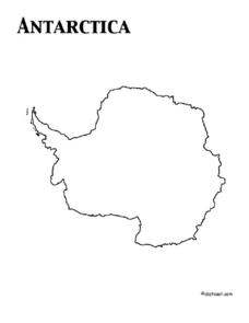
Map of Antarctica
In this map worksheet, 3rd graders will study a map of Antarctica. Students will use this map to label and/or familiarize themselves with various aspects of the continent.
Curated OER
Electric Field Mapping / Equipotential Lines
Students determine the equipotential lines surrounding a charged object. In this physics lesson, students draw lines to identify areas. They relate the spacing of the field lines to the strength of the charge.
Agriculture’s Lasting Heritage
Apples Around Us
Apple tasting launches an investigation of the story and travels of John Chapman, also known as Johnny Appleseed. After listening to his story, class members craft a summary of the tale, chart his journeys on a map, and sample different...
Curated OER
The Rocks Under Illinois
The goal of this fine geology lesson is to have learners create a map that shows how the rock layers are arranged far underground where they can't be seen. The ambitious lesson plan requires high schoolers to learn the law of...
Curated OER
Giving Students a Little Latitude
Students use a world outline map to locate places using coordinates of latitude and longitude. They answer questions about places based on their knowledge of the map and on their research and make up more questions of this sort for each...
Curated OER
European Cities
Learners study European cities and label countries on a map, match cities to countries, and answer true and false questions. In this European cities lesson plan, students also guess the names of cities they see pictures of.
Curated OER
Jamestown Journey Part 1
Fourth graders work to solve one of the major problems facing the Jamestown settlers, the best location to settle upon arrival in Jamestown. Students discuss and review the past European and American events that lead to the...
Curated OER
Poland
For this Poland maps worksheet, 6th graders research, study and label the regions, states and landmarks on a map of Poland. Students hang their maps up on the wall.
Curated OER
Germany
In this map of Germany worksheet, students view a map of Germany and then label its regions, major cities and important landmarks on a paper version of a map of Germany.
Other popular searches
- Map Labeling
- Africa Map Labeling
- Midwest Map Labeling
- Geography Map Labeling
- Labeling a Map Continents
- Blank Labeling Maps
- Labeling Maps Pangaea
- Labeling Map Parts


